
| Memorials | : | 0 |
| Location | : | Randolph County, USA |
| Coordinate | : | 39.2990210, -92.3256260 |
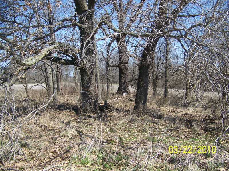
| Description | : | Located in T52 R13 S14 about .15 miles south of CR 2782 just on the east side of Big Creek This cemetery is in the middle of a field, and it seems that all headstones have been removed. The only stones found were unmarked footstones. There are a few graves marked with fieldstones. The burials listed are taken from obituaries and family histories. |
frequently asked questions (FAQ):
-
Where is Crews-Adams Cemetery?
Crews-Adams Cemetery is located at Randolph County ,Missouri ,USA.
-
Crews-Adams Cemetery cemetery's updated grave count on graveviews.com?
0 memorials
-
Where are the coordinates of the Crews-Adams Cemetery?
Latitude: 39.2990210
Longitude: -92.3256260

Nearby Cemetories:
1. Mount Vernon Cemetery
Clark, Randolph County, USA
Coordinate: 39.2980990, -92.3704250
2. Chapel Grove Cemetery
Clark, Randolph County, USA
Coordinate: 39.2658005, -92.3424988
3. Mount Pisgah Cemetery
Audrain County, USA
Coordinate: 39.2731500, -92.2908000
4. Macedonia Cemetery
Audrain County, USA
Coordinate: 39.3177700, -92.2818780
5. Elington-Rice Cemetery
Randolph County, USA
Coordinate: 39.2744100, -92.3659200
6. New Hope Cemetery
Clark, Randolph County, USA
Coordinate: 39.3485030, -92.3280720
7. Birkhead Cemetery
Clark, Randolph County, USA
Coordinate: 39.3486230, -92.3101490
8. Pleasant Grove Cemetery
Audrain County, USA
Coordinate: 39.3022900, -92.2536200
9. Moberly Mennonite Church Cemetery
Moberly, Randolph County, USA
Coordinate: 39.3500670, -92.3735083
10. Sturgeon Cemetery
Sturgeon, Boone County, USA
Coordinate: 39.2331009, -92.2936020
11. Delaney-Embree Cemetery
Randolph County, USA
Coordinate: 39.3667240, -92.3516240
12. Stephens Cemetery
Middle Grove, Monroe County, USA
Coordinate: 39.3695100, -92.2960100
13. Settle Cemetery
Middle Grove, Monroe County, USA
Coordinate: 39.3723100, -92.2777000
14. Fairview Cemetery
Randolph County, USA
Coordinate: 39.2649994, -92.4229965
15. Brink-Gibson Cemetery
Sturgeon, Boone County, USA
Coordinate: 39.2195540, -92.2956280
16. Bruce Cemetery
Clark, Randolph County, USA
Coordinate: 39.2559260, -92.4175290
17. Hubbard Cemetery
Randolph County, USA
Coordinate: 39.3341400, -92.4267300
18. Dulaney Cemetery
Moberly, Randolph County, USA
Coordinate: 39.3851850, -92.3099830
19. Lick Fork Cemetery
Sturgeon, Boone County, USA
Coordinate: 39.2139282, -92.3494873
20. Brooks-Mobley Cemetery
Randolph County, USA
Coordinate: 39.3838040, -92.3529620
21. Irons Cemetery
Moberly, Randolph County, USA
Coordinate: 39.3797900, -92.3710200
22. Hardin Cemetery
Randolph County, USA
Coordinate: 39.3103770, -92.4387990
23. Mount Horeb Cemetery
Sturgeon, Boone County, USA
Coordinate: 39.2158012, -92.2842026
24. Kimbrough-Brockman Cemetery
Randolph County, USA
Coordinate: 39.3285510, -92.4360870