
| Memorials | : | 0 |
| Location | : | Sturgeon, Boone County, USA |
| Coordinate | : | 39.2139282, -92.3494873 |
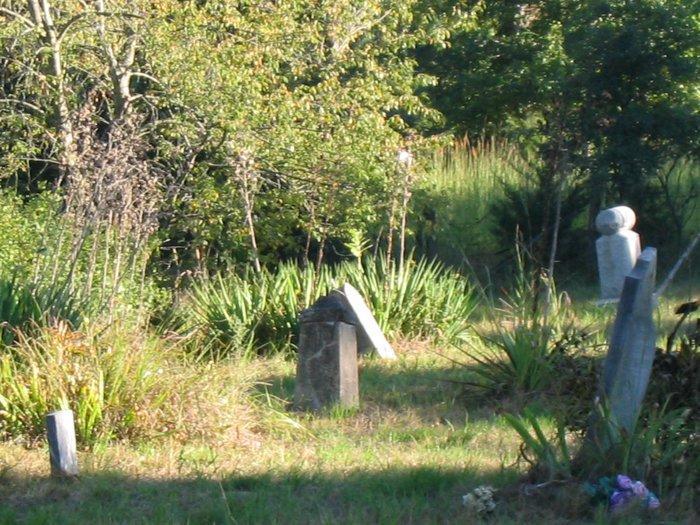
| Description | : | There are some broken stones with pieces missing & several graves marked with native stones as well as funeral home plates that are unreadable. I am sure there are many more graves with no signs of who is buried in them here in the cemetery. (BLSW) Directions to Lick Fork Cemetery; SW of Strugeon, Boone Co., Missouri: Take Highway 63 to CC (W Roy Barnes Rd); turn on W Harper County Road, follow W Harper County Road until you come to N Ponderosa Road follow until you reach cemetery, sits on left side of road. Bourbon Township 51, Boone County, Missouri List... Read More |
frequently asked questions (FAQ):
-
Where is Lick Fork Cemetery?
Lick Fork Cemetery is located at Sturgeon, Boone County ,Missouri ,USA.
-
Lick Fork Cemetery cemetery's updated grave count on graveviews.com?
0 memorials
-
Where are the coordinates of the Lick Fork Cemetery?
Latitude: 39.2139282
Longitude: -92.3494873
Nearby Cemetories:
1. Robinson Cemetery
Rucker, Boone County, USA
Coordinate: 39.2265500, -92.4009200
2. Brink-Gibson Cemetery
Sturgeon, Boone County, USA
Coordinate: 39.2195540, -92.2956280
3. Union Cumberland Presbyterian Church Cemetery
Riggs, Boone County, USA
Coordinate: 39.1716309, -92.3455200
4. Sturgeon Cemetery
Sturgeon, Boone County, USA
Coordinate: 39.2331009, -92.2936020
5. Locust Grove Church Cemetery
Boone County, USA
Coordinate: 39.1702461, -92.3188477
6. Locust Grove Baptist Church Cemetery
Sturgeon, Boone County, USA
Coordinate: 39.1698300, -92.3185900
7. Mount Horeb Cemetery
Sturgeon, Boone County, USA
Coordinate: 39.2158012, -92.2842026
8. Chapel Grove Cemetery
Clark, Randolph County, USA
Coordinate: 39.2658005, -92.3424988
9. Mount Carmel Cemetery
Boone County, USA
Coordinate: 39.1627998, -92.3653030
10. Naylor Cemetery
Riggs, Boone County, USA
Coordinate: 39.1589012, -92.3368988
11. Palmer Cemetery
Bourbon Township, Boone County, USA
Coordinate: 39.1880989, -92.2833023
12. Perche Church Cemetery
Rucker, Boone County, USA
Coordinate: 39.1990400, -92.4224400
13. Ruth Nowell Burial
Sturgeon, Boone County, USA
Coordinate: 39.1734026, -92.2921461
14. Elington-Rice Cemetery
Randolph County, USA
Coordinate: 39.2744100, -92.3659200
15. Bruce Cemetery
Clark, Randolph County, USA
Coordinate: 39.2559260, -92.4175290
16. Mount Pisgah Cemetery
Audrain County, USA
Coordinate: 39.2731500, -92.2908000
17. Fairview Cemetery
Randolph County, USA
Coordinate: 39.2649994, -92.4229965
18. Palmer Family Cemetery
Sturgeon, Boone County, USA
Coordinate: 39.1666718, -92.2712555
19. Mount Vernon Cemetery
Clark, Randolph County, USA
Coordinate: 39.2980990, -92.3704250
20. Far West Cemetery
Sturgeon, Boone County, USA
Coordinate: 39.1986008, -92.2388992
21. Crews-Adams Cemetery
Randolph County, USA
Coordinate: 39.2990210, -92.3256260
22. Fountain Cemetery
Boone County, USA
Coordinate: 39.1963997, -92.2118988
23. Harrisburg Cemetery
Harrisburg, Boone County, USA
Coordinate: 39.1413400, -92.4553200
24. Red Rock Cemetery
Harrisburg, Boone County, USA
Coordinate: 39.1059400, -92.4015400