
| Memorials | : | 4 |
| Location | : | Berkeley County, USA |
| Coordinate | : | 39.4138500, -78.1124900 |
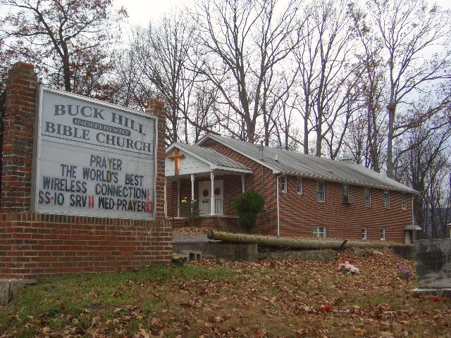
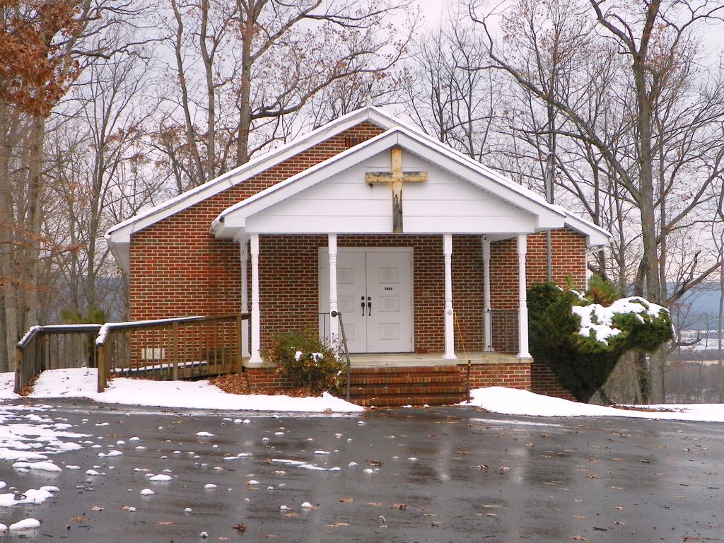
| Description | : | From Gerrardstown, take Rt. 51 (Gerrardstown Rd.) west to Mills Gap straight across CR45 on to Buck Hill Rd. for about 2 miles to church on left. A lot of land on Buck Ridge was transferred on December 15, 1884, to the trustees of the "United Brethern in Christ," under the control of the Virginia Conference, for a burying ground and for religious purposes only. The building of the first church was started soon after the land was acquired and finished by the early 1900's as a wooden structure with the cemetery adjacent. The United Brethren Church, as it was originally... Read More |
frequently asked questions (FAQ):
-
Where is Buck Hill Bible Church Cemetery?
Buck Hill Bible Church Cemetery is located at Berkeley County ,West Virginia ,USA.
-
Buck Hill Bible Church Cemetery cemetery's updated grave count on graveviews.com?
4 memorials
-
Where are the coordinates of the Buck Hill Bible Church Cemetery?
Latitude: 39.4138500
Longitude: -78.1124900

Nearby Cemetories:
1. Central Chapel Cemetery
Hedgesville, Berkeley County, USA
Coordinate: 39.4151993, -78.1471024
2. Trinity Lutheran Cemetery
Arden, Berkeley County, USA
Coordinate: 39.4193993, -78.0774994
3. Ganotown United Methodist Church Cemetery
Glengary, Berkeley County, USA
Coordinate: 39.4056900, -78.1492000
4. Joseph Hagaman Cemetery
Hedgesville, Berkeley County, USA
Coordinate: 39.4409160, -78.1326200
5. Shanghai Presbyterian Cemetery
Shanghai, Berkeley County, USA
Coordinate: 39.4438400, -78.1308700
6. Back Creek Valley Full Gospel Church Cemetery
Shanghai, Berkeley County, USA
Coordinate: 39.4467300, -78.1314800
7. Mountain Side Tabernacle Cemetery
Martinsburg, Berkeley County, USA
Coordinate: 39.4305900, -78.0678100
8. Lutheran Cemetery
Gerrardstown, Berkeley County, USA
Coordinate: 39.3735008, -78.0972977
9. Moutainview Baptist Church Cemetery
Glengary, Berkeley County, USA
Coordinate: 39.3853500, -78.1561500
10. Gerrardstown Presbyterian Church Cemetery
Gerrardstown, Berkeley County, USA
Coordinate: 39.3692398, -78.0989532
11. Pitzers Chapel Cemetery
Berkeley County, USA
Coordinate: 39.4303017, -78.0522003
12. Mount Olive Cemetery
Gerrardstown, Berkeley County, USA
Coordinate: 39.3647780, -78.1253350
13. Arden United Methodist Church Cemetery
Martinsburg, Berkeley County, USA
Coordinate: 39.4190407, -78.0407562
14. Old Quaker Cemetery
Martinsburg, Berkeley County, USA
Coordinate: 39.4191960, -78.0403630
15. Roe Chapel Cemetery
Berkeley County, USA
Coordinate: 39.4074650, -78.1849660
16. Mount Carmel Methodist Church Cemetery
Glengary, Berkeley County, USA
Coordinate: 39.3908950, -78.1887700
17. Salem United Methodist Cemetery
Martinsburg, Berkeley County, USA
Coordinate: 39.4623600, -78.0473000
18. Everhart-Kees Cemetery
Jones Springs, Berkeley County, USA
Coordinate: 39.4838390, -78.1043390
19. Poor House Farm Cemetery #1, #2, #3
Martinsburg, Berkeley County, USA
Coordinate: 39.4602520, -78.0395790
20. Brannon Cemetery
Glengary, Berkeley County, USA
Coordinate: 39.3626100, -78.1798300
21. Jones Springs Cemetery
Jones Springs, Berkeley County, USA
Coordinate: 39.4905900, -78.0963500
22. Jones Spring Calvary Bible Church Cemetery
Jones Springs, Berkeley County, USA
Coordinate: 39.4911400, -78.0926900
23. Weidman - Suver Cemetery
Bunker Hill, Berkeley County, USA
Coordinate: 39.3335340, -78.1162690
24. Darkesville Cemetery
Darkesville, Berkeley County, USA
Coordinate: 39.3783300, -78.0191500