| Memorials | : | 0 |
| Location | : | Glengary, Berkeley County, USA |
| Coordinate | : | 39.3626100, -78.1798300 |
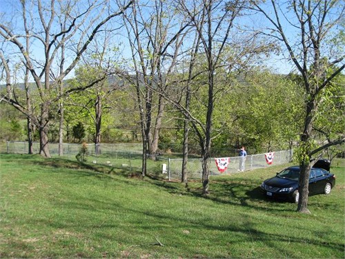
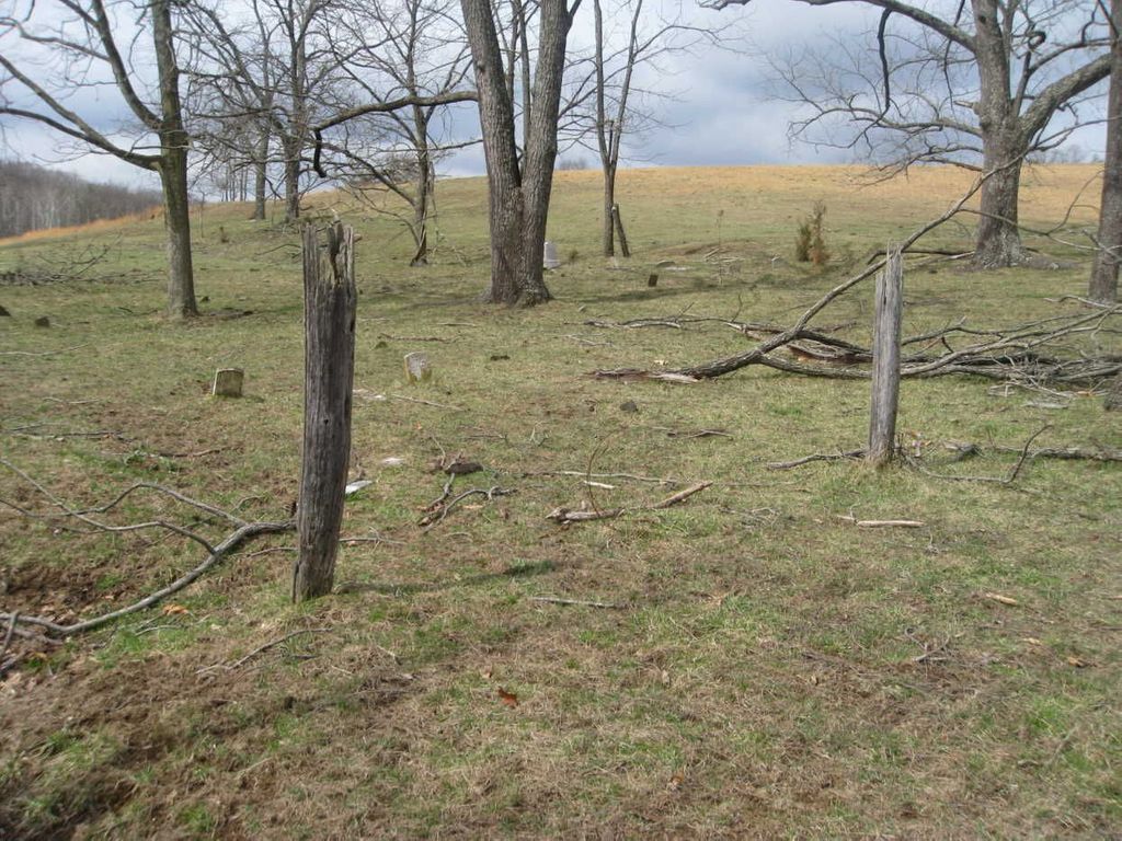
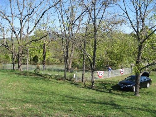
| Description | : | Situated in the Back Creek Valley of what was once Frederick County Virginia, the cemetery, now located in Berkeley County West Virginia, lies on the farm once owned by John Brannon. This cemetery is the resting place of at least 3 Revolutionary War Patriots. Map GPS location is approximate as this cemetery is on privately owned land. |
frequently asked questions (FAQ):
-
Where is Brannon Cemetery?
Brannon Cemetery is located at Brannons Ford Rd Glengary, Berkeley County ,West Virginia , 25421USA.
-
Brannon Cemetery cemetery's updated grave count on graveviews.com?
0 memorials
-
Where are the coordinates of the Brannon Cemetery?
Latitude: 39.3626100
Longitude: -78.1798300
Nearby Cemetories:
1. Pine Grove United Methodist Church Cemetery
De Haven, Frederick County, USA
Coordinate: 39.3513985, -78.1857986
2. Howards Chapel United Methodist Church Cemetery
Siler, Frederick County, USA
Coordinate: 39.3585014, -78.2171021
3. Mount Carmel Methodist Church Cemetery
Glengary, Berkeley County, USA
Coordinate: 39.3908950, -78.1887700
4. Moutainview Baptist Church Cemetery
Glengary, Berkeley County, USA
Coordinate: 39.3853500, -78.1561500
5. Mount Olive Cemetery
Gerrardstown, Berkeley County, USA
Coordinate: 39.3647780, -78.1253350
6. Strowbridge Cemetery
Siler, Frederick County, USA
Coordinate: 39.3635530, -78.2354260
7. Roe Chapel Cemetery
Berkeley County, USA
Coordinate: 39.4074650, -78.1849660
8. Mount Pleasant Cemetery
Gerrardstown, Berkeley County, USA
Coordinate: 39.3338730, -78.1343120
9. Ganotown United Methodist Church Cemetery
Glengary, Berkeley County, USA
Coordinate: 39.4056900, -78.1492000
10. Chestnut Grove Cemetery
Siler, Frederick County, USA
Coordinate: 39.3306007, -78.2304001
11. Shockeysville United Methodist Church Cemetery
Shockeysville, Frederick County, USA
Coordinate: 39.3861008, -78.2432022
12. Weidman - Suver Cemetery
Bunker Hill, Berkeley County, USA
Coordinate: 39.3335340, -78.1162690
13. Files Chapel Cemetery
Shockeysville, Frederick County, USA
Coordinate: 39.3781013, -78.2515335
14. Central Chapel Cemetery
Hedgesville, Berkeley County, USA
Coordinate: 39.4151993, -78.1471024
15. Heironimus Gravesite
Siler, Frederick County, USA
Coordinate: 39.3558899, -78.2574669
16. Old Stone Church Cemetery
Green Spring, Frederick County, USA
Coordinate: 39.3011017, -78.1675034
17. Gerrardstown Presbyterian Church Cemetery
Gerrardstown, Berkeley County, USA
Coordinate: 39.3692398, -78.0989532
18. Lutheran Cemetery
Gerrardstown, Berkeley County, USA
Coordinate: 39.3735008, -78.0972977
19. Kaes Park
Frederick County, USA
Coordinate: 39.3218200, -78.2454900
20. White Hall United Methodist Church Cemetery
White Hall, Frederick County, USA
Coordinate: 39.2937012, -78.1489029
21. Buck Hill Bible Church Cemetery
Berkeley County, USA
Coordinate: 39.4138500, -78.1124900
22. Pleasant Valley United Methodist Church Cemetery
Cedar Grove, Frederick County, USA
Coordinate: 39.2834015, -78.1800995
23. Joseph Hagaman Cemetery
Hedgesville, Berkeley County, USA
Coordinate: 39.4409160, -78.1326200
24. Greenwood Cemetery
Greenwood, Morgan County, USA
Coordinate: 39.4403000, -78.2356033

