
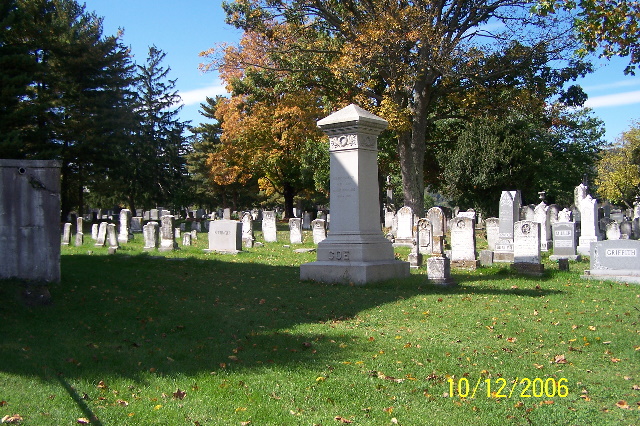
| Memorials | : | 119 |
| Location | : | Gerrardstown, Berkeley County, USA |
| Phone | : | 304-229-2316 |
| Coordinate | : | 39.3692398, -78.0989532 |
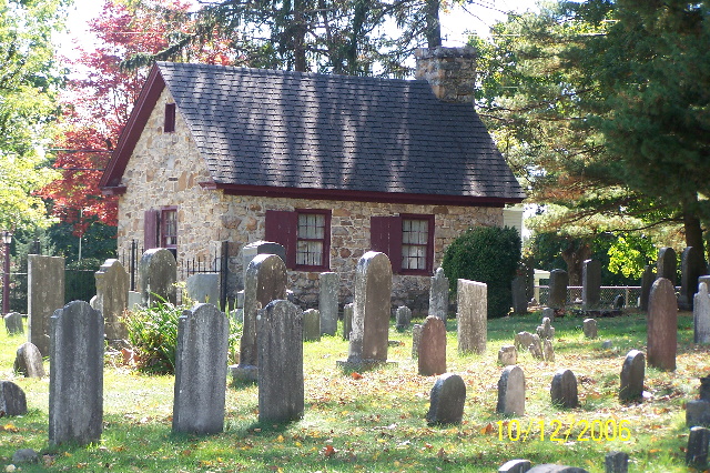
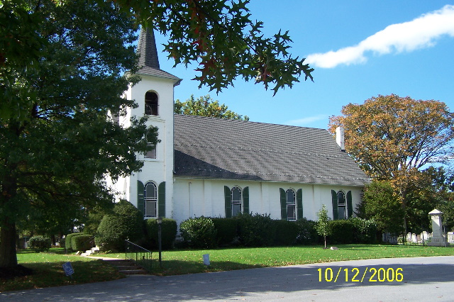
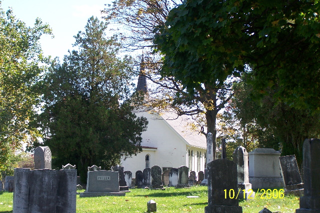
| Description | : | Located approximately 4 miles from Interstate 81 at Exit 5, in Gerrardstown on Dominion Rd. (CR 51/2) just 0.2 miles south of Gerrardstown Rd. (Rt. 51). The village of Middletown was established in 1784. The first Presbyterian Church in Gerrardstown was erected in 1797-98. The building project was completed in 1817. The deed for the property was for one acre from Thomas Lewis and was dated Dec. 18, 1800. The first church, a plain fifty by forty foot brick structure with windows on each side, was adjacent to a fine stone meetinghouse, which had been built about 1760. ... Read More |
frequently asked questions (FAQ):
-
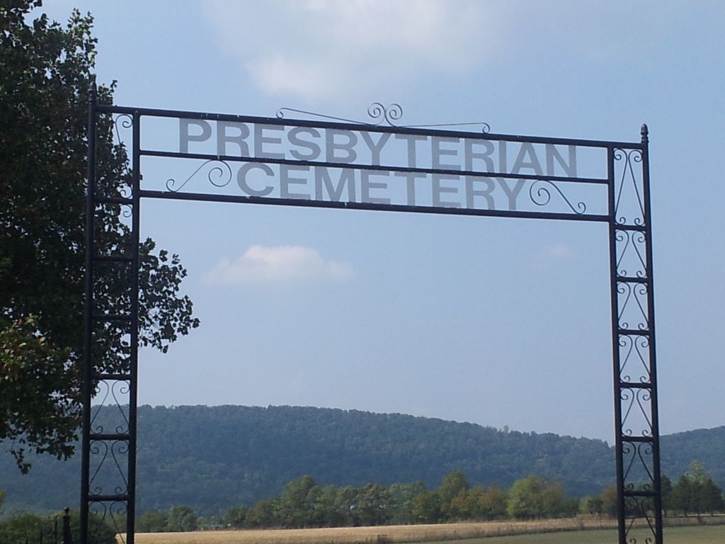
Where is Gerrardstown Presbyterian Church Cemetery?
Gerrardstown Presbyterian Church Cemetery is located at 372 Dominion Road Gerrardstown, Berkeley County ,West Virginia , 25420USA.
-
Gerrardstown Presbyterian Church Cemetery cemetery's updated grave count on graveviews.com?
114 memorials
-
Where are the coordinates of the Gerrardstown Presbyterian Church Cemetery?
Latitude: 39.3692398
Longitude: -78.0989532

Nearby Cemetories:
1. Lutheran Cemetery
Gerrardstown, Berkeley County, USA
Coordinate: 39.3735008, -78.0972977
2. Mount Olive Cemetery
Gerrardstown, Berkeley County, USA
Coordinate: 39.3647780, -78.1253350
3. Weidman - Suver Cemetery
Bunker Hill, Berkeley County, USA
Coordinate: 39.3335340, -78.1162690
4. Mount Pleasant Cemetery
Gerrardstown, Berkeley County, USA
Coordinate: 39.3338730, -78.1343120
5. Buck Hill Bible Church Cemetery
Berkeley County, USA
Coordinate: 39.4138500, -78.1124900
6. Moutainview Baptist Church Cemetery
Glengary, Berkeley County, USA
Coordinate: 39.3853500, -78.1561500
7. Bunker Hill Cemetery
Bunker Hill, Berkeley County, USA
Coordinate: 39.3339005, -78.0585022
8. Mount Tabor Church Cemetery
Bunker Hill, Berkeley County, USA
Coordinate: 39.3317032, -78.0534286
9. Trinity Lutheran Cemetery
Arden, Berkeley County, USA
Coordinate: 39.4193993, -78.0774994
10. Ganotown United Methodist Church Cemetery
Glengary, Berkeley County, USA
Coordinate: 39.4056900, -78.1492000
11. Central Chapel Cemetery
Hedgesville, Berkeley County, USA
Coordinate: 39.4151993, -78.1471024
12. Darkesville Cemetery
Darkesville, Berkeley County, USA
Coordinate: 39.3783300, -78.0191500
13. Brannon Cemetery
Glengary, Berkeley County, USA
Coordinate: 39.3626100, -78.1798300
14. Mountain Side Tabernacle Cemetery
Martinsburg, Berkeley County, USA
Coordinate: 39.4305900, -78.0678100
15. Arden United Methodist Church Cemetery
Martinsburg, Berkeley County, USA
Coordinate: 39.4190407, -78.0407562
16. Old Quaker Cemetery
Martinsburg, Berkeley County, USA
Coordinate: 39.4191960, -78.0403630
17. Pine Grove United Methodist Church Cemetery
De Haven, Frederick County, USA
Coordinate: 39.3513985, -78.1857986
18. Pitzers Chapel Cemetery
Berkeley County, USA
Coordinate: 39.4303017, -78.0522003
19. Mount Carmel Methodist Church Cemetery
Glengary, Berkeley County, USA
Coordinate: 39.3908950, -78.1887700
20. Mountain View Church of the Brethren Cemetery
Inwood, Berkeley County, USA
Coordinate: 39.3320600, -78.0146000
21. Joseph Hagaman Cemetery
Hedgesville, Berkeley County, USA
Coordinate: 39.4409160, -78.1326200
22. Roe Chapel Cemetery
Berkeley County, USA
Coordinate: 39.4074650, -78.1849660
23. Rest United Methodist Church Cemetery
Rest, Frederick County, USA
Coordinate: 39.2919006, -78.0820999
24. Shanghai Presbyterian Cemetery
Shanghai, Berkeley County, USA
Coordinate: 39.4438400, -78.1308700