
| Memorials | : | 0 |
| Location | : | Hot Springs, Garland County, USA |
| Coordinate | : | 34.6130524, -93.3421173 |
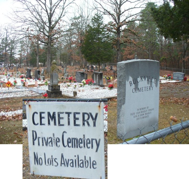
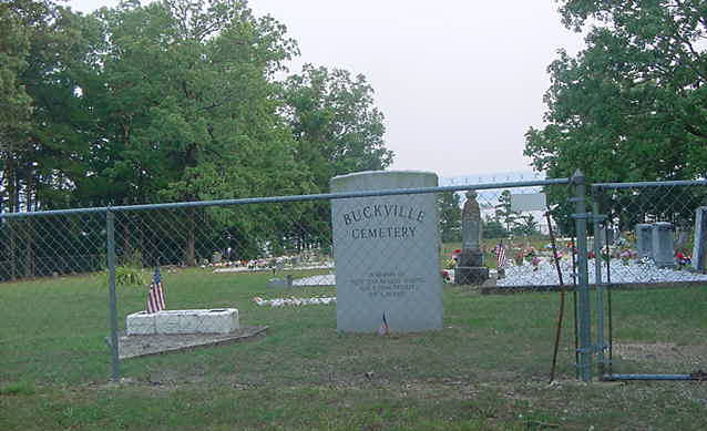
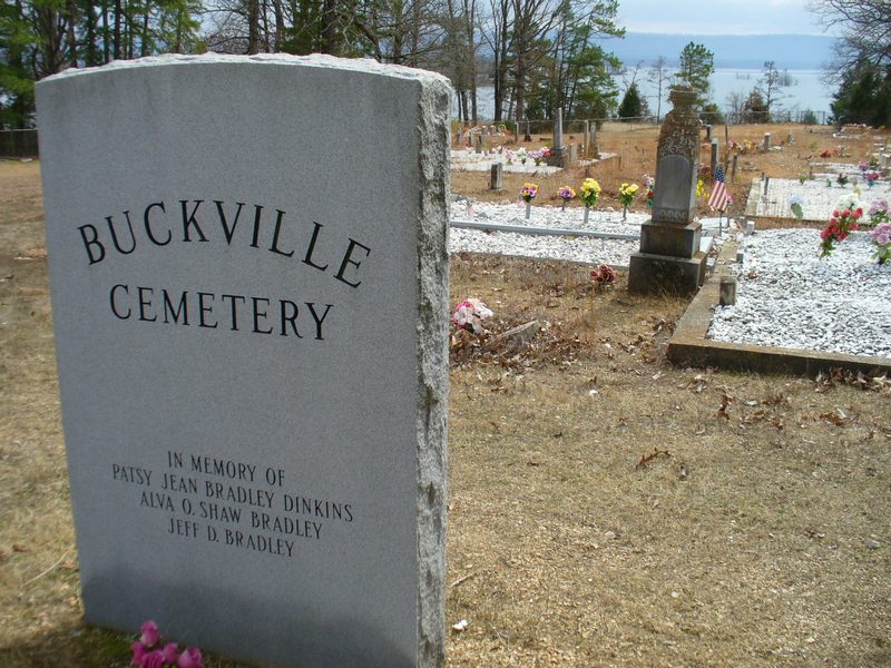
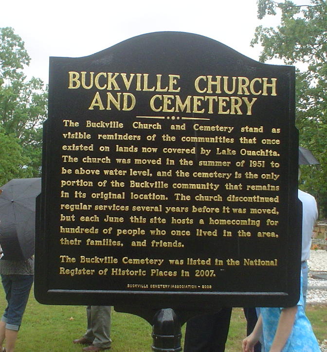
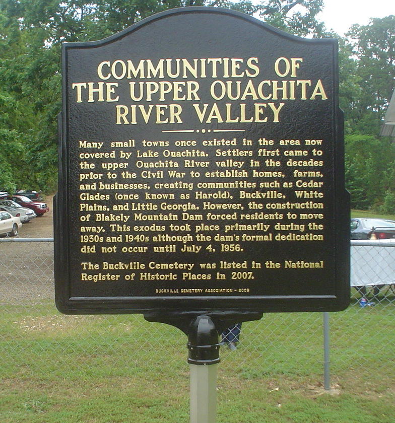
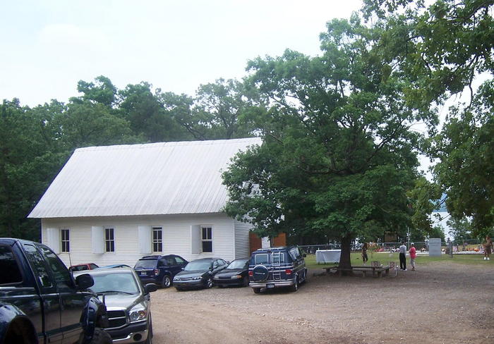
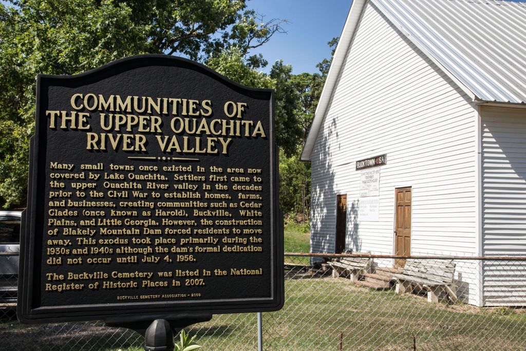
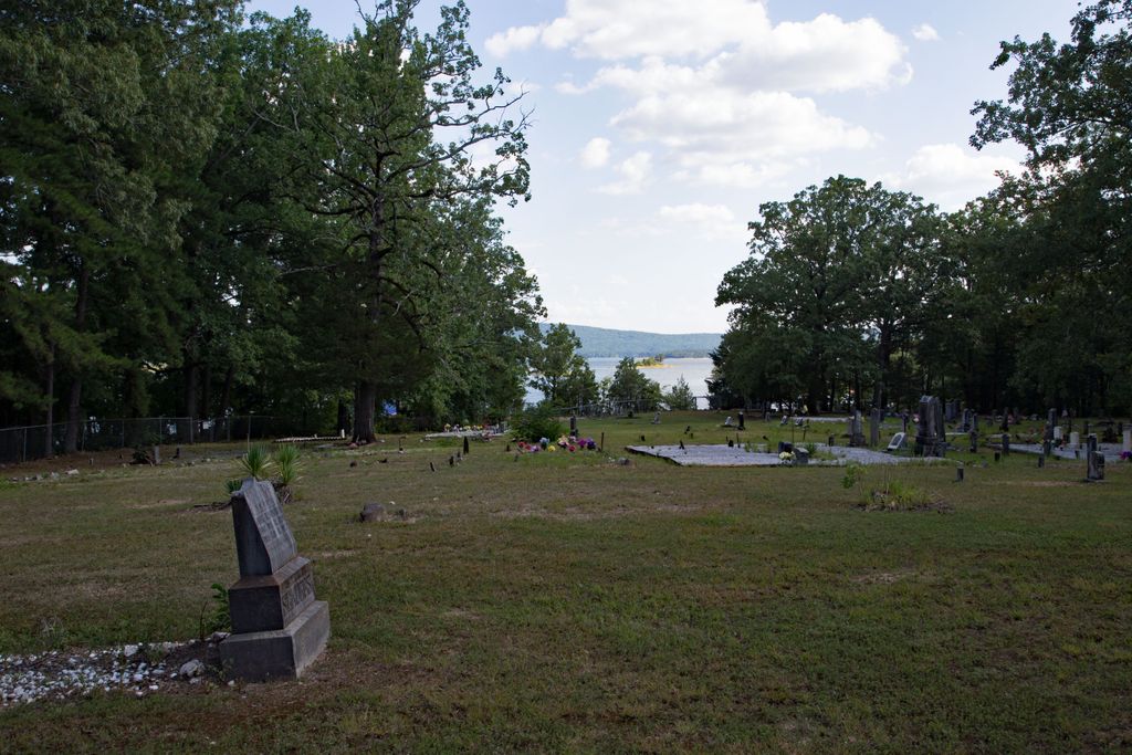
| Description | : | Cemetery closed No lots available The church was moved in 1951 from a hilltop about a mile from the cemetery. The hilltop went under water,but the church was saved and moved by putting in on logs hooked to a tractor. It was set up by the cemetery. |
frequently asked questions (FAQ):
-
Where is Buckville Cemetery?
Buckville Cemetery is located at Hot Springs, Garland County ,Arkansas ,USA.
-
Buckville Cemetery cemetery's updated grave count on graveviews.com?
0 memorials
-
Where are the coordinates of the Buckville Cemetery?
Latitude: 34.6130524
Longitude: -93.3421173
Nearby Cemetories:
1. New Cedar Glades Cemetery
Garland County, USA
Coordinate: 34.6148987, -93.3437271
2. Brooks Cemetery
Garland County, USA
Coordinate: 34.6162491, -93.3390274
3. Avant Cemetery
Garland County, USA
Coordinate: 34.6383018, -93.3399963
4. Daley Cemetery
Garland County, USA
Coordinate: 34.6716995, -93.3416977
5. Crystal Springs Cemetery
Crystal Springs, Garland County, USA
Coordinate: 34.5208588, -93.3443985
6. Mount Tabor Cemetery
Mount Tabor, Garland County, USA
Coordinate: 34.7117004, -93.3319016
7. Little Fir Cemetery
Little Fir Landing, Montgomery County, USA
Coordinate: 34.6220700, -93.4651000
8. Oakwood Cemetery
Mountain Pine, Garland County, USA
Coordinate: 34.7140007, -93.3927994
9. Murphy Cemetery
Montgomery County, USA
Coordinate: 34.5257988, -93.4235992
10. Joplin Cemetery
Mount Ida, Montgomery County, USA
Coordinate: 34.5428009, -93.4505997
11. Cain-Crumpton Cemetery
Royal, Garland County, USA
Coordinate: 34.5094000, -93.2853000
12. Lowe Cemetery
Royal, Garland County, USA
Coordinate: 34.5093994, -93.2853012
13. Rock Springs Cemetery
Cedar Glades, Garland County, USA
Coordinate: 34.6852989, -93.2335968
14. Lewis Cemetery
Crystal Springs, Garland County, USA
Coordinate: 34.4935000, -93.3452000
15. McDowell Cemetery
Garland County, USA
Coordinate: 34.4919014, -93.2983017
16. Caldwell Cemetery
Mount Tabor, Garland County, USA
Coordinate: 34.7369003, -93.2919006
17. Cunningham Cemetery
Royal, Garland County, USA
Coordinate: 34.5292015, -93.2200012
18. Peak Cemetery
Royal, Garland County, USA
Coordinate: 34.4883118, -93.3948212
19. Big Fir Cemetery
Montgomery County, USA
Coordinate: 34.6049995, -93.5053024
20. Little Fir Cemetery
Rubie, Montgomery County, USA
Coordinate: 34.6050400, -93.5056000
21. Hughes Cemetery
Mountain Pine, Garland County, USA
Coordinate: 34.5509911, -93.1818466
22. Ben Johnson Cemetery
Garland County, USA
Coordinate: 34.5559290, -93.1779660
23. Mountain Pine Cemetery
Mountain Pine, Garland County, USA
Coordinate: 34.5793304, -93.1681137
24. Crossroads Cemetery
Pearcy, Garland County, USA
Coordinate: 34.4625015, -93.3375015