
| Memorials | : | 2 |
| Location | : | Garland County, USA |
| Coordinate | : | 34.6148987, -93.3437271 |
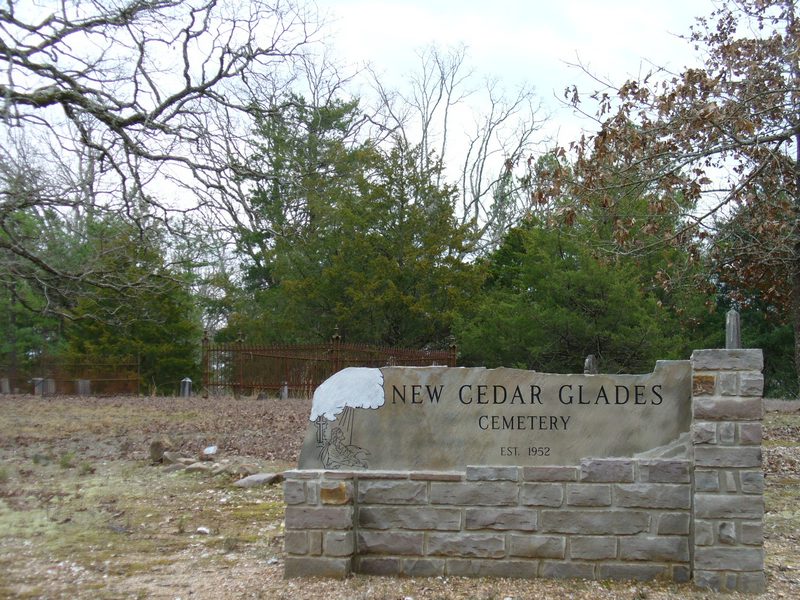
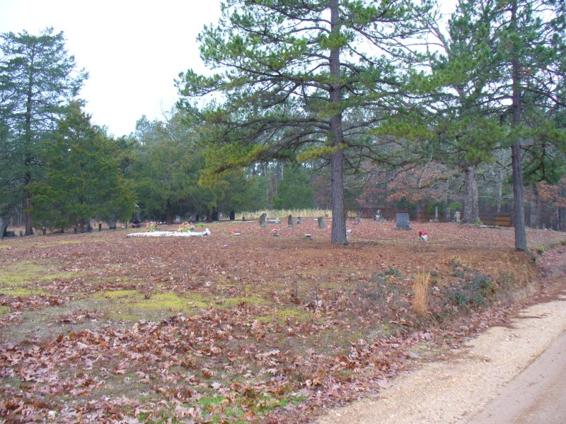
| Description | : | This is the New Cedar Glades Cemetery, named by the Army Corp of Engineers during the grave removal project in the 1950s; only recently has a sign been placed there. It is a combination of (the graves found at the former towns of) Pittman, Bradley, Cedar Glades etc. that are now under Lake Ouachita. |
frequently asked questions (FAQ):
-
Where is New Cedar Glades Cemetery?
New Cedar Glades Cemetery is located at Garland County ,Arkansas ,USA.
-
New Cedar Glades Cemetery cemetery's updated grave count on graveviews.com?
2 memorials
-
Where are the coordinates of the New Cedar Glades Cemetery?
Latitude: 34.6148987
Longitude: -93.3437271
Nearby Cemetories:
1. Buckville Cemetery
Hot Springs, Garland County, USA
Coordinate: 34.6130524, -93.3421173
2. Brooks Cemetery
Garland County, USA
Coordinate: 34.6162491, -93.3390274
3. Avant Cemetery
Garland County, USA
Coordinate: 34.6383018, -93.3399963
4. Daley Cemetery
Garland County, USA
Coordinate: 34.6716995, -93.3416977
5. Crystal Springs Cemetery
Crystal Springs, Garland County, USA
Coordinate: 34.5208588, -93.3443985
6. Mount Tabor Cemetery
Mount Tabor, Garland County, USA
Coordinate: 34.7117004, -93.3319016
7. Little Fir Cemetery
Little Fir Landing, Montgomery County, USA
Coordinate: 34.6220700, -93.4651000
8. Oakwood Cemetery
Mountain Pine, Garland County, USA
Coordinate: 34.7140007, -93.3927994
9. Murphy Cemetery
Montgomery County, USA
Coordinate: 34.5257988, -93.4235992
10. Joplin Cemetery
Mount Ida, Montgomery County, USA
Coordinate: 34.5428009, -93.4505997
11. Rock Springs Cemetery
Cedar Glades, Garland County, USA
Coordinate: 34.6852989, -93.2335968
12. Cain-Crumpton Cemetery
Royal, Garland County, USA
Coordinate: 34.5094000, -93.2853000
13. Lowe Cemetery
Royal, Garland County, USA
Coordinate: 34.5093994, -93.2853012
14. Lewis Cemetery
Crystal Springs, Garland County, USA
Coordinate: 34.4935000, -93.3452000
15. McDowell Cemetery
Garland County, USA
Coordinate: 34.4919014, -93.2983017
16. Caldwell Cemetery
Mount Tabor, Garland County, USA
Coordinate: 34.7369003, -93.2919006
17. Cunningham Cemetery
Royal, Garland County, USA
Coordinate: 34.5292015, -93.2200012
18. Big Fir Cemetery
Montgomery County, USA
Coordinate: 34.6049995, -93.5053024
19. Peak Cemetery
Royal, Garland County, USA
Coordinate: 34.4883118, -93.3948212
20. Little Fir Cemetery
Rubie, Montgomery County, USA
Coordinate: 34.6050400, -93.5056000
21. Hughes Cemetery
Mountain Pine, Garland County, USA
Coordinate: 34.5509911, -93.1818466
22. Ben Johnson Cemetery
Garland County, USA
Coordinate: 34.5559290, -93.1779660
23. Mountain Pine Cemetery
Mountain Pine, Garland County, USA
Coordinate: 34.5793304, -93.1681137
24. Breashears Cemetery
Fannie, Montgomery County, USA
Coordinate: 34.6988983, -93.4969025