
| Memorials | : | 0 |
| Location | : | Sugar Land, Fort Bend County, USA |
| Website | : | heavy.com/news/2018/08/sugar-land-texas-mass-grave/ |
| Coordinate | : | 29.6062060, -95.6490625 |
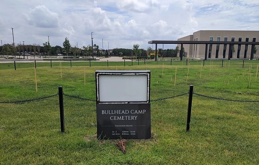
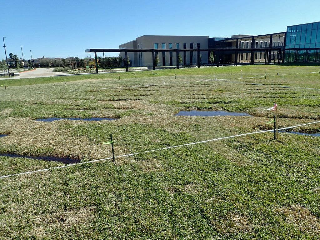
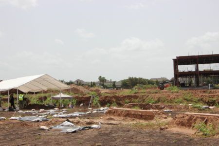
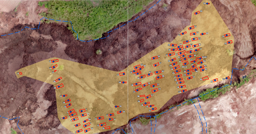
| Description | : | Unmarked graves were found during the construction of the James Reese Career and Technical Center on once Imperial Sugar Company land. The graves of 95 prisoners were discovered, dating from 1878 to 1911. Part of the new educational building was planned to be built where this previously forgotten cemetery was located. Cooperation between the Fort Bend School District and the Fort Bend County authorities determined that the graves will remain in place, and the educational building wing planned for that area will not be built to the original plans. The county has accepted responsibility for the care of the cemetery.... Read More |
frequently asked questions (FAQ):
-
Where is Bullhead Camp Cemetery?
Bullhead Camp Cemetery is located at 12300 University Blvd Sugar Land, Fort Bend County ,Texas , 77479USA.
-
Bullhead Camp Cemetery cemetery's updated grave count on graveviews.com?
0 memorials
-
Where are the coordinates of the Bullhead Camp Cemetery?
Latitude: 29.6062060
Longitude: -95.6490625
Nearby Cemetories:
1. Imperial Prison Farm Cemetery
Sugar Land, Fort Bend County, USA
Coordinate: 29.6050850, -95.6574230
2. Watkins Cemetery
New Territory, Fort Bend County, USA
Coordinate: 29.5860600, -95.6781500
3. New Home Cemetery
Sugar Land, Fort Bend County, USA
Coordinate: 29.6243992, -95.6817017
4. Thompsons Chapel Cemetery
Fort Bend County, USA
Coordinate: 29.5905040, -95.6867550
5. Hodges Bend Cemetery
Fort Bend County, USA
Coordinate: 29.6406900, -95.6624200
6. Cementerio San Isidro
Sugar Land, Fort Bend County, USA
Coordinate: 29.6044006, -95.6014023
7. William J. Stafford Cemetery
Stafford, Fort Bend County, USA
Coordinate: 29.6059100, -95.5861300
8. Dickson Cemetery
Sugar Land, Fort Bend County, USA
Coordinate: 29.5573980, -95.6891050
9. Pickens Cemetery
Greatwood, Fort Bend County, USA
Coordinate: 29.5430830, -95.6843250
10. Frost Plantation Cemetery
Missouri City, Fort Bend County, USA
Coordinate: 29.5814120, -95.5731770
11. Pleasant Green Cemetery
Fort Bend County, USA
Coordinate: 29.6566000, -95.7070000
12. First United Methodist Church Columbarium
Missouri City, Fort Bend County, USA
Coordinate: 29.6017620, -95.5653030
13. Sansberry Cemetery
Richmond, Fort Bend County, USA
Coordinate: 29.5467400, -95.6981700
14. Mount Pleasant Baptist Church Cemetery
Thompsons, Fort Bend County, USA
Coordinate: 29.5268400, -95.6243400
15. New Hope Cemetery
Stafford, Fort Bend County, USA
Coordinate: 29.6000004, -95.5532990
16. Packer Family Cemetery
Stafford, Fort Bend County, USA
Coordinate: 29.5976293, -95.5528472
17. Craven Cemetery
Stafford, Fort Bend County, USA
Coordinate: 29.6240997, -95.5510025
18. Kuykendall Cemetery
Richmond, Fort Bend County, USA
Coordinate: 29.5440830, -95.7230000
19. Armstrong Family Cemetery
Brazoria County, USA
Coordinate: 29.6129500, -95.7569670
20. Mount Olive Baptist Church Cemetery
Sugar Land, Fort Bend County, USA
Coordinate: 29.5373900, -95.5727800
21. San Gabriel Cemetery
Richmond, Fort Bend County, USA
Coordinate: 29.5741997, -95.7544022
22. Dyer Cemetery
Fort Bend County, USA
Coordinate: 29.5776500, -95.7571170
23. William Jenkins Burial Site
Richmond, Fort Bend County, USA
Coordinate: 29.5945250, -95.7616850
24. Mount Carmel Cemetery
Richmond, Fort Bend County, USA
Coordinate: 29.5939007, -95.7621994