
| Memorials | : | 0 |
| Location | : | Oak Grove, Carroll County, USA |
| Coordinate | : | 33.5210480, -85.0753460 |
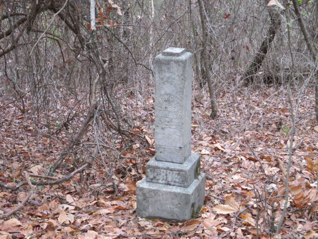
| Description | : | From Carrollton go south on Highway 27 past Oak Grove Road about 250-300 feet. This one grave cemetery is on the east side of the highway. David Burden's 3-4 foot high monument is facing west. He is supposedly buried in solid rock in a grave that he prepared before he died. |
frequently asked questions (FAQ):
-
Where is Burden Cemetery?
Burden Cemetery is located at Oak Grove, Carroll County ,Georgia ,USA.
-
Burden Cemetery cemetery's updated grave count on graveviews.com?
0 memorials
-
Where are the coordinates of the Burden Cemetery?
Latitude: 33.5210480
Longitude: -85.0753460
Nearby Cemetories:
1. Shadinger Cemetery
Carrollton, Carroll County, USA
Coordinate: 33.5235000, -85.0715170
2. Oak Grove Baptist Church Cemetery
Carrollton, Carroll County, USA
Coordinate: 33.5259895, -85.0868301
3. Emmaus Primitive Baptist Church Cemetery
Carroll County, USA
Coordinate: 33.5163994, -85.0871964
4. Oak Grove Baptist Church Cemetery
Carrollton, Carroll County, USA
Coordinate: 33.5096260, -85.0872230
5. Stripling Chapel United Methodist Church Cemetery
Carrollton, Carroll County, USA
Coordinate: 33.5416985, -85.0746994
6. Rocky Mount Baptist Cemetery
Carrollton, Carroll County, USA
Coordinate: 33.5331410, -85.1030180
7. Carroll Memory Gardens
Carrollton, Carroll County, USA
Coordinate: 33.5457993, -85.0625000
8. Lambert Cemetery
Carrollton, Carroll County, USA
Coordinate: 33.5031610, -85.1000880
9. Whooping Creek Primitive Baptist Church Cemetery
Carrollton, Carroll County, USA
Coordinate: 33.5147018, -85.0428009
10. Martin Cemetery
Carroll County, USA
Coordinate: 33.5477240, -85.0976300
11. Old Lutheran Cemetery
Carrollton, Carroll County, USA
Coordinate: 33.5395530, -85.0386640
12. Holy Ground Baptist Church Cemetery
Roopville, Carroll County, USA
Coordinate: 33.4872050, -85.0930600
13. Mount Pleasant Baptist Church Cemetery
Carrollton, Carroll County, USA
Coordinate: 33.5266991, -85.0286026
14. Roy Richards Family Cemetery
Carrollton, Carroll County, USA
Coordinate: 33.5650260, -85.0678150
15. Prickett Cemetery
Roopville, Carroll County, USA
Coordinate: 33.4841450, -85.1136590
16. Stallings Cemetery
Lowell, Carroll County, USA
Coordinate: 33.4813530, -85.0401020
17. Clem Cemetery
Clem, Carroll County, USA
Coordinate: 33.5243988, -85.0160980
18. Piney Grove Cemetery
Carroll County, USA
Coordinate: 33.5518990, -85.1224976
19. Mount Lowell Baptist Church Cemetery
Lowell, Carroll County, USA
Coordinate: 33.4751070, -85.0489210
20. Bonner Cemetery
Roopville, Carroll County, USA
Coordinate: 33.4939003, -85.1271973
21. Roopville Road Baptist Church Cemetery
Carroll County, USA
Coordinate: 33.4753070, -85.1082940
22. Lees Chapel First Congregational Methodist Cemeter
Carrollton, Carroll County, USA
Coordinate: 33.5196991, -85.1421967
23. Community Bible Church Cemetery
Carroll County, USA
Coordinate: 33.4668999, -85.0594025
24. Mount Lowell Cemetery
Carroll County, USA
Coordinate: 33.4678001, -85.0543976