
| Memorials | : | 0 |
| Location | : | Carrollton, Carroll County, USA |
| Coordinate | : | 33.5395530, -85.0386640 |
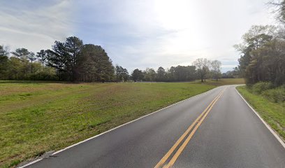
| Description | : | From Carrollton, take the Highway 166 South Bypass. Go southeast on Blandenberg Road to the junction of Mount Pleasant Church Road; turn right and go 0.02 mile. Cross over the railroad tracks to an old farm road bed on the left. Go out this road bed about 100-150 feet to the one grave marker on the left. At one time, according to previous landowners, there may have been as many as seven or eight graves and it was believed to have been a Lutheran Church. Today, only one grave marker remains, which is about 430... Read More |
frequently asked questions (FAQ):
-
Where is Old Lutheran Cemetery?
Old Lutheran Cemetery is located at Carrollton, Carroll County ,Georgia ,USA.
-
Old Lutheran Cemetery cemetery's updated grave count on graveviews.com?
0 memorials
-
Where are the coordinates of the Old Lutheran Cemetery?
Latitude: 33.5395530
Longitude: -85.0386640
Nearby Cemetories:
1. Mount Pleasant Baptist Church Cemetery
Carrollton, Carroll County, USA
Coordinate: 33.5266991, -85.0286026
2. Carroll Memory Gardens
Carrollton, Carroll County, USA
Coordinate: 33.5457993, -85.0625000
3. Clem Cemetery
Clem, Carroll County, USA
Coordinate: 33.5243988, -85.0160980
4. Whooping Creek Primitive Baptist Church Cemetery
Carrollton, Carroll County, USA
Coordinate: 33.5147018, -85.0428009
5. Stripling Chapel United Methodist Church Cemetery
Carrollton, Carroll County, USA
Coordinate: 33.5416985, -85.0746994
6. Antioch Missionary Baptist Church Cemetery
Carrollton, Carroll County, USA
Coordinate: 33.5311012, -85.0036011
7. Shadinger Cemetery
Carrollton, Carroll County, USA
Coordinate: 33.5235000, -85.0715170
8. Stevens Cemetery
Carrollton, Carroll County, USA
Coordinate: 33.5742250, -85.0451230
9. Roy Richards Family Cemetery
Carrollton, Carroll County, USA
Coordinate: 33.5650260, -85.0678150
10. Burden Cemetery
Oak Grove, Carroll County, USA
Coordinate: 33.5210480, -85.0753460
11. Alms House Cemetery
Carrollton, Carroll County, USA
Coordinate: 33.5762630, -85.0465070
12. Oak Grove Baptist Church Cemetery
Carrollton, Carroll County, USA
Coordinate: 33.5259895, -85.0868301
13. Cook Family Cemetery
Carrollton, Carroll County, USA
Coordinate: 33.5077080, -85.0020030
14. Pleasant Hill Baptist Cemetery
Carroll County, USA
Coordinate: 33.5802994, -85.0136032
15. Harper Cemetery
Clem, Carroll County, USA
Coordinate: 33.5132490, -84.9936250
16. Emmaus Primitive Baptist Church Cemetery
Carroll County, USA
Coordinate: 33.5163994, -85.0871964
17. Bandy Cemetery
Oak Mountain, Carroll County, USA
Coordinate: 33.5811790, -85.0128400
18. Latimer Cemetery
Carrollton, Carroll County, USA
Coordinate: 33.5815190, -85.0126790
19. Saint Margaret's Episcopal Memorial Garden
Carroll County, USA
Coordinate: 33.5806330, -85.0678950
20. Davis Cemetery
Carroll County, USA
Coordinate: 33.4944000, -85.0152969
21. Martin Cemetery
Carroll County, USA
Coordinate: 33.5477240, -85.0976300
22. Oak Grove Baptist Church Cemetery
Carrollton, Carroll County, USA
Coordinate: 33.5096260, -85.0872230
23. Gilley Cemetery
Cross Plains, Carroll County, USA
Coordinate: 33.5459200, -84.9777460
24. Rocky Mount Baptist Cemetery
Carrollton, Carroll County, USA
Coordinate: 33.5331410, -85.1030180