
| Memorials | : | 0 |
| Location | : | Carrollton, Carroll County, USA |
| Coordinate | : | 33.5096260, -85.0872230 |
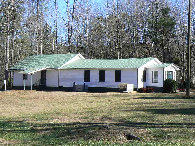
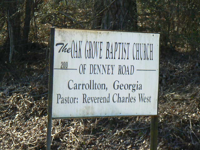
| Description | : | African American Cemetery. From Carrollton take Highway 27 south for 3.0 miles to Oak Grove Road. Turn right and go 1.0 mile to Oak Grove Church Road. Turn left and go 1.0 mile to Denney Road. Turn left and go 0.5 mile to the cemetery on the left side of road. |
frequently asked questions (FAQ):
-
Where is Oak Grove Baptist Church Cemetery?
Oak Grove Baptist Church Cemetery is located at Carrollton, Carroll County ,Georgia ,USA.
-
Oak Grove Baptist Church Cemetery cemetery's updated grave count on graveviews.com?
0 memorials
-
Where are the coordinates of the Oak Grove Baptist Church Cemetery?
Latitude: 33.5096260
Longitude: -85.0872230
Nearby Cemetories:
1. Emmaus Primitive Baptist Church Cemetery
Carroll County, USA
Coordinate: 33.5163994, -85.0871964
2. Lambert Cemetery
Carrollton, Carroll County, USA
Coordinate: 33.5031610, -85.1000880
3. Burden Cemetery
Oak Grove, Carroll County, USA
Coordinate: 33.5210480, -85.0753460
4. Oak Grove Baptist Church Cemetery
Carrollton, Carroll County, USA
Coordinate: 33.5259895, -85.0868301
5. Shadinger Cemetery
Carrollton, Carroll County, USA
Coordinate: 33.5235000, -85.0715170
6. Holy Ground Baptist Church Cemetery
Roopville, Carroll County, USA
Coordinate: 33.4872050, -85.0930600
7. Rocky Mount Baptist Cemetery
Carrollton, Carroll County, USA
Coordinate: 33.5331410, -85.1030180
8. Prickett Cemetery
Roopville, Carroll County, USA
Coordinate: 33.4841450, -85.1136590
9. Stripling Chapel United Methodist Church Cemetery
Carrollton, Carroll County, USA
Coordinate: 33.5416985, -85.0746994
10. Bonner Cemetery
Roopville, Carroll County, USA
Coordinate: 33.4939003, -85.1271973
11. Whooping Creek Primitive Baptist Church Cemetery
Carrollton, Carroll County, USA
Coordinate: 33.5147018, -85.0428009
12. Roopville Road Baptist Church Cemetery
Carroll County, USA
Coordinate: 33.4753070, -85.1082940
13. Martin Cemetery
Carroll County, USA
Coordinate: 33.5477240, -85.0976300
14. Carroll Memory Gardens
Carrollton, Carroll County, USA
Coordinate: 33.5457993, -85.0625000
15. Lees Chapel First Congregational Methodist Cemeter
Carrollton, Carroll County, USA
Coordinate: 33.5196991, -85.1421967
16. Mount Lowell Baptist Church Cemetery
Lowell, Carroll County, USA
Coordinate: 33.4751070, -85.0489210
17. Stallings Cemetery
Lowell, Carroll County, USA
Coordinate: 33.4813530, -85.0401020
18. Community Bible Church Cemetery
Carroll County, USA
Coordinate: 33.4668999, -85.0594025
19. Pentecost Cemetery
Lowell, Carroll County, USA
Coordinate: 33.4608002, -85.0749969
20. Mount Lowell Cemetery
Carroll County, USA
Coordinate: 33.4678001, -85.0543976
21. Old Lutheran Cemetery
Carrollton, Carroll County, USA
Coordinate: 33.5395530, -85.0386640
22. Piney Grove Cemetery
Carroll County, USA
Coordinate: 33.5518990, -85.1224976
23. Mount Pleasant Baptist Church Cemetery
Carrollton, Carroll County, USA
Coordinate: 33.5266991, -85.0286026
24. Lowell Congregational Holiness Church Cemetery
Lowell, Carroll County, USA
Coordinate: 33.4694680, -85.0478270