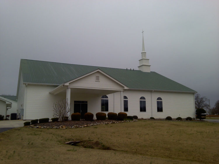
| Memorials | : | 0 |
| Location | : | Roopville, Carroll County, USA |
| Coordinate | : | 33.4872050, -85.0930600 |
| Description | : | From Carrollton go south on Highway 27; turn east on Hester Road; then turn south on Shirey Dairy Road to the cemetery. |
frequently asked questions (FAQ):
-
Where is Holy Ground Baptist Church Cemetery?
Holy Ground Baptist Church Cemetery is located at Roopville, Carroll County ,Georgia ,USA.
-
Holy Ground Baptist Church Cemetery cemetery's updated grave count on graveviews.com?
0 memorials
-
Where are the coordinates of the Holy Ground Baptist Church Cemetery?
Latitude: 33.4872050
Longitude: -85.0930600
Nearby Cemetories:
1. Lambert Cemetery
Carrollton, Carroll County, USA
Coordinate: 33.5031610, -85.1000880
2. Roopville Road Baptist Church Cemetery
Carroll County, USA
Coordinate: 33.4753070, -85.1082940
3. Prickett Cemetery
Roopville, Carroll County, USA
Coordinate: 33.4841450, -85.1136590
4. Oak Grove Baptist Church Cemetery
Carrollton, Carroll County, USA
Coordinate: 33.5096260, -85.0872230
5. Bonner Cemetery
Roopville, Carroll County, USA
Coordinate: 33.4939003, -85.1271973
6. Emmaus Primitive Baptist Church Cemetery
Carroll County, USA
Coordinate: 33.5163994, -85.0871964
7. Pentecost Cemetery
Lowell, Carroll County, USA
Coordinate: 33.4608002, -85.0749969
8. Community Bible Church Cemetery
Carroll County, USA
Coordinate: 33.4668999, -85.0594025
9. Burden Cemetery
Oak Grove, Carroll County, USA
Coordinate: 33.5210480, -85.0753460
10. Mount Lowell Cemetery
Carroll County, USA
Coordinate: 33.4678001, -85.0543976
11. Mount Lowell Baptist Church Cemetery
Lowell, Carroll County, USA
Coordinate: 33.4751070, -85.0489210
12. Pleasant Grove Baptist Church Cemetery
Roopville, Carroll County, USA
Coordinate: 33.4592018, -85.1252975
13. Oak Grove Baptist Church Cemetery
Carrollton, Carroll County, USA
Coordinate: 33.5259895, -85.0868301
14. Shadinger Cemetery
Carrollton, Carroll County, USA
Coordinate: 33.5235000, -85.0715170
15. Staples Family Cemetery
Roopville, Carroll County, USA
Coordinate: 33.4604820, -85.1310830
16. Lowell Congregational Holiness Church Cemetery
Lowell, Carroll County, USA
Coordinate: 33.4694680, -85.0478270
17. Gibson-McLucas Cemetery
Lowell, Carroll County, USA
Coordinate: 33.4680540, -85.0475690
18. Lowell Community Cemetery
Lowell, Carroll County, USA
Coordinate: 33.4658012, -85.0472031
19. Union Cemetery
Roopville, Carroll County, USA
Coordinate: 33.4641991, -85.1378021
20. Veal Family Cemetery
Roopville, Carroll County, USA
Coordinate: 33.4692540, -85.1416830
21. Stallings Cemetery
Lowell, Carroll County, USA
Coordinate: 33.4813530, -85.0401020
22. Roopville City Cemetery
Roopville, Carroll County, USA
Coordinate: 33.4566994, -85.1335983
23. Gentry-Bloodworth Cemetery
Roopville, Carroll County, USA
Coordinate: 33.4648680, -85.1407920
24. Steed Family Cemetery
Roopville, Carroll County, USA
Coordinate: 33.4848940, -85.1477520

