
| Memorials | : | 1 |
| Location | : | Coldwater, Tate County, USA |
| Coordinate | : | 34.6853720, -89.8199770 |
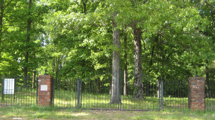
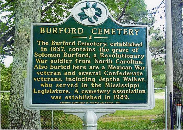
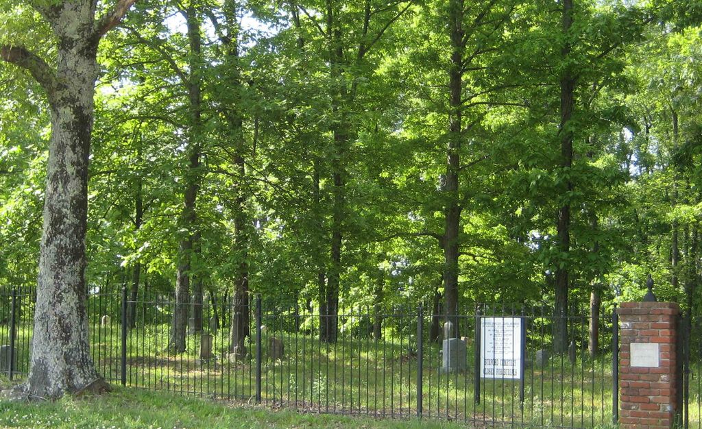
| Description | : | From the intersection of Peyton Rd, & US-51, in Coldwater, travel east on Payton Rd. for 1.5 mi.; turning southeast (slightly right) to continue east on Peyton Rd., going 8.8 mi.; turning north (left) to the entrance walk gate of this early 'deeded' cemetery, within a classic iron fence, as notated on USGS topo maps. Burford's cemetery is the oldest known graveyard in the southern part of DeSoto County, MS, which in 1873, became part of the newly formed Tate County, MS. Solomon Burford died unexpectedly on February 27, 1837 in Marshall County, MS. This territory was... Read More |
frequently asked questions (FAQ):
-
Where is Burford Cemetery?
Burford Cemetery is located at 10378 Peyton Road Coldwater, Tate County ,Mississippi ,USA.
-
Burford Cemetery cemetery's updated grave count on graveviews.com?
1 memorials
-
Where are the coordinates of the Burford Cemetery?
Latitude: 34.6853720
Longitude: -89.8199770
Nearby Cemetories:
1. Mount Zion Cemetery
Independence, Tate County, USA
Coordinate: 34.6986008, -89.8080978
2. Fredonia Cemetery
Coldwater, Tate County, USA
Coordinate: 34.6588650, -89.8288760
3. Hopewell Church Cemetery
Independence, Tate County, USA
Coordinate: 34.6744440, -89.7856500
4. Sandidge Cemetery
Independence, Tate County, USA
Coordinate: 34.6738190, -89.7788960
5. Eavenson Bett Cemetery
Bett, Tate County, USA
Coordinate: 34.6874810, -89.7596930
6. Jamison Cemetery
Independence, Tate County, USA
Coordinate: 34.7206130, -89.7771390
7. House Cemetery
Barr, Tate County, USA
Coordinate: 34.6390250, -89.7852380
8. Hancock Cemetery
Independence, Tate County, USA
Coordinate: 34.7179480, -89.7636780
9. Dean Crawford Cemetery
Coldwater, Tate County, USA
Coordinate: 34.6565620, -89.8824520
10. Brownlee Cemetery
Senatobia, Tate County, USA
Coordinate: 34.6265480, -89.8113390
11. Wright Cemetery
Looxahoma, Tate County, USA
Coordinate: 34.6291620, -89.8503950
12. LeSure Cemetery
Coldwater, Tate County, USA
Coordinate: 34.6924070, -89.8948280
13. Wall Hill Church of Christ Cemetery
Independence, Tate County, USA
Coordinate: 34.7111930, -89.7494050
14. McLeod Cemetery
Antioch, Tate County, USA
Coordinate: 34.7133270, -89.8907720
15. Zion Hill-Barr Church Cemetery
Tate County, USA
Coordinate: 34.6262520, -89.7849790
16. Hickory Grove M.B. Church Cemetery
Senatobia, Tate County, USA
Coordinate: 34.6489910, -89.8891830
17. Scotland Cemetery
Antioch, Tate County, USA
Coordinate: 34.7147910, -89.8951430
18. Thyatira Sunset Cemetery
Thyatira, Tate County, USA
Coordinate: 34.6389770, -89.7572090
19. Thyatira Cemetery
Thyatira, Tate County, USA
Coordinate: 34.6393470, -89.7562520
20. New Garden Cemetery
Coldwater, Tate County, USA
Coordinate: 34.7471300, -89.7770200
21. Strickland Cemetery
Coldwater, Tate County, USA
Coordinate: 34.6929800, -89.9079700
22. Looxahoma Church of Christ Cemetery
Looxahoma, Tate County, USA
Coordinate: 34.6119930, -89.8361240
23. Eavenson Cemetery
Coldwater, Tate County, USA
Coordinate: 34.6765020, -89.9113860
24. Daniels Chapel Cemetery
Coldwater, Tate County, USA
Coordinate: 34.7430620, -89.8817200