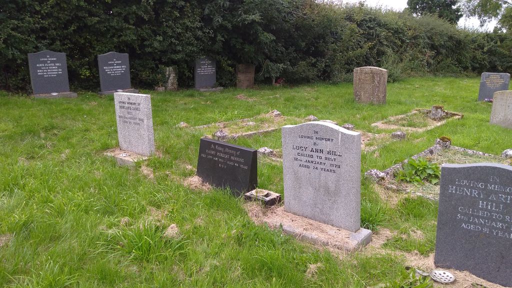
| Memorials | : | 0 |
| Location | : | Burley, Rutland Unitary Authority, England |
frequently asked questions (FAQ):
-
Where is Burley Langham Lane Cemetery?
Burley Langham Lane Cemetery is located at Burley, Rutland Unitary Authority, England.
-
Burley Langham Lane Cemetery cemetery's updated grave count on graveviews.com?
0 memorials
Nearby Cemetories:
1. St John the Baptist Churchyard
Bisbrooke, Rutland Unitary Authority, England
Coordinate: 52.7144490, -0.7200580
2. Cottesmore Rogues Lane Cemetery
Cottesmore, Rutland Unitary Authority, England
3. St. Nicholas Churchyard
Cottesmore, Rutland Unitary Authority, England
4. St. Andrew's Churchyard
Glaston, Rutland Unitary Authority, England
Coordinate: 52.7026000, -0.4489000
5. Ketton Empingham Road Cemetery
Ketton, Rutland Unitary Authority, England
Coordinate: 52.6585060, -0.6712280
6. Ketton Park Burial Ground
Ketton, Rutland Unitary Authority, England
7. Ketton St Mary the Virgin Churchyard
Ketton, Rutland Unitary Authority, England
Coordinate: 52.6186570, -0.6211140
8. Manton Cemetery
Manton, Rutland Unitary Authority, England
9. St Mary Churchyard
Manton, Rutland Unitary Authority, England
Coordinate: 52.6067200, -0.6114100
10. St Peter & Paul Churchyard
Preston, Rutland Unitary Authority, England
Coordinate: 52.5975766, -0.7413414
11. St Andrew Churchyard
Stoke Dry, Rutland Unitary Authority, England
Coordinate: 52.5996800, -0.7324400
12. St Luke
Tixover, Rutland Unitary Authority, England
Coordinate: 52.5873820, -0.7221660
13. St Mary the Virgin Churchyard
Ashwell, Rutland Unitary Authority, England
Coordinate: 52.7144490, -0.7200580
14. First Presbyterian Churchyard
Burley, Rutland Unitary Authority, England
15. Holy Cross Church - Burley on the Hill
Burley, Rutland Unitary Authority, England
16. St Mary Magdalene Churchyard
Essendine, Rutland Unitary Authority, England
Coordinate: 52.7026000, -0.4489000
17. St Andrew Churchyard
Hambleton, Rutland Unitary Authority, England
Coordinate: 52.6585060, -0.6712280
18. St. Andrew's Churchyard
Lyddington, Rutland Unitary Authority, England
19. St. John The Baptist Church
North Luffenham, Rutland Unitary Authority, England
Coordinate: 52.6186570, -0.6211140
20. South Luffenham Stamford Road Cemetery
South Luffenham, Rutland Unitary Authority, England
21. St Mary the Virgin Churchyard
South Luffenham, Rutland Unitary Authority, England
Coordinate: 52.6067200, -0.6114100
22. Leicester Road Cemetery
Uppingham, Rutland Unitary Authority, England
Coordinate: 52.5975766, -0.7413414
23. St. Mary the Virgin Churchyard
Uppingham, Rutland Unitary Authority, England
Coordinate: 52.5996800, -0.7324400
24. St. Peter and St. Paul's Churchyard
Uppingham, Rutland Unitary Authority, England
Coordinate: 52.5873820, -0.7221660


