
| Memorials | : | 18 |
| Location | : | Stoke Dry, Rutland Unitary Authority, England |
| Coordinate | : | 52.5620632, -0.7394099 |
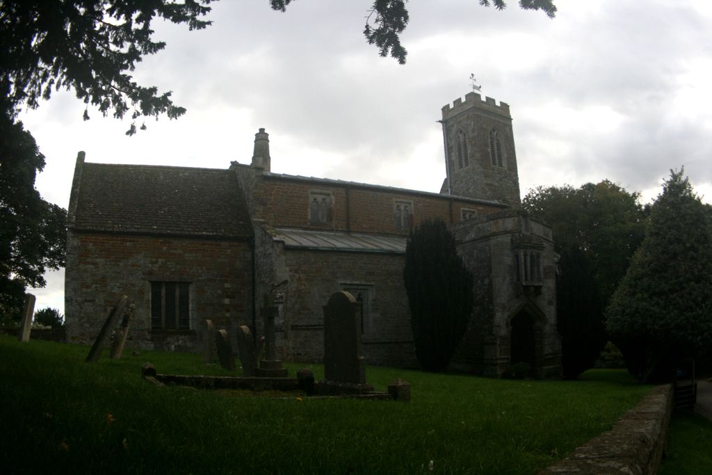
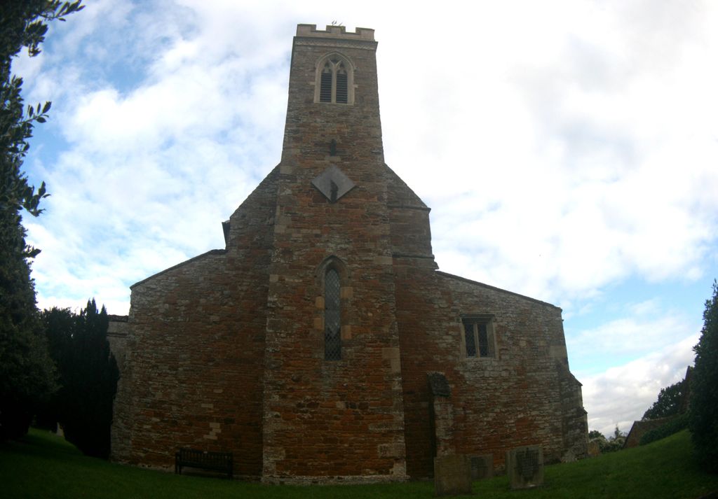
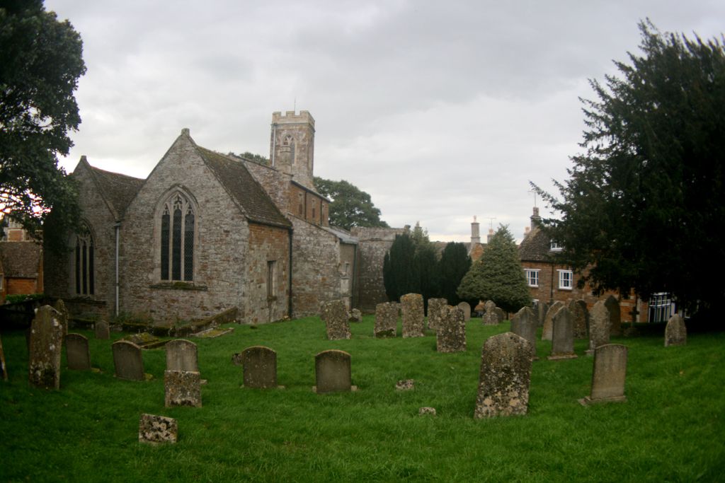
| Description | : | A majority of the grave stones in the St. Andrew churchyard can be found in the north east corner of the yard, with a small number also found in the south east and west sections surrounding the church. Additional grave stones, memorial plaques, monuments, and memorial windows can be found inside the church. The church of St. Andrew, Stoke Dry was originally an aisleless 12th century building, with the current church consisting of a chancel, south chapel, clearstoried nave of three bays, north aisle, south aisle, north porch and south porches, and a small west tower. The upper room on... Read More |
frequently asked questions (FAQ):
-
Where is St Andrew Churchyard?
St Andrew Churchyard is located at Main Street Stoke Dry, Rutland Unitary Authority ,Rutland , LE15 9JGEngland.
-
St Andrew Churchyard cemetery's updated grave count on graveviews.com?
18 memorials
-
Where are the coordinates of the St Andrew Churchyard?
Latitude: 52.5620632
Longitude: -0.7394099
Nearby Cemetories:
1. St. Peter's Churchyard
Stockerston, Harborough District, England
Coordinate: 52.5687800, -0.7706600
2. Uppingham Lawn Cemetery
Uppingham, Rutland Unitary Authority, England
Coordinate: 52.5855800, -0.7229700
3. St. Peter and St. Paul's Churchyard
Uppingham, Rutland Unitary Authority, England
Coordinate: 52.5873820, -0.7221660
4. St. John the Evangelist Churchyard
Caldecott, Rutland Unitary Authority, England
Coordinate: 52.5341600, -0.7213400
5. St. Andrew Churchyard Extension
Hallaton, Harborough District, England
Coordinate: 52.5308470, -0.7505850
6. St. Andrew's Churchyard
Great Easton, Harborough District, England
Coordinate: 52.5288590, -0.7525630
7. Independant Chapel Cemetery
Great Easton, Harborough District, England
Coordinate: 52.5268820, -0.7472440
8. Leicester Road Cemetery
Uppingham, Rutland Unitary Authority, England
Coordinate: 52.5975766, -0.7413414
9. St. Mary the Virgin Churchyard
Uppingham, Rutland Unitary Authority, England
Coordinate: 52.5996800, -0.7324400
10. Saint Nicholas Cemetery
Bringhurst, Harborough District, England
Coordinate: 52.5216700, -0.7614220
11. Saint Nicholas Churchyard
Bringhurst, Harborough District, England
Coordinate: 52.5208900, -0.7613600
12. St. James Churchyard
Gretton, Corby Borough, England
Coordinate: 52.5403000, -0.6763400
13. St Mary's Churchyard
Nevill Holt, Harborough District, England
Coordinate: 52.5350180, -0.7977290
14. All Hallows Churchyard
Seaton, Rutland Unitary Authority, England
Coordinate: 52.5745730, -0.6670810
15. St. Andrew's Churchyard
Glaston, Rutland Unitary Authority, England
Coordinate: 52.5953628, -0.6781534
16. St Peter & Paul Churchyard
Preston, Rutland Unitary Authority, England
Coordinate: 52.6122600, -0.7162560
17. St Peter Churchyard
Belton, Rutland Unitary Authority, England
Coordinate: 52.6038200, -0.7957000
18. Saint John The Baptist Churchyard
Harringworth, East Northamptonshire Borough, England
Coordinate: 52.5671000, -0.6491000
19. Shire Lodge Cemetery
Corby, Corby Borough, England
Coordinate: 52.5073610, -0.7084990
20. St Giles Churchyard
Medbourne, Harborough District, England
Coordinate: 52.5296410, -0.8226870
21. St Michael and All Angels Churchyard
Hallaton, Harborough District, England
Coordinate: 52.5609190, -0.8411740
22. St Mary Magdalene
Cottingham, Corby Borough, England
Coordinate: 52.5008296, -0.7551008
23. St. Peter and St. Paul's Churchyard
Wing, Rutland Unitary Authority, England
Coordinate: 52.6172140, -0.6814150
24. All Saints Churchyard
Slawston, Harborough District, England
Coordinate: 52.5428240, -0.8500170