
| Memorials | : | 1 |
| Location | : | Platte County, USA |
| Coordinate | : | 39.4151900, -94.6160800 |
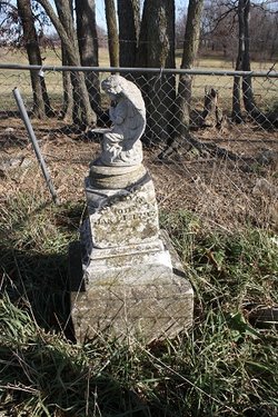
| Description | : | Byrd Family Cemetery, located on the privately owned David Miller Farm (now owned by a descendant), Township 53, Range 33, Section 9. Survey done by Mrs. Harold Harris and Mrs. Howard Taylor some time before 1999. This cemetery is located in Section 9 of T53-R33. This is somewhere west of the Platte County Line Road, northwest of Goss Cemetery. See coordinates below. These headstones apparently were not photographed when the original survey was done and the tombstones were still legible. The survey was done prior to 1999 but no one seems to know actual year. One photo volunteer walked through pastures and climbed... Read More |
frequently asked questions (FAQ):
-
Where is Byrd Cemetery?
Byrd Cemetery is located at On Private Land 39.4158/94.6152 Platte County ,Missouri ,USA.
-
Byrd Cemetery cemetery's updated grave count on graveviews.com?
1 memorials
-
Where are the coordinates of the Byrd Cemetery?
Latitude: 39.4151900
Longitude: -94.6160800


Nearby Cemetories:
1. Goss Cemetery
Smithville, Clay County, USA
Coordinate: 39.4118996, -94.5922012
2. Smith Cemetery
Ridgely, Platte County, USA
Coordinate: 39.4164009, -94.6477966
3. Heath Cemetery
Hoover, Platte County, USA
Coordinate: 39.4090300, -94.6557200
4. Shafer Cemetery
Smithville, Clay County, USA
Coordinate: 39.4013300, -94.5790900
5. Karr Cemetery
Platte County, USA
Coordinate: 39.3852000, -94.6352500
6. Smithville Memorial Cemetery
Smithville, Clay County, USA
Coordinate: 39.3924713, -94.5837021
7. Wood Cemetery
Smithville, Clay County, USA
Coordinate: 39.3816800, -94.6004500
8. Owens Cemetery
Smithville, Clay County, USA
Coordinate: 39.3993500, -94.5719200
9. Baber Family Cemetery
Platte County, USA
Coordinate: 39.4099400, -94.6663100
10. McComas Cemetery
Hoover, Platte County, USA
Coordinate: 39.3969002, -94.6688995
11. Rollins Family Cemetery
Clay County, USA
Coordinate: 39.4301200, -94.5556000
12. Ridgely Community Cemetery
Ridgely, Platte County, USA
Coordinate: 39.4606018, -94.6406021
13. Cockriel Cemetery
Ridgely, Platte County, USA
Coordinate: 39.4336014, -94.6755981
14. Grayson Cemetery
Ridgely, Platte County, USA
Coordinate: 39.4633300, -94.6354200
15. Davenport Cemetery
Excelsior Springs Junction, Clay County, USA
Coordinate: 39.4375000, -94.5556030
16. Lutes Cemetery
Platte County, USA
Coordinate: 39.4110985, -94.6830978
17. Brooks Cemetery
Smithville, Clay County, USA
Coordinate: 39.3753014, -94.5699997
18. DeBerry Cemetery
Platte County, USA
Coordinate: 39.3657900, -94.6437800
19. Aker Cemetery
Clay County, USA
Coordinate: 39.4109955, -94.5460129
20. Thatcher Cemetery
Smithville, Clay County, USA
Coordinate: 39.3662400, -94.5816800
21. Blankenship Family Cemetery
Platte County, USA
Coordinate: 39.4518800, -94.6711600
22. Brasfield Cemetery
Platte County, USA
Coordinate: 39.3741000, -94.6684600
23. Mann-Vance-Young Burying Ground
Platte County, USA
Coordinate: 39.3544800, -94.6234900
24. Dixon Cemetery
Platte County, USA
Coordinate: 39.3542400, -94.6392200