
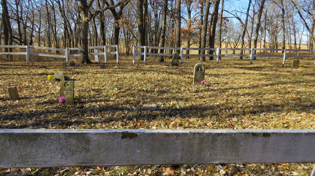
| Memorials | : | 0 |
| Location | : | Clay County, USA |
| Coordinate | : | 39.4109955, -94.5460129 |
frequently asked questions (FAQ):
-
Where is Aker Cemetery?
Aker Cemetery is located at Clay County ,Missouri ,USA.
-
Aker Cemetery cemetery's updated grave count on graveviews.com?
0 memorials
-
Where are the coordinates of the Aker Cemetery?
Latitude: 39.4109955
Longitude: -94.5460129


Nearby Cemetories:
1. Rollins Family Cemetery
Clay County, USA
Coordinate: 39.4301200, -94.5556000
2. Owens Cemetery
Smithville, Clay County, USA
Coordinate: 39.3993500, -94.5719200
3. Shafer Cemetery
Smithville, Clay County, USA
Coordinate: 39.4013300, -94.5790900
4. Davenport Cemetery
Excelsior Springs Junction, Clay County, USA
Coordinate: 39.4375000, -94.5556030
5. Paradise Cemetery
Paradise, Clay County, USA
Coordinate: 39.4244804, -94.5149307
6. Duncan Cemetery
Smithville, Clay County, USA
Coordinate: 39.3867336, -94.5214471
7. Smithville Memorial Cemetery
Smithville, Clay County, USA
Coordinate: 39.3924713, -94.5837021
8. Goss Cemetery
Smithville, Clay County, USA
Coordinate: 39.4118996, -94.5922012
9. Brooks Cemetery
Smithville, Clay County, USA
Coordinate: 39.3753014, -94.5699997
10. Wade-Bailey Cemetery
Clay County, USA
Coordinate: 39.4206600, -94.4935700
11. Garner Cemetery
Clay County, USA
Coordinate: 39.4420600, -94.5035700
12. Wood Cemetery
Smithville, Clay County, USA
Coordinate: 39.3816800, -94.6004500
13. Thatcher Cemetery
Smithville, Clay County, USA
Coordinate: 39.3662400, -94.5816800
14. Byrd Cemetery
Platte County, USA
Coordinate: 39.4151900, -94.6160800
15. Pleasant Hill Primitive Baptist Church Cemetery
Trimble, Clinton County, USA
Coordinate: 39.4697495, -94.5203629
16. Ecton Cemetery
Clay County, USA
Coordinate: 39.3807983, -94.4713974
17. Karr Cemetery
Platte County, USA
Coordinate: 39.3852000, -94.6352500
18. Corum-Judy Cemetery
Clay County, USA
Coordinate: 39.3343520, -94.5564480
19. Arley Cemetery
Kearney, Clay County, USA
Coordinate: 39.4041061, -94.4458237
20. Smith Cemetery
Ridgely, Platte County, USA
Coordinate: 39.4164009, -94.6477966
21. K.M. Woods Family Cemetery
Smithville, Clay County, USA
Coordinate: 39.3397300, -94.5906400
22. Mount Olivet Christian Church Cemetery
Smithville, Clay County, USA
Coordinate: 39.3320150, -94.5286950
23. Watkins Cemetery
Clay County, USA
Coordinate: 39.3513985, -94.4760971
24. Mann-Vance-Young Burying Ground
Platte County, USA
Coordinate: 39.3544800, -94.6234900