
| Memorials | : | 0 |
| Location | : | Clay County, USA |
| Coordinate | : | 39.4301200, -94.5556000 |
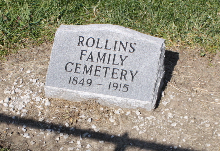
| Description | : | The Rollins Family Cemetery sits on private land owned by the Neth family. The cemetery is fenced, and directly east of their farm house and buildings out in the middle of a pasture. |
frequently asked questions (FAQ):
-
Where is Rollins Family Cemetery?
Rollins Family Cemetery is located at Clay County ,Missouri ,USA.
-
Rollins Family Cemetery cemetery's updated grave count on graveviews.com?
0 memorials
-
Where are the coordinates of the Rollins Family Cemetery?
Latitude: 39.4301200
Longitude: -94.5556000


Nearby Cemetories:
1. Davenport Cemetery
Excelsior Springs Junction, Clay County, USA
Coordinate: 39.4375000, -94.5556030
2. Aker Cemetery
Clay County, USA
Coordinate: 39.4109955, -94.5460129
3. Paradise Cemetery
Paradise, Clay County, USA
Coordinate: 39.4244804, -94.5149307
4. Owens Cemetery
Smithville, Clay County, USA
Coordinate: 39.3993500, -94.5719200
5. Goss Cemetery
Smithville, Clay County, USA
Coordinate: 39.4118996, -94.5922012
6. Shafer Cemetery
Smithville, Clay County, USA
Coordinate: 39.4013300, -94.5790900
7. Garner Cemetery
Clay County, USA
Coordinate: 39.4420600, -94.5035700
8. Smithville Memorial Cemetery
Smithville, Clay County, USA
Coordinate: 39.3924713, -94.5837021
9. Pleasant Hill Primitive Baptist Church Cemetery
Trimble, Clinton County, USA
Coordinate: 39.4697495, -94.5203629
10. Wade-Bailey Cemetery
Clay County, USA
Coordinate: 39.4206600, -94.4935700
11. Byrd Cemetery
Platte County, USA
Coordinate: 39.4151900, -94.6160800
12. Duncan Cemetery
Smithville, Clay County, USA
Coordinate: 39.3867336, -94.5214471
13. Brooks Cemetery
Smithville, Clay County, USA
Coordinate: 39.3753014, -94.5699997
14. Wood Cemetery
Smithville, Clay County, USA
Coordinate: 39.3816800, -94.6004500
15. Thatcher Cemetery
Smithville, Clay County, USA
Coordinate: 39.3662400, -94.5816800
16. Reed Cemetery
Trimble, Clinton County, USA
Coordinate: 39.4945908, -94.5832138
17. Mecca Cemetery
Mecca, Clinton County, USA
Coordinate: 39.4895200, -94.5105200
18. Grayson Cemetery
Ridgely, Platte County, USA
Coordinate: 39.4633300, -94.6354200
19. Ridgely Community Cemetery
Ridgely, Platte County, USA
Coordinate: 39.4606018, -94.6406021
20. Smith Cemetery
Ridgely, Platte County, USA
Coordinate: 39.4164009, -94.6477966
21. Winn family Cemetery
Clinton County, USA
Coordinate: 39.5019500, -94.5845200
22. Karr Cemetery
Platte County, USA
Coordinate: 39.3852000, -94.6352500
23. Elliott Cemetery
Grayson, Clinton County, USA
Coordinate: 39.5062000, -94.5452000
24. Heath Cemetery
Hoover, Platte County, USA
Coordinate: 39.4090300, -94.6557200