
| Memorials | : | 39 |
| Location | : | Grayson County, USA |
| Coordinate | : | 36.6116000, -81.5218000 |
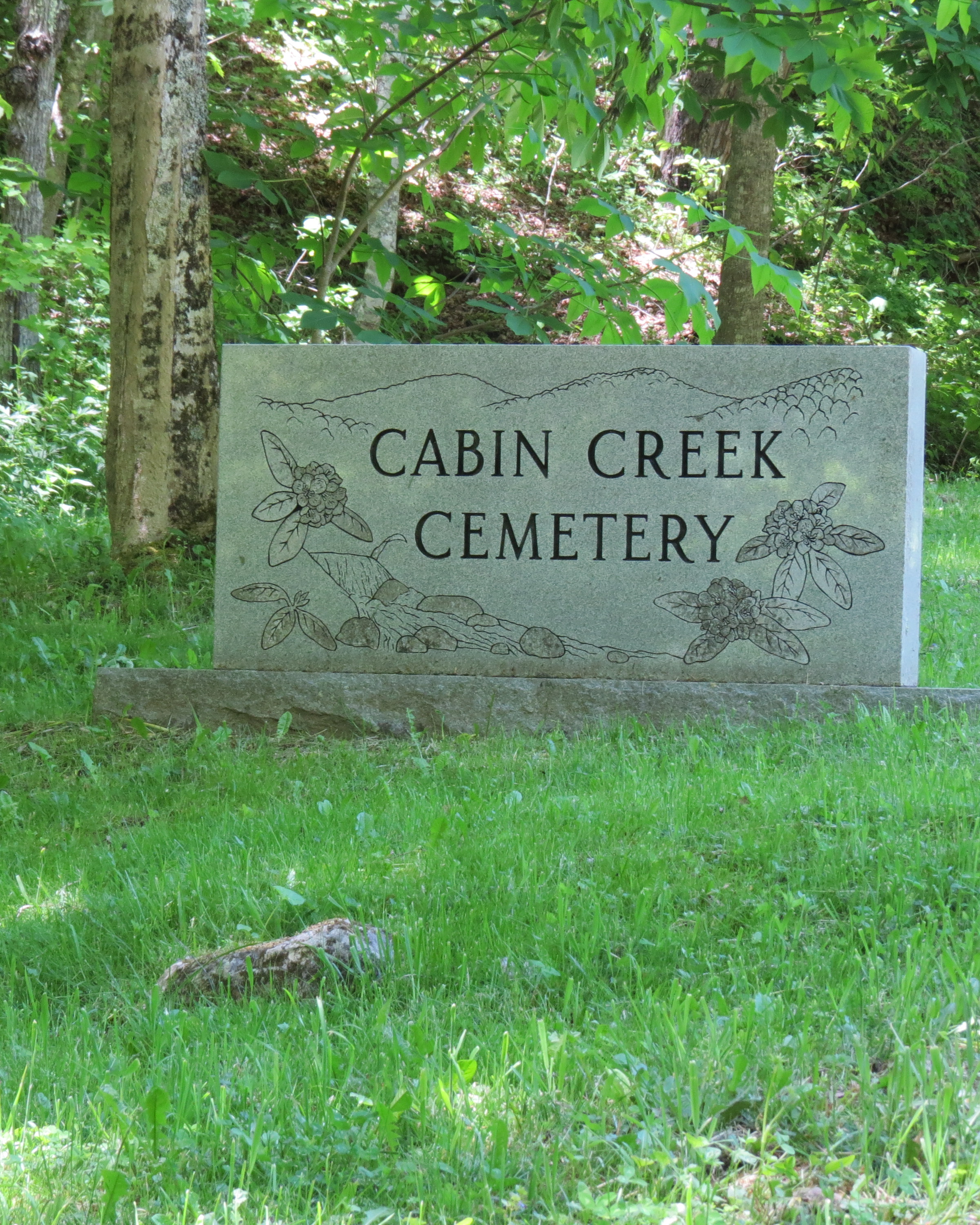
| Description | : | Location: Approximately 2 miles north of Mt Rogers High School Directions: From the junction of Highlands Pkwy (US Hwy 58) and Cabin Creek Ln (Rt 749) go 0.2 mile north on Cabin Creek Ln to cemetery on left side of road. Surveyed by: Mr. and Mrs. William Hensley 9 May 1992 Comments: The cemetery is visible approx 500 ft up slope from the road. It was fenced and tended. An unverified story says, Lee Massie carried a dead child from Massie's Gap during a blizzard. He couldn't go any farther, so E.C. Osborne permitted him to bury this child on... Read More |
frequently asked questions (FAQ):
-
Where is Cabin Creek Cemetery?
Cabin Creek Cemetery is located at Cabin Creek Ln (Rt 749) Grayson County ,Virginia ,USA.
-
Cabin Creek Cemetery cemetery's updated grave count on graveviews.com?
39 memorials
-
Where are the coordinates of the Cabin Creek Cemetery?
Latitude: 36.6116000
Longitude: -81.5218000
Nearby Cemetories:
1. Osborne Cemetery
Grayson County, USA
Coordinate: 36.6119003, -81.5216980
2. Greer Cemetery
Grayson County, USA
Coordinate: 36.6180992, -81.5243988
3. Fees Ridge Cemetery
Mouth of Wilson, Grayson County, USA
Coordinate: 36.5936130, -81.5113800
4. Haw Orchard Cemetery
Grayson County, USA
Coordinate: 36.6081009, -81.4950027
5. Lewis-Perry Cemetery
Grayson County, USA
Coordinate: 36.5849991, -81.5355988
6. Kilby Cemetery
Grayson County, USA
Coordinate: 36.5825005, -81.5092010
7. Duvall Family Cemetery
Grayson County, USA
Coordinate: 36.5942130, -81.4864020
8. Roop Cemetery
Grayson County, USA
Coordinate: 36.5868988, -81.5505981
9. Marshel Jones Cemetery
Rugby, Grayson County, USA
Coordinate: 36.6279230, -81.4816490
10. Timothy F Young Cemetery
Rugby, Grayson County, USA
Coordinate: 36.5955220, -81.4797870
11. Richardson Family Cemetery
Rugby, Grayson County, USA
Coordinate: 36.5975760, -81.4766480
12. Elijah Franklin Sexton Family Cemetery
Mill Creek, Grayson County, USA
Coordinate: 36.6156371, -81.4691845
13. Gideon Weaver Cemetery
Rugby, Grayson County, USA
Coordinate: 36.6156830, -81.4691750
14. Phipps Cemetery
Grayson County, USA
Coordinate: 36.5850830, -81.4794240
15. Roby Testerman Family Cemetery
Mouth of Wilson, Grayson County, USA
Coordinate: 36.5818560, -81.4749340
16. Ambrose Spencer Family Cemetery
Ashe County, USA
Coordinate: 36.5720300, -81.4873300
17. Andrew Hurley Family Cemetery
Ashe County, USA
Coordinate: 36.5633011, -81.5246964
18. Samuel Tucker Family Cemetery
Mouth of Wilson, Grayson County, USA
Coordinate: 36.6092250, -81.4614260
19. Abram Reedy Cemetery
Rugby, Grayson County, USA
Coordinate: 36.5958220, -81.4602810
20. Barnes Cemetery
Rugby, Grayson County, USA
Coordinate: 36.5847700, -81.4625570
21. Bill Reedy Cemetery
Rugby, Grayson County, USA
Coordinate: 36.5943000, -81.4571000
22. John Weiss Cemetery
Rugby, Grayson County, USA
Coordinate: 36.5809630, -81.4629810
23. Corinth Baptist Church Cemetery
Rugby, Grayson County, USA
Coordinate: 36.6119240, -81.4470280
24. Osborne-Williams Cemetery
Low Gap, Grayson County, USA
Coordinate: 36.6266230, -81.4456550