
| Memorials | : | 0 |
| Location | : | Perrysville, Carroll County, USA |
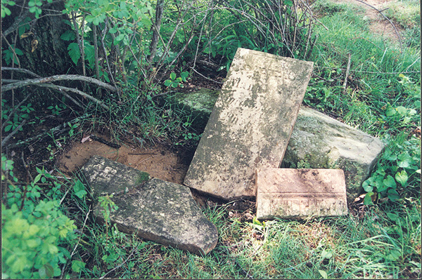
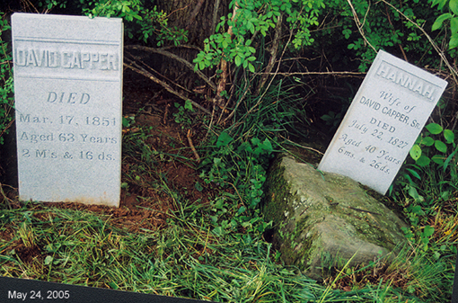
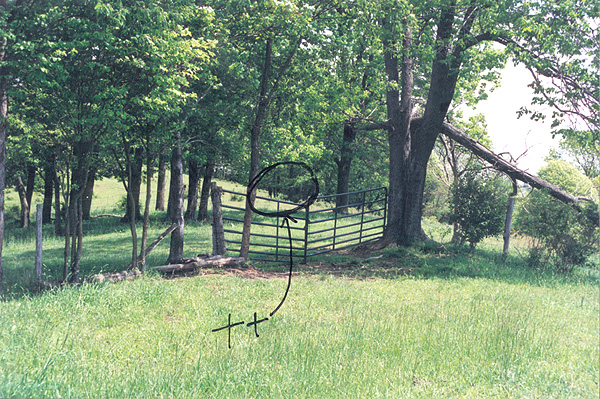
| Description | : | Capper Cemetery is located off of Aster Road in Perry Township, Carroll County, Ohio. It is on PRIVATE PROPERTY. The cemetery is located in Perry Township, Carroll County, Ohio, and is # 14475 (Capper Cemetery) in “Ohio Cemeteries 1803-2003”, compiled by the Ohio Genealogical Society. |
frequently asked questions (FAQ):
-
Where is Capper Cemetery?
Capper Cemetery is located at No GPS information available Add GPS31 Aster Road Perrysville, Carroll County ,Ohio , 44615USA.
-
Capper Cemetery cemetery's updated grave count on graveviews.com?
0 memorials
Nearby Cemetories:
1. Allen Memorial Cemetery
Carroll County, USA
Coordinate: 40.5133018, -81.1967010
2. Baxters Ridge Cemetery
Carroll County, USA
Coordinate: 40.6697006, -81.1235962
3. Big Spring Cemetery
Carroll County, USA
Coordinate: 40.5748980, -80.9652890
4. Bird Cemetery
Carroll County, USA
Coordinate: 40.6691400, -80.9653910
5. Brush Creek Baptist Cemetery
Carroll County, USA
6. Chestnut Knob Cemetery
Carroll County, USA
Coordinate: 40.5696983, -80.8728027
7. County Home Cemetery
Carroll County, USA
Coordinate: 40.5491982, -80.9336014
8. Downing Cemetery
Carroll County, USA
Coordinate: 40.5219002, -81.0053024
9. Glade Run Cemetery
East Township, Carroll County, USA
Coordinate: 40.5522003, -80.9749985
10. Glade Run Mennonite Church Cemetery
East Township, Carroll County, USA
Coordinate: 40.6094017, -81.3003006
11. Wanless Burial Site
East Township, Carroll County, USA
Coordinate: 40.6217003, -81.1994019
12. Bethel Cemetery
Leavittsville, Carroll County, USA
Coordinate: 40.5449982, -81.0033035
13. Leavittsville Cemetery
Leavittsville, Carroll County, USA
Coordinate: 40.5133018, -81.1967010
14. Devils Half Acre Cemetery
Oneida, Carroll County, USA
Coordinate: 40.6697006, -81.1235962
15. Scroggsfield Cemetery
Scroggsfield, Carroll County, USA
Coordinate: 40.5748980, -80.9652890
16. Upper Glade Run Cemetery
Carroll County, USA
Coordinate: 40.6691400, -80.9653910
17. Dunbar Cemetery
Wattsville, Carroll County, USA
18. Greenbrier-West Union Cemetery
Carroll County, USA
Coordinate: 40.5696983, -80.8728027
19. Chestnut Ridge Cemetery
Harlem Springs, Carroll County, USA
Coordinate: 40.5491982, -80.9336014
20. Harlem Springs Cemetery
Harlem Springs, Carroll County, USA
Coordinate: 40.5219002, -81.0053024
21. McGauran Cemetery
Harlem Springs, Carroll County, USA
Coordinate: 40.5522003, -80.9749985
22. Lindentree Cemetery
Carroll County, USA
Coordinate: 40.6094017, -81.3003006
23. Macedonia Cemetery
Carroll County, USA
Coordinate: 40.6217003, -81.1994019
24. Moorehead Cemetery
Carroll County, USA
Coordinate: 40.5449982, -81.0033035