
| Memorials | : | 254 |
| Location | : | Scroggsfield, Carroll County, USA |
| Coordinate | : | 40.5748980, -80.9652890 |
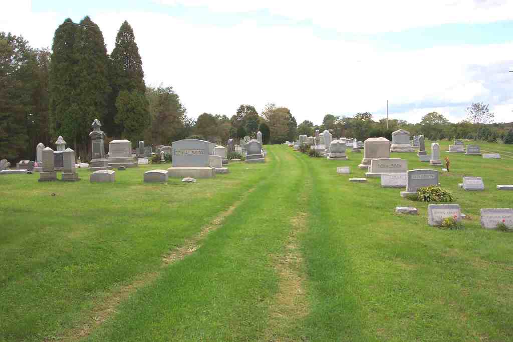
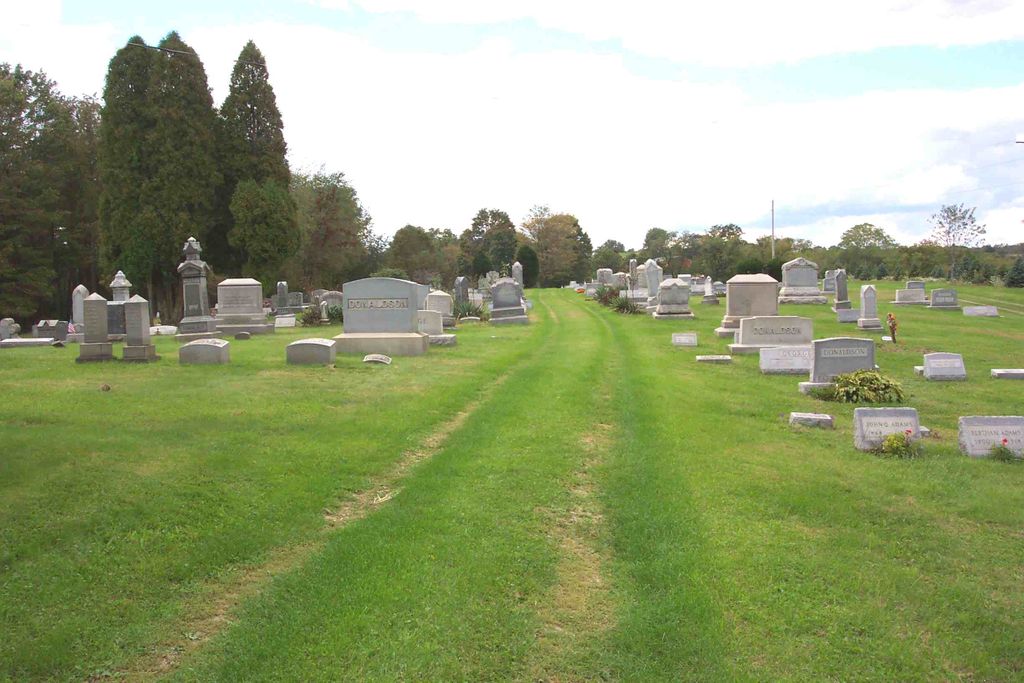
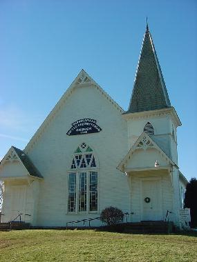
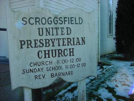
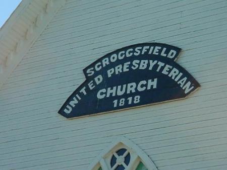
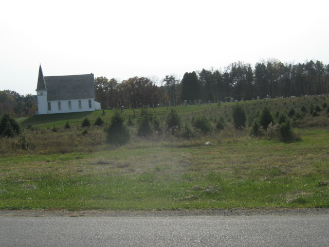
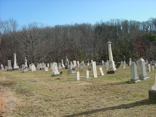
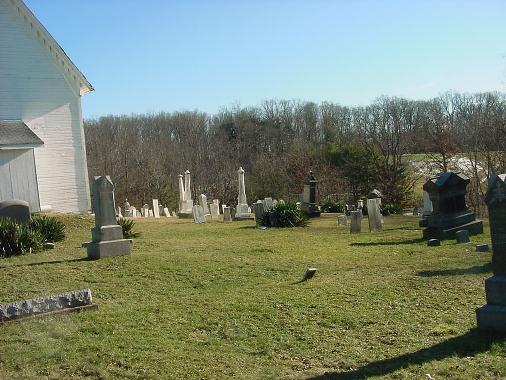
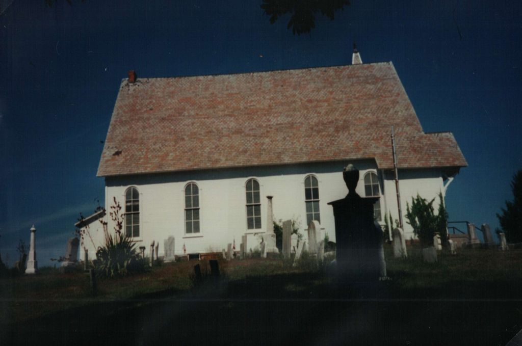
| Description | : | The cemetery is located on the west side of Apollo Road NE (County Road 12) behind and beside the Scroggsfield United Presbyterian Church about 0.1 miles south of its intersection with Avon Road NE (County Road 21). The cemetery is located in Fox Township, Carroll County, Ohio, and is # 1413 (Scroggsfield Cemetery / Scroggsfield Presbyterian Cemetery) in “Ohio Cemeteries 1803-2003”, compiled by the Ohio Genealogical Society. The U.S. Geological Survey (USGS) Geographic Names Information System (GNIS) feature ID for the cemetery is 1052470 (Scroggsfield Cemetery). |
frequently asked questions (FAQ):
-
Where is Scroggsfield Cemetery?
Scroggsfield Cemetery is located at Apollo Road NE and Avon Road NE Scroggsfield, Carroll County ,Ohio , 44615USA.
-
Scroggsfield Cemetery cemetery's updated grave count on graveviews.com?
250 memorials
-
Where are the coordinates of the Scroggsfield Cemetery?
Latitude: 40.5748980
Longitude: -80.9652890
Nearby Cemetories:
1. Palmer Cemetery
Fox Township, Carroll County, USA
Coordinate: 40.5578003, -80.9764023
2. McGauran Cemetery
Harlem Springs, Carroll County, USA
Coordinate: 40.5522003, -80.9749985
3. Chestnut Ridge Cemetery
Harlem Springs, Carroll County, USA
Coordinate: 40.5491982, -80.9336014
4. Mount Olivet Cemetery
Carroll County, USA
Coordinate: 40.5905991, -81.0081024
5. Downing Cemetery
Carroll County, USA
Coordinate: 40.5567017, -81.0117035
6. Corinth-Mechanicstown Cemetery
Mechanicstown, Carroll County, USA
Coordinate: 40.6156006, -80.9578018
7. Moorehead Cemetery
Carroll County, USA
Coordinate: 40.5449982, -81.0033035
8. Snyder Cemetery
Carroll County, USA
Coordinate: 40.6169014, -80.9766998
9. Denver George Haddock Family Cemetery
Carrollton, Carroll County, USA
Coordinate: 40.5443880, -81.0227370
10. Wells-Jackman Cemetery
Carroll County, USA
Coordinate: 40.5177994, -80.9522018
11. Harlem Springs Cemetery
Harlem Springs, Carroll County, USA
Coordinate: 40.5219002, -81.0053024
12. Lee Cemetery
Carroll County, USA
Coordinate: 40.5391998, -81.0314026
13. Green Hill Cemetery
Carroll County, USA
Coordinate: 40.5303001, -81.0246964
14. Greenbrier-West Union Cemetery
Carroll County, USA
Coordinate: 40.5696983, -80.8728027
15. Brush Creek Baptist Cemetery
Carroll County, USA
Coordinate: 40.5624008, -80.8715973
16. Bergholz Cemetery
Bergholz, Jefferson County, USA
Coordinate: 40.5155983, -80.8955994
17. Crawford Cemetery
Lee Township, Carroll County, USA
Coordinate: 40.4935030, -80.9578650
18. West Grove Cemetery
Brush Creek Township, Jefferson County, USA
Coordinate: 40.5985985, -80.8613968
19. Herrington Bethel Cemetery
Carroll County, USA
Coordinate: 40.6493988, -81.0128021
20. Stuller Cemetery
Carroll County, USA
Coordinate: 40.6302986, -81.0513992
21. Aller Family Cemetery
Carrollton, Carroll County, USA
Coordinate: 40.5879760, -81.0771540
22. Dunbar Family Cemetery
Monroeville, Jefferson County, USA
Coordinate: 40.5878080, -80.8514680
23. County Home Cemetery
Carroll County, USA
Coordinate: 40.6175003, -81.0674973
24. Grandview Cemetery
Carrollton, Carroll County, USA
Coordinate: 40.5694008, -81.0828018