
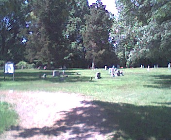
| Memorials | : | 11 |
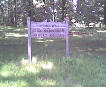
| Location | : | Graves County, USA |
| Coordinate | : | 36.9307610, -88.5379510 |
frequently asked questions (FAQ):
-
Where is Carters Mill Cemetery?
Carters Mill Cemetery is located at Jarvis Road Graves County ,Kentucky , 42082USA.
-
Carters Mill Cemetery cemetery's updated grave count on graveviews.com?
11 memorials
-
Where are the coordinates of the Carters Mill Cemetery?
Latitude: 36.9307610
Longitude: -88.5379510
Nearby Cemetories:
1. Pryors Chapel Cemetery
Graves County, USA
Coordinate: 36.9282990, -88.5397034
2. McClure Cemetery
Graves County, USA
Coordinate: 36.9108009, -88.5661011
3. Hardmoney Baptist Church Cemetery
Boaz, Graves County, USA
Coordinate: 36.9424190, -88.5839870
4. Clarks River Cemetery
Kaler, Graves County, USA
Coordinate: 36.8906059, -88.5353851
5. Boat Cemetery
Graves County, USA
Coordinate: 36.9185982, -88.5877991
6. Boaz Cemetery
Dogwood, Graves County, USA
Coordinate: 36.9185390, -88.5883430
7. Boaz Cemetery
Graves County, USA
Coordinate: 36.9025002, -88.5789032
8. Crowell Cemetery
Graves County, USA
Coordinate: 36.8988991, -88.4931030
9. Wallace Cemetery #1
Iola, Marshall County, USA
Coordinate: 36.9157982, -88.4721985
10. Spring Creek Church of Christ Cemetery
Dogwood, Graves County, USA
Coordinate: 36.8830480, -88.5752620
11. Feezor Cemetery
Elva, Marshall County, USA
Coordinate: 36.9049988, -88.4710999
12. Mount Pleasant Cemetery
Boaz, Graves County, USA
Coordinate: 36.9248795, -88.6161303
13. Ewing-Dishman Cemetery
Sharpe, Marshall County, USA
Coordinate: 36.9735985, -88.4766998
14. Dishman Cemetery
Sharpe, Marshall County, USA
Coordinate: 36.9794370, -88.4813630
15. Oakland Cumberland Presbyterian Cemetery
Sharpe, Marshall County, USA
Coordinate: 36.9793091, -88.4800034
16. Park Cemetery
Oak Level, Marshall County, USA
Coordinate: 36.8796883, -88.4818497
17. Thompson Cemetery
McCracken County, USA
Coordinate: 36.9644012, -88.6132965
18. Mount Pisgah Cemetery
Boaz, Graves County, USA
Coordinate: 36.8842200, -88.6086600
19. Gore Cemetery
Saint Johns, McCracken County, USA
Coordinate: 36.9479710, -88.6274400
20. Reid Cemetery
Reidland, McCracken County, USA
Coordinate: 37.0046160, -88.5315190
21. Sharpe Church of Christ Cemetery
Sharpe, Marshall County, USA
Coordinate: 36.9674797, -88.4566803
22. Rosebower Church Cemetery
Paducah, McCracken County, USA
Coordinate: 37.0022011, -88.5008011
23. Johnson Cemetery
Boaz, Graves County, USA
Coordinate: 36.8993988, -88.6283035
24. Old Spring Creek Church of Christ Cemetery
Clear Springs, Graves County, USA
Coordinate: 36.8620770, -88.5879140