
| Memorials | : | 0 |
| Location | : | Edneyville, Henderson County, USA |
| Coordinate | : | 35.4324390, -82.3312470 |
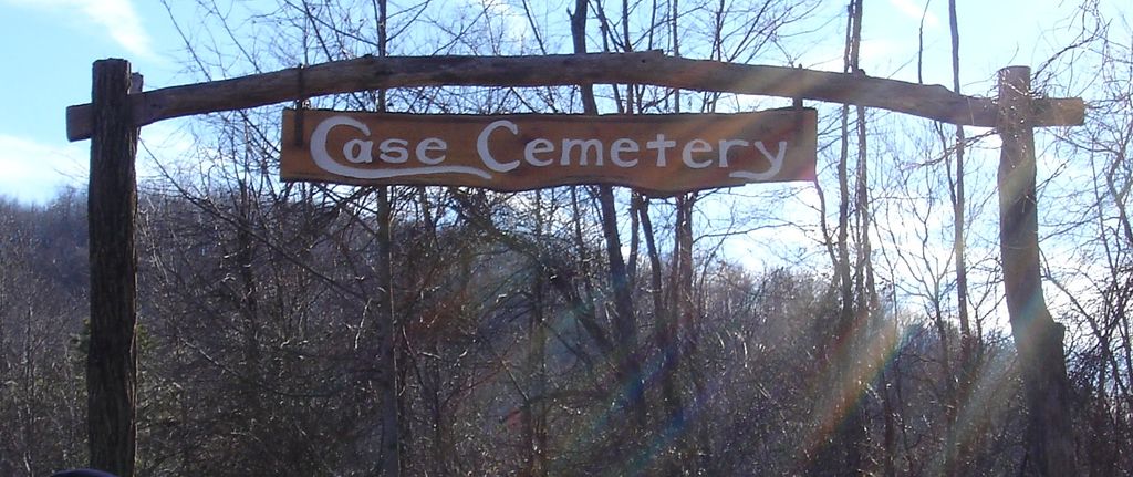
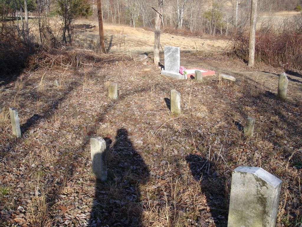
| Description | : | Located to the left off Great Smokey Lane in the Edneyville community. Great Smokey Lane is located off Old Clear Creek Road between Grant Mountain Road and Wash Freeman Road. The cemetery is surrounded by private property and homes. Private property must be crossed to reach the cemetery. Take Route 64 East to Fruitland; turn right on Old Clear Creek Road to Apple Haven Orchard (building on the left). Turn left & then turn right to fork in road -- take left fork. prior to 1995 cemetery was behind a mobile home. The cemetery, about .22 acre, is set aside... Read More |
frequently asked questions (FAQ):
-
Where is Case Family Cemetery?
Case Family Cemetery is located at Edneyville, Henderson County ,North Carolina ,USA.
-
Case Family Cemetery cemetery's updated grave count on graveviews.com?
0 memorials
-
Where are the coordinates of the Case Family Cemetery?
Latitude: 35.4324390
Longitude: -82.3312470
Nearby Cemetories:
1. Barnwell Family Cemetery
Edneyville, Henderson County, USA
Coordinate: 35.4391000, -82.3244640
2. Saint Paul Cemetery
Edneyville, Henderson County, USA
Coordinate: 35.4133210, -82.3366600
3. Barnwell Baptist Church Cemetery
Henderson County, USA
Coordinate: 35.4483000, -82.3164700
4. Liberty Baptist Church Cemetery
Henderson County, USA
Coordinate: 35.4266700, -82.3563300
5. Rhodes-Lyda Family Cemetery
Edneyville, Henderson County, USA
Coordinate: 35.4135900, -82.3491700
6. Hill Cemetery
Edneyville, Henderson County, USA
Coordinate: 35.4081750, -82.3169610
7. Edney Family Cemetery
Bat Cave, Henderson County, USA
Coordinate: 35.4403960, -82.2958910
8. Edneyville United Methodist Church Cemetery
Edneyville, Henderson County, USA
Coordinate: 35.4043999, -82.3550034
9. Conner Cemetery
Bat Cave, Henderson County, USA
Coordinate: 35.4575005, -82.2981033
10. Bat Cave Baptist Church Cemetery
Bat Cave, Henderson County, USA
Coordinate: 35.4503420, -82.2892850
11. Hill Cemetery
Bat Cave, Henderson County, USA
Coordinate: 35.4608002, -82.2960968
12. Mount Moriah Baptist Church Cemetery
Edneyville, Henderson County, USA
Coordinate: 35.3911580, -82.3324770
13. Drake Cemetery
Fruitland, Henderson County, USA
Coordinate: 35.4301390, -82.3851940
14. Collins Cemetery
Edneyville, Henderson County, USA
Coordinate: 35.4082280, -82.2849970
15. Episcopal Church of the Transfiguration Cemetery
Bat Cave, Henderson County, USA
Coordinate: 35.4501200, -82.2800600
16. East of Gerton
Gerton, Henderson County, USA
Coordinate: 35.4773890, -82.3387500
17. Edney-Coston Cemetery
Edneyville, Henderson County, USA
Coordinate: 35.3895250, -82.3550190
18. Asa Edney Family Cemetery
Edneyville, Henderson County, USA
Coordinate: 35.3928300, -82.3708000
19. Mountain Home Baptist Church Cemetery
Edneyville, Henderson County, USA
Coordinate: 35.3950745, -82.2884417
20. Bearwallow Cemetery
Gerton, Henderson County, USA
Coordinate: 35.4809900, -82.3510300
21. Byers Family Cemetery
Edneyville, Henderson County, USA
Coordinate: 35.3810500, -82.3298310
22. John Jackson Family Cemetery
Edneyville, Henderson County, USA
Coordinate: 35.3801861, -82.3202583
23. Mills Cemetery
Henderson County, USA
Coordinate: 35.3863860, -82.3652670
24. Searcy Family Cemetery
Henderson County, USA
Coordinate: 35.4708150, -82.2826950