
| Memorials | : | 0 |
| Location | : | Gravelford, Coos County, USA |
| Coordinate | : | 43.1087530, -124.0890310 |
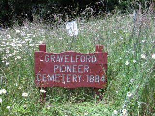
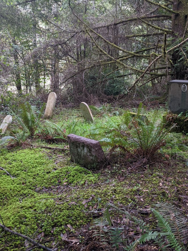
| Description | : | The Gravelford Cemetery is located .6 miles up Brady Road off the Myrtle Point-Sitkum Road. From Myrtle Point, travel northeast towards Dora/Sitkum until just before the Gravelford Bridge. Brady Road will be on the left. This road is a single lane, gravel road. The cemetery is located on the left, with the cemetery sign visible from the road about 50 feet from the roadway. There is a small clearing and steep driveway where a car may be parked. The cemetery entrance is to the right of the sign, and the cemetery itself is located under the trees to the north.... Read More |
frequently asked questions (FAQ):
-
Where is Gravelford Pioneer Cemetery?
Gravelford Pioneer Cemetery is located at Brady Road Gravelford, Coos County ,Oregon , 97458USA.
-
Gravelford Pioneer Cemetery cemetery's updated grave count on graveviews.com?
0 memorials
-
Where are the coordinates of the Gravelford Pioneer Cemetery?
Latitude: 43.1087530
Longitude: -124.0890310
Nearby Cemetories:
1. Hansen-Culbertson Cemetery
Gravelford, Coos County, USA
Coordinate: 43.1105800, -124.0721900
2. Fox Bridge Cemetery
Coos County, USA
Coordinate: 43.1375008, -124.1027985
3. Norway Cemetery
Norway, Coos County, USA
Coordinate: 43.1035995, -124.1552963
4. Rackleff Cemetery
Myrtle Point, Coos County, USA
Coordinate: 43.0808400, -124.1454200
5. Myrtle Point Cemetery
Myrtle Point, Coos County, USA
Coordinate: 43.0639000, -124.1196976
6. Garrett Cemetery
Coos County, USA
Coordinate: 43.0405998, -124.1144028
7. Hoffman Cemetery
Myrtle Point, Coos County, USA
Coordinate: 43.0402300, -124.1152400
8. Brack Cemetery
Bridge, Coos County, USA
Coordinate: 43.0280991, -124.0877991
9. Myrtle Crest Memorial Gardens
Coquille, Coos County, USA
Coordinate: 43.1596985, -124.1761017
10. Dora Cemetery
Dora, Coos County, USA
Coordinate: 43.1554900, -123.9963200
11. Robison-Lower Fishtrap Cemetery
Arago, Coos County, USA
Coordinate: 43.1232986, -124.2007980
12. Warner Cemetery
Coos County, USA
Coordinate: 43.0250015, -124.1280975
13. Breuer Cemetery
Coos County, USA
Coordinate: 43.0194016, -124.0792007
14. Mast Cemetery
McKinley, Coos County, USA
Coordinate: 43.1886559, -124.0274048
15. Whittington Cemetery
Myrtle Point, Coos County, USA
Coordinate: 43.0222783, -124.1486533
16. Smalley Cemetery
Myrtle Point, Coos County, USA
Coordinate: 43.0776900, -124.2176000
17. Fairview Cemetery
Fairview, Coos County, USA
Coordinate: 43.2089005, -124.0888977
18. Miller Cemetery
Myrtle Point, Coos County, USA
Coordinate: 43.0104600, -124.1321500
19. Coquille IOOF Pioneer Cemetery #1
Coquille, Coos County, USA
Coordinate: 43.1802377, -124.1912000
20. IOOF Cemetery #1
Coquille, Coos County, USA
Coordinate: 43.1802266, -124.1913498
21. Upper Fish Trap Cemetery
Coos County, USA
Coordinate: 43.1074690, -124.2352010
22. Masonic Cemetery
Coquille, Coos County, USA
Coordinate: 43.1868540, -124.1943520
23. Coos County Poor Farm Cemetery
Coquille, Coos County, USA
Coordinate: 43.2078940, -124.1567270
24. Coquille Pioneer Cemetery
Coquille, Coos County, USA
Coordinate: 43.1894120, -124.1951130