
| Memorials | : | 0 |
| Location | : | Salt River, Maricopa County, USA |
| Coordinate | : | 33.4853210, -111.8686880 |
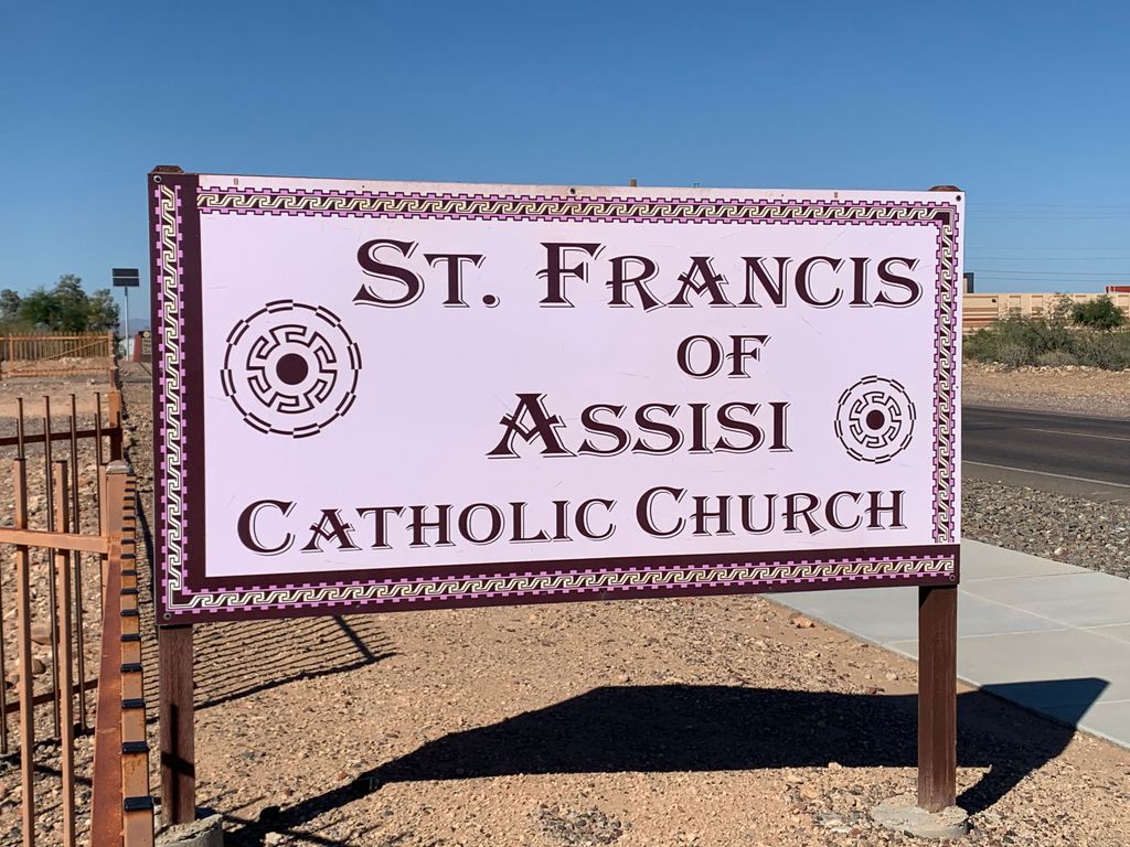
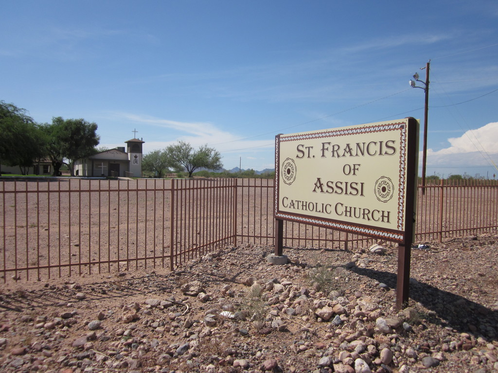
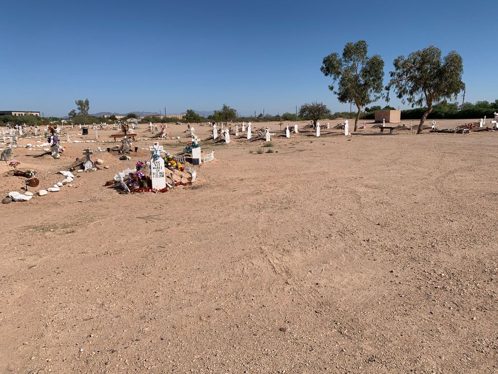
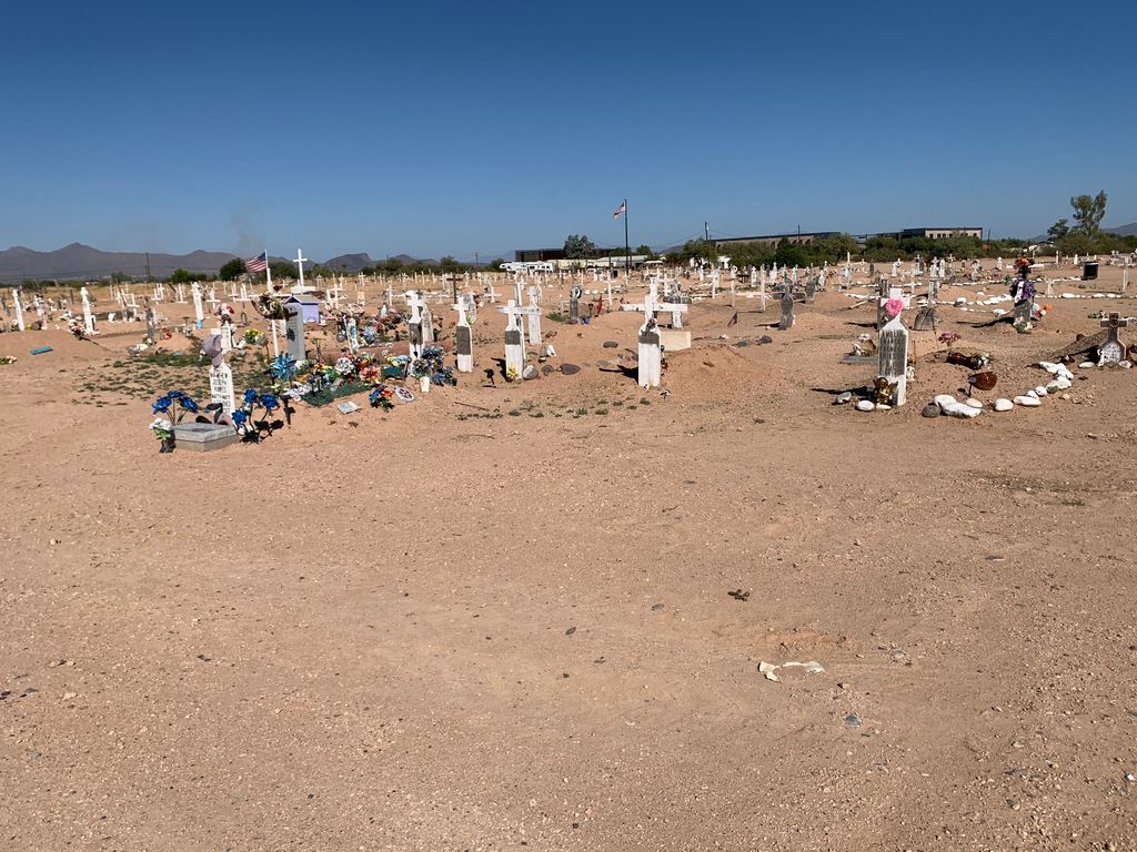
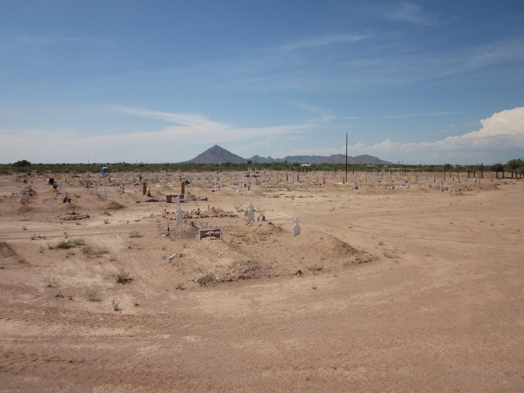
| Description | : | The Catholic Church Cemetery is a small (~150 graves) cemetery located southwest of the corner of Osborn and Longmore roads on lands of the Salt River Pima-Maricopa Indian Community in Maricopa County, AZ. The cemetery is accessible by using an unpaved road extending west from Longmore Road or by using driveways off of Earl Drive. This cemetery is most likely associated with the St. Francis of Assisi Catholic Church located nearby on the west side of Longmore Road. |
frequently asked questions (FAQ):
-
Where is Catholic Church Cemetery?
Catholic Church Cemetery is located at E Earl Drive Salt River, Maricopa County ,Arizona , 85256USA.
-
Catholic Church Cemetery cemetery's updated grave count on graveviews.com?
0 memorials
-
Where are the coordinates of the Catholic Church Cemetery?
Latitude: 33.4853210
Longitude: -111.8686880
Nearby Cemetories:
1. Salt River Pima-Maricopa Indian Cemetery
Maricopa County, USA
Coordinate: 33.4687000, -111.8502000
2. Scottsdale United Methodist Church Memorial Garden
Scottsdale, Maricopa County, USA
Coordinate: 33.4967330, -111.9183910
3. Green Acres Memorial Park
Scottsdale, Maricopa County, USA
Coordinate: 33.4530983, -111.9056015
4. Lehi Cemetery
Maricopa County, USA
Coordinate: 33.4811740, -111.8103000
5. City of Mesa Cemetery
Mesa, Maricopa County, USA
Coordinate: 33.4383774, -111.8329163
6. Valley Presbyterian Church Memorial Garden
Paradise Valley, Maricopa County, USA
Coordinate: 33.5219000, -111.9311000
7. Camelback Cemetery
Paradise Valley, Maricopa County, USA
Coordinate: 33.5243900, -111.9328200
8. First Evangelical Lutheran Church Memorial Garden
Mesa, Maricopa County, USA
Coordinate: 33.4182770, -111.8448890
9. Papago Park
Phoenix, Maricopa County, USA
Coordinate: 33.4519000, -111.9443000
10. Saint Barnabas on the Desert Memorial Garden
Paradise Valley, Maricopa County, USA
Coordinate: 33.5358000, -111.9330000
11. Prince of Peace Lutheran Church Columbarium
Phoenix, Maricopa County, USA
Coordinate: 33.4909000, -111.9596330
12. Phoenix Zoo
Phoenix, Maricopa County, USA
Coordinate: 33.4501220, -111.9496530
13. First Presbyterian Church of Mesa Columbarium
Mesa, Maricopa County, USA
Coordinate: 33.4190950, -111.8225900
14. Saint Marks Episcopal Church Columbarium
Mesa, Maricopa County, USA
Coordinate: 33.4215140, -111.8147770
15. Ascension Lutheran Church Memorial Garden
Paradise Valley, Maricopa County, USA
Coordinate: 33.5415180, -111.9350160
16. Shepherd of the Hills UCC Memorial Garden
Phoenix, Maricopa County, USA
Coordinate: 33.4950920, -111.9626900
17. First United Methodist Church of Mesa Columbarium
Mesa, Maricopa County, USA
Coordinate: 33.4127690, -111.8307530
18. First Congregational Church Columbarium
Maricopa County, USA
Coordinate: 33.4240000, -111.9378000
19. Episcopal Church of the Epiphany Columbarium
Tempe, Maricopa County, USA
Coordinate: 33.4033720, -111.8932090
20. First United Methodist Church Memorial Garden
Tempe, Maricopa County, USA
Coordinate: 33.4214970, -111.9363410
21. Saint Francis Catholic Cemetery
Phoenix, Maricopa County, USA
Coordinate: 33.4733009, -111.9738998
22. Saint Augustines Episcopal Church Columbarium
Tempe, Maricopa County, USA
Coordinate: 33.4084100, -111.9345750
23. Mountain View Presbyterian Church Memorial Garden
Scottsdale, Maricopa County, USA
Coordinate: 33.5755940, -111.9069290
24. Cross Cut Cemetery
Phoenix, Maricopa County, USA
Coordinate: 33.4514370, -111.9794850