
| Memorials | : | 0 |
| Location | : | Thorpe Constantine, Lichfield District, England |
| Coordinate | : | 52.6611100, -1.6510330 |
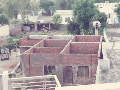
| Description | : | A private chapel with family cemetery, standing in the grounds of Statfold Hall, and not open to the public. |
frequently asked questions (FAQ):
-
Where is Chapel of All Saints, Statfold?
Chapel of All Saints, Statfold is located at Off Clifton Lane Thorpe Constantine, Lichfield District ,Staffordshire , B79 0AEEngland.
-
Chapel of All Saints, Statfold cemetery's updated grave count on graveviews.com?
0 memorials
-
Where are the coordinates of the Chapel of All Saints, Statfold?
Latitude: 52.6611100
Longitude: -1.6510330
Nearby Cemetories:
1. All Saints Churchyard
Seckington, North Warwickshire Borough, England
Coordinate: 52.6638760, -1.6167310
2. St. Matthew's Churchyard
Shuttington, North Warwickshire Borough, England
Coordinate: 52.6440000, -1.6244720
3. Amington Cemetery
Amington, Tamworth Borough, England
Coordinate: 52.6356092, -1.6552355
4. St Leonard Churchyard
Wigginton and Hopwas, Lichfield District, England
Coordinate: 52.6704490, -1.6927530
5. Wigginton Road Cemetery
Tamworth, Tamworth Borough, England
Coordinate: 52.6479590, -1.6928170
6. St Michael & St James Catholic Churchyard
Haunton, Lichfield District, England
Coordinate: 52.6946050, -1.6514690
7. Glascote Cemetery
Glascote, Tamworth Borough, England
Coordinate: 52.6290130, -1.6774860
8. St. Editha Churchyard
Tamworth, Tamworth Borough, England
Coordinate: 52.6344040, -1.6946000
9. St Mary the Virgin Churchyard
Newton Regis, North Warwickshire Borough, England
Coordinate: 52.6642390, -1.5886760
10. St. Matthew's churchyard
Harlaston, Lichfield District, England
Coordinate: 52.6957682, -1.6832017
11. Polesworth Abbey Churchyard
Polesworth, North Warwickshire Borough, England
Coordinate: 52.6193460, -1.6115790
12. St Mary the Virgin Churchyard
No Man's Heath, North Warwickshire Borough, England
Coordinate: 52.6770470, -1.5722540
13. Holy Trinity Churchyard
Warton, North Warwickshire Borough, England
Coordinate: 52.6292929, -1.5865304
14. Wilnecote New Cemetery
Wilnecote, Tamworth Borough, England
Coordinate: 52.6119140, -1.6716640
15. Wilencote Old Cemetery
Wilnecote, Tamworth Borough, England
Coordinate: 52.6099808, -1.6676261
16. St Nicholas' Churchyard
Austrey, North Warwickshire Borough, England
Coordinate: 52.6534340, -1.5644170
17. Austrey Baptist Church
Austrey, North Warwickshire Borough, England
Coordinate: 52.6551940, -1.5631710
18. All Saints Churchyard
Lullington, South Derbyshire District, England
Coordinate: 52.7135620, -1.6316530
19. Hopwas Cemetery
Tamworth, Tamworth Borough, England
Coordinate: 52.6417200, -1.7362600
20. St Peter's Churchyard
Elford, Lichfield District, England
Coordinate: 52.6928330, -1.7274120
21. St. Paul's Churchyard
Fazeley, Lichfield District, England
Coordinate: 52.6128860, -1.7002090
22. St Matthew Churchyard
Chilcote, North West Leicestershire District, England
Coordinate: 52.6995200, -1.5804990
23. St Chad's
Tamworth Borough, England
Coordinate: 52.6433000, -1.7418000
24. St Leonard's Churchyard
Dordon, North Warwickshire Borough, England
Coordinate: 52.6004250, -1.6132720