
| Memorials | : | 1 |
| Location | : | Charlton Kings, Cheltenham Borough, England |
| Coordinate | : | 51.8798820, -2.0498090 |
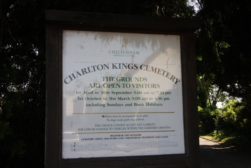
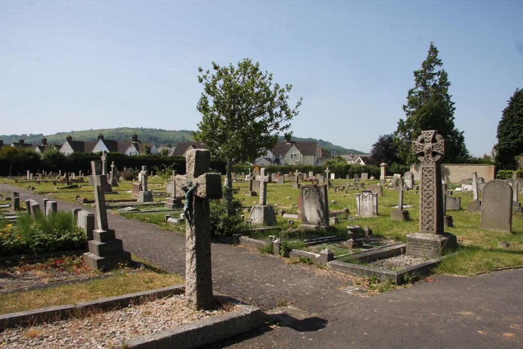
| Description | : | Charlton Kings Cemetery was opened on 25 September 1909 by the Urban District Council, and taken over by Cheltenham Borough Council upon reorganisation on 1 April 1974. |
frequently asked questions (FAQ):
-
Where is Charlton Kings Cemetery?
Charlton Kings Cemetery is located at Horsefair Street Charlton Kings, Cheltenham Borough ,Gloucestershire ,England.
-
Charlton Kings Cemetery cemetery's updated grave count on graveviews.com?
1 memorials
-
Where are the coordinates of the Charlton Kings Cemetery?
Latitude: 51.8798820
Longitude: -2.0498090
Nearby Cemetories:
1. St. Mary's Churchyard
Charlton Kings, Cheltenham Borough, England
Coordinate: 51.8825010, -2.0528610
2. St Philip and St James Churchyard
Leckhampton, Cheltenham Borough, England
Coordinate: 51.8885652, -2.0821259
3. St. Peter's Churchyard
Leckhampton, Cheltenham Borough, England
Coordinate: 51.8732120, -2.0842780
4. Cheltenham Cemetery and Crematorium
Cheltenham, Cheltenham Borough, England
Coordinate: 51.9054527, -2.0454979
5. St Mary with St Matthew Churchyard
Cheltenham, Cheltenham Borough, England
Coordinate: 51.9013790, -2.0765460
6. Christ Church
Cheltenham, Cheltenham Borough, England
Coordinate: 51.8988860, -2.0889160
7. St. Michael's Churchyard
Dowdeswell, Cotswold District, England
Coordinate: 51.8778615, -1.9996354
8. St Mary's Churchyard
Prestbury, Cheltenham Borough, England
Coordinate: 51.9143880, -2.0451090
9. Cheltenham Racecourse
Cheltenham, Cheltenham Borough, England
Coordinate: 51.9203900, -2.0674400
10. St. Paul's Churchyard
Shurdington, Tewkesbury Borough, England
Coordinate: 51.8679260, -2.1159880
11. St Philips and St James
Up Hatherley, Cheltenham Borough, England
Coordinate: 51.8853307, -2.1223815
12. St. Mary's Churchyard
Cowley, Cotswold District, England
Coordinate: 51.8304330, -2.0520550
13. Saint Nicholas Churchyard
Swindon, Cheltenham Borough, England
Coordinate: 51.9228800, -2.0956000
14. St. Peter's Churchyard
Bentham, Tewkesbury Borough, England
Coordinate: 51.8436420, -2.1249330
15. Holy Trinity Churchyard
Badgeworth, Tewkesbury Borough, England
Coordinate: 51.8715360, -2.1444640
16. St. Andrew's Churchyard
Sevenhampton, Tewkesbury Borough, England
Coordinate: 51.8941180, -1.9539430
17. St Michael & All Angels Church
Bishop's Cleeve, Tewkesbury Borough, England
Coordinate: 51.9476200, -2.0594800
18. Church of St. Mary
Great Witcombe, Tewkesbury Borough, England
Coordinate: 51.8316950, -2.1311090
19. St George Churchyard
Brockworth, Tewkesbury Borough, England
Coordinate: 51.8517460, -2.1598180
20. Stoke Orchard Cemetery
Stoke Orchard, Tewkesbury Borough, England
Coordinate: 51.9522350, -2.1212140
21. St. Mary the Virgin Churchyard
Syde, Cotswold District, England
Coordinate: 51.7961724, -2.0750209
22. Saint Michael and All Angels Churchyard
Brimpsfield, Cotswold District, England
Coordinate: 51.8000000, -2.1000000
23. Ss Philip and James Churchyard
Hucclecote, Tewkesbury Borough, England
Coordinate: 51.8573040, -2.1876440
24. St. Peter Churchyard
Winchcombe, Tewkesbury Borough, England
Coordinate: 51.9525100, -1.9679600