
| Memorials | : | 1 |
| Location | : | Brimpsfield, Cotswold District, England |
| Coordinate | : | 51.8000000, -2.1000000 |
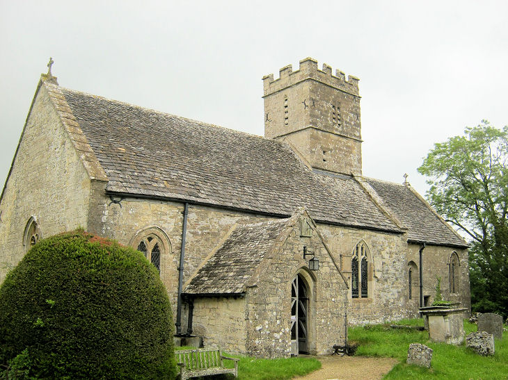
| Description | : | Saint Michael and All Angels Church is a Grade I Listed Building that dates from the early 12th century |
frequently asked questions (FAQ):
-
Where is Saint Michael and All Angels Churchyard?
Saint Michael and All Angels Churchyard is located at Brimpsfield, Cotswold District ,Gloucestershire ,England.
-
Saint Michael and All Angels Churchyard cemetery's updated grave count on graveviews.com?
1 memorials
-
Where are the coordinates of the Saint Michael and All Angels Churchyard?
Latitude: 51.8000000
Longitude: -2.1000000
Nearby Cemetories:
1. St. Mary the Virgin Churchyard
Syde, Cotswold District, England
Coordinate: 51.7961724, -2.0750209
2. St. Andrew's Churchyard
Miserden, Stroud District, England
Coordinate: 51.7787500, -2.0940500
3. Church of St. Mary
Great Witcombe, Tewkesbury Borough, England
Coordinate: 51.8316950, -2.1311090
4. St. John the Apostle Churchyard
Sheepscombe, Stroud District, England
Coordinate: 51.7894990, -2.1582430
5. St. James the Great Churchyard
Cranham, Stroud District, England
Coordinate: 51.8102797, -2.1596329
6. St. Mary's Churchyard
Cowley, Cotswold District, England
Coordinate: 51.8304330, -2.0520550
7. St. Peter's Churchyard
Bentham, Tewkesbury Borough, England
Coordinate: 51.8436420, -2.1249330
8. St Peter Churchyard
Duntisbourne Abbots, Cotswold District, England
Coordinate: 51.7694080, -2.0438190
9. Prinknash Abbey
Cranham, Stroud District, England
Coordinate: 51.8225000, -2.1761110
10. All Saints Churchyard
Bisley, Stroud District, England
Coordinate: 51.7520580, -2.1409380
11. Bisley Burial Ground
Bisley, Stroud District, England
Coordinate: 51.7493640, -2.1389080
12. Painswick Cemetery
Painswick, Stroud District, England
Coordinate: 51.7971040, -2.1918690
13. St. Mary the Virgin Churchyard
Painswick, Stroud District, England
Coordinate: 51.7852975, -2.1947224
14. St George Churchyard
Brockworth, Tewkesbury Borough, England
Coordinate: 51.8517460, -2.1598180
15. Holy Trinity Churchyard
Slad, Stroud District, England
Coordinate: 51.7647770, -2.1866550
16. St. Paul's Churchyard
Shurdington, Tewkesbury Borough, England
Coordinate: 51.8679260, -2.1159880
17. St. Kenelm's Churchyard
Sapperton, Cotswold District, England
Coordinate: 51.7294000, -2.0775000
18. Eastcombe Baptist Churchyard
Eastcombe, Stroud District, England
Coordinate: 51.7378009, -2.1606789
19. St Bartholemew Church
Oakridge, Stroud District, England
Coordinate: 51.7291209, -2.1276180
20. St. Peter's Churchyard
Leckhampton, Cheltenham Borough, England
Coordinate: 51.8732120, -2.0842780
21. Holy Trinity Churchyard
Badgeworth, Tewkesbury Borough, England
Coordinate: 51.8715360, -2.1444640
22. St John the Baptist Churchyard
Pitchcombe, Stroud District, England
Coordinate: 51.7727590, -2.2166790
23. St. John the Baptist Churchyard
France Lynch, Stroud District, England
Coordinate: 51.7265600, -2.1445600
24. Ss Philip and James Churchyard
Hucclecote, Tewkesbury Borough, England
Coordinate: 51.8573040, -2.1876440