
| Memorials | : | 32 |
| Location | : | Bentham, Tewkesbury Borough, England |
| Coordinate | : | 51.8436420, -2.1249330 |
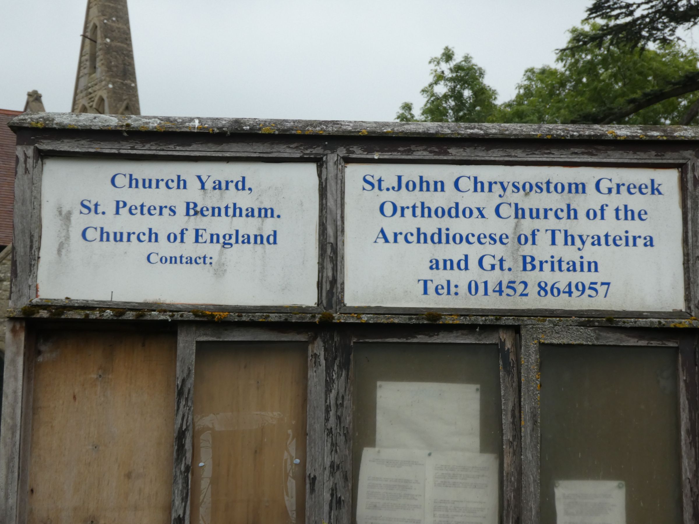
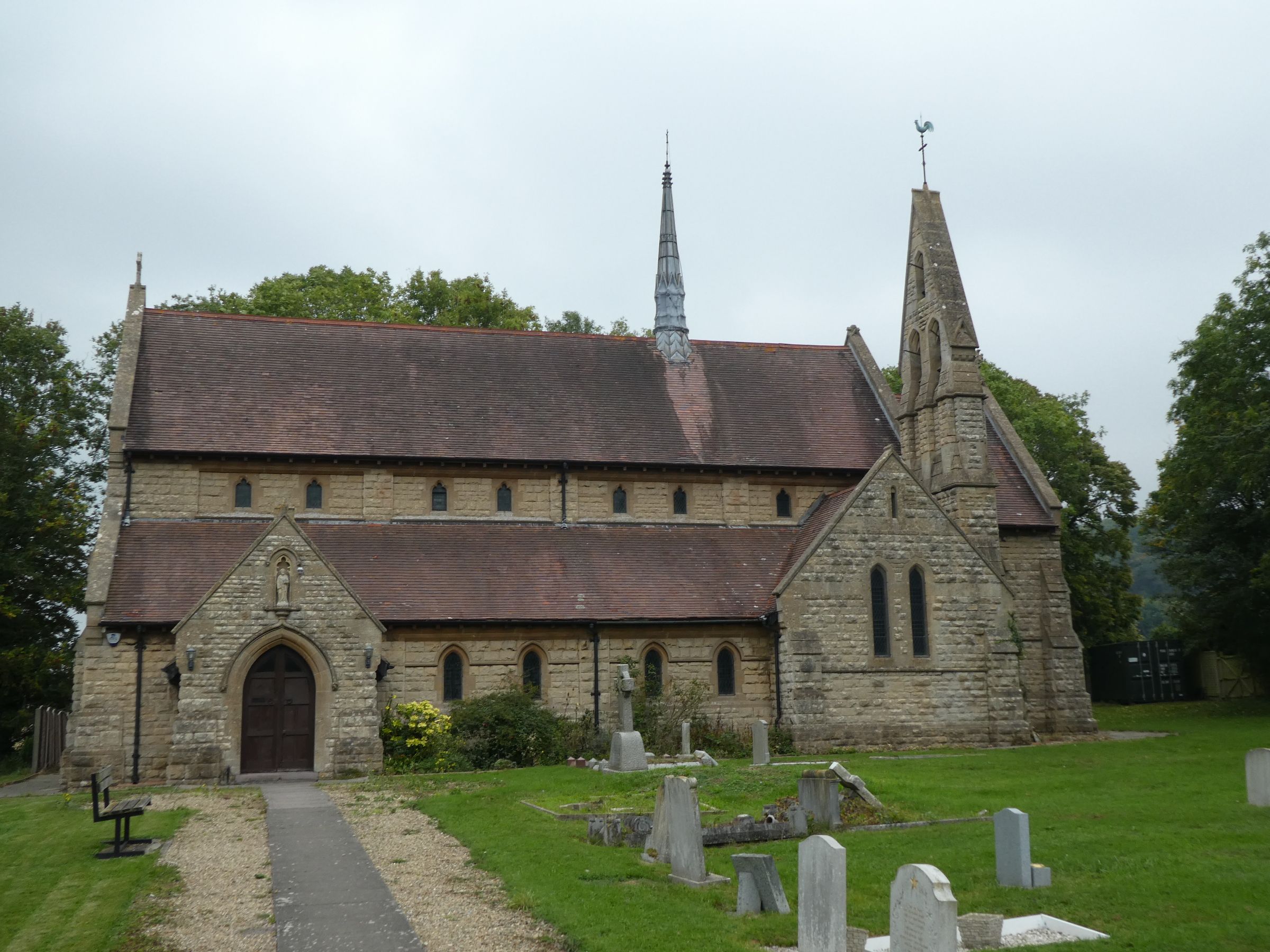
| Description | : | The Church building is currently used by the Greek Orthodox Church and is know as St John of Chrysostom but the graveyard was created and used when the Church was dedicated as St Peters. |
frequently asked questions (FAQ):
-
Where is St. Peter's Churchyard?
St. Peter's Churchyard is located at Dog Lane Bentham, Tewkesbury Borough ,Gloucestershire , GL3 4UDEngland.
-
St. Peter's Churchyard cemetery's updated grave count on graveviews.com?
0 memorials
-
Where are the coordinates of the St. Peter's Churchyard?
Latitude: 51.8436420
Longitude: -2.1249330
Nearby Cemetories:
1. Church of St. Mary
Great Witcombe, Tewkesbury Borough, England
Coordinate: 51.8316950, -2.1311090
2. St George Churchyard
Brockworth, Tewkesbury Borough, England
Coordinate: 51.8517460, -2.1598180
3. St. Paul's Churchyard
Shurdington, Tewkesbury Borough, England
Coordinate: 51.8679260, -2.1159880
4. Holy Trinity Churchyard
Badgeworth, Tewkesbury Borough, England
Coordinate: 51.8715360, -2.1444640
5. Prinknash Abbey
Cranham, Stroud District, England
Coordinate: 51.8225000, -2.1761110
6. St. Peter's Churchyard
Leckhampton, Cheltenham Borough, England
Coordinate: 51.8732120, -2.0842780
7. St. James the Great Churchyard
Cranham, Stroud District, England
Coordinate: 51.8102797, -2.1596329
8. Ss Philip and James Churchyard
Hucclecote, Tewkesbury Borough, England
Coordinate: 51.8573040, -2.1876440
9. St Philips and St James
Up Hatherley, Cheltenham Borough, England
Coordinate: 51.8853307, -2.1223815
10. Saint Michael and All Angels Churchyard
Brimpsfield, Cotswold District, England
Coordinate: 51.8000000, -2.1000000
11. St. Mary's Churchyard
Cowley, Cotswold District, England
Coordinate: 51.8304330, -2.0520550
12. St Philip and St James Churchyard
Leckhampton, Cheltenham Borough, England
Coordinate: 51.8885652, -2.0821259
13. St Lawrence Churchyard
Barnwood, City of Gloucester, England
Coordinate: 51.8580470, -2.2069750
14. St. Mary the Virgin Churchyard
Syde, Cotswold District, England
Coordinate: 51.7961724, -2.0750209
15. St. John the Apostle Churchyard
Sheepscombe, Stroud District, England
Coordinate: 51.7894990, -2.1582430
16. Charlton Kings Cemetery
Charlton Kings, Cheltenham Borough, England
Coordinate: 51.8798820, -2.0498090
17. St. Mary's Churchyard
Charlton Kings, Cheltenham Borough, England
Coordinate: 51.8825010, -2.0528610
18. Christ Church
Cheltenham, Cheltenham Borough, England
Coordinate: 51.8988860, -2.0889160
19. Gloucester Crematorium
Gloucester, City of Gloucester, England
Coordinate: 51.8538180, -2.2219260
20. Painswick Cemetery
Painswick, Stroud District, England
Coordinate: 51.7971040, -2.1918690
21. Gloucester Old Cemetery
Gloucester, City of Gloucester, England
Coordinate: 51.8482100, -2.2276700
22. St Mary with St Matthew Churchyard
Cheltenham, Cheltenham Borough, England
Coordinate: 51.9013790, -2.0765460
23. Horton Road Cemetery
Gloucester, City of Gloucester, England
Coordinate: 51.8666900, -2.2268300
24. St. Andrew's Churchyard
Miserden, Stroud District, England
Coordinate: 51.7787500, -2.0940500