
| Memorials | : | 0 |
| Location | : | Hucclecote, Tewkesbury Borough, England |
| Coordinate | : | 51.8573040, -2.1876440 |
| Description | : | Hucclecote is a village in Gloucestershire, United Kingdom, in the City of Gloucester, and adjacent civil parish in the Borough of Tewkesbury. It is located on the periphery of the city, between Barnwood and Brockworth along Ermine Way, an old Roman road connecting Gloucester with Cirencester and the Cotswolds. |
frequently asked questions (FAQ):
-
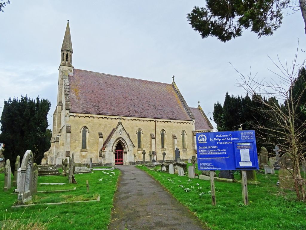
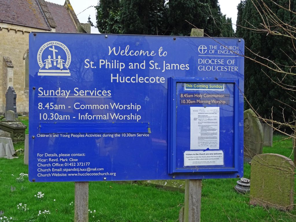
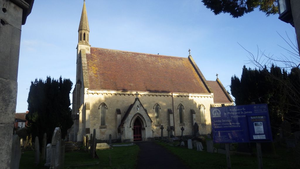
Where is Ss Philip and James Churchyard?
Ss Philip and James Churchyard is located at Larkhay Road Hucclecote, Tewkesbury Borough ,Gloucestershire , GL3 3NSEngland.
-
Ss Philip and James Churchyard cemetery's updated grave count on graveviews.com?
0 memorials
-
Where are the coordinates of the Ss Philip and James Churchyard?
Latitude: 51.8573040
Longitude: -2.1876440
Nearby Cemetories:
1. St Lawrence Churchyard
Barnwood, City of Gloucester, England
Coordinate: 51.8580470, -2.2069750
2. St George Churchyard
Brockworth, Tewkesbury Borough, England
Coordinate: 51.8517460, -2.1598180
3. Gloucester Crematorium
Gloucester, City of Gloucester, England
Coordinate: 51.8538180, -2.2219260
4. Horton Road Cemetery
Gloucester, City of Gloucester, England
Coordinate: 51.8666900, -2.2268300
5. Gloucester Old Cemetery
Gloucester, City of Gloucester, England
Coordinate: 51.8482100, -2.2276700
6. Saint Catharine's
Gloucester, City of Gloucester, England
Coordinate: 51.8691700, -2.2273500
7. Chapel of St Mary Magdalen
Gloucester, City of Gloucester, England
Coordinate: 51.8693000, -2.2291000
8. St Margaret's Chapel
Gloucester, City of Gloucester, England
Coordinate: 51.8686720, -2.2321530
9. Holy Trinity Churchyard
Badgeworth, Tewkesbury Borough, England
Coordinate: 51.8715360, -2.1444640
10. Prinknash Abbey
Cranham, Stroud District, England
Coordinate: 51.8225000, -2.1761110
11. Gloucester Cathedral
Gloucester, City of Gloucester, England
Coordinate: 51.8675920, -2.2467670
12. Saint Oswald's Priory
Gloucester, City of Gloucester, England
Coordinate: 51.8694000, -2.2478000
13. St Nicholas' Church
Gloucester, City of Gloucester, England
Coordinate: 51.8672800, -2.2496760
14. St. Peter's Churchyard
Bentham, Tewkesbury Borough, England
Coordinate: 51.8436420, -2.1249330
15. Llanthony Secunda Priory
Hempsted, City of Gloucester, England
Coordinate: 51.8602130, -2.2572640
16. Church of St. Mary
Great Witcombe, Tewkesbury Borough, England
Coordinate: 51.8316950, -2.1311090
17. St. Matthew's Cemetery
Twigworth, Tewkesbury Borough, England
Coordinate: 51.8936090, -2.2307820
18. St. Paul's Churchyard
Shurdington, Tewkesbury Borough, England
Coordinate: 51.8679260, -2.1159880
19. St Philips and St James
Up Hatherley, Cheltenham Borough, England
Coordinate: 51.8853307, -2.1223815
20. St Margaret Church
Whaddon, Stroud District, England
Coordinate: 51.8214600, -2.2433000
21. St. James the Great Churchyard
Cranham, Stroud District, England
Coordinate: 51.8102797, -2.1596329
22. St. Swithun's Churchyard
Hempsted, City of Gloucester, England
Coordinate: 51.8515740, -2.2719420
23. St. Swithun Churchyard
Brookthorpe, Stroud District, England
Coordinate: 51.8087500, -2.2402900
24. Painswick Cemetery
Painswick, Stroud District, England
Coordinate: 51.7971040, -2.1918690