
| Memorials | : | 0 |
| Location | : | Chesterfield, Chesterfield Borough, England |
| Coordinate | : | 53.2532570, -1.4066520 |
frequently asked questions (FAQ):
-
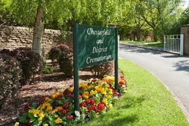
Where is Chesterfield and District Crematorium?
Chesterfield and District Crematorium is located at Chesterfield Road Chesterfield, Chesterfield Borough ,Derbyshire , S43 1AUEngland.
-
Chesterfield and District Crematorium cemetery's updated grave count on graveviews.com?
0 memorials
-
Where are the coordinates of the Chesterfield and District Crematorium?
Latitude: 53.2532570
Longitude: -1.4066520

Nearby Cemetories:
1. Brimington Cemetery
Brimington, Chesterfield Borough, England
Coordinate: 53.2538000, -1.4043520
2. Christ Church Churchyard
Chesterfield, Chesterfield Borough, England
Coordinate: 53.2463580, -1.4241670
3. Holy Trinity Churchyard
Chesterfield, Chesterfield Borough, England
Coordinate: 53.2401580, -1.4287290
4. St Mary and All Saints Churchyard
Chesterfield, Chesterfield Borough, England
Coordinate: 53.2363373, -1.4248396
5. St. Peter's Churchyard
Chesterfield, Chesterfield Borough, England
Coordinate: 53.2340842, -1.3902336
6. Spital Cemetery
Chesterfield, Chesterfield Borough, England
Coordinate: 53.2322980, -1.4160870
7. St. Bartholomew's Churchyard
Old Whittington, Chesterfield Borough, England
Coordinate: 53.2728810, -1.4249180
8. St. John The Evangelist Churchyard
Newbold, Chesterfield Borough, England
Coordinate: 53.2573090, -1.4437910
9. Staveley Cemetery
Staveley, Chesterfield Borough, England
Coordinate: 53.2619760, -1.3529670
10. St John the Baptist Churchyard
Staveley, Chesterfield Borough, England
Coordinate: 53.2690540, -1.3514830
11. St Thomas Churchyard
Brampton, North East Derbyshire District, England
Coordinate: 53.2314930, -1.4584950
12. Hasland Cemetery
Hasland, North East Derbyshire District, England
Coordinate: 53.2122300, -1.4081600
13. St Peter & St Paul's Church
Duckmanton, North East Derbyshire District, England
Coordinate: 53.2385800, -1.3377020
14. St Lawrence Churchyard
Barlow, North East Derbyshire District, England
Coordinate: 53.2680970, -1.4846110
15. All Saints Churchyard
Wingerworth, North East Derbyshire District, England
Coordinate: 53.2027700, -1.4281100
16. Dronfield Cemetery
Dronfield, North East Derbyshire District, England
Coordinate: 53.2968660, -1.4626160
17. St. Peter and St. Paul Churchyard
Brampton, North East Derbyshire District, England
Coordinate: 53.2433700, -1.4978600
18. Saint Peter Churchyard
Holymoorside, North East Derbyshire District, England
Coordinate: 53.2184100, -1.4918500
19. St Peter and St Paul Churchyard
Eckington, North East Derbyshire District, England
Coordinate: 53.3132130, -1.3530820
20. Eckington Cemetery
Eckington, North East Derbyshire District, England
Coordinate: 53.3159630, -1.3517140
21. All Saints Churchyard
Heath, North East Derbyshire District, England
Coordinate: 53.1988682, -1.3305255
22. All Saints Church
Heath, North East Derbyshire District, England
Coordinate: 53.1986620, -1.3305840
23. Ridgeway Methodist Church Cemetery
Sheffield, Metropolitan Borough of Sheffield, England
Coordinate: 53.3248360, -1.3979360
24. St. John the Evangelist Churchyard
North East Derbyshire District, England
Coordinate: 53.3262300, -1.3987400