
| Memorials | : | 1 |
| Location | : | Chesterfield, Chesterfield Borough, England |
| Website | : | www.chesterfield.gov.uk/living-here/people-and-families/bereavement-services/cemeteries-and-churchyards.aspx |
| Coordinate | : | 53.2322980, -1.4160870 |
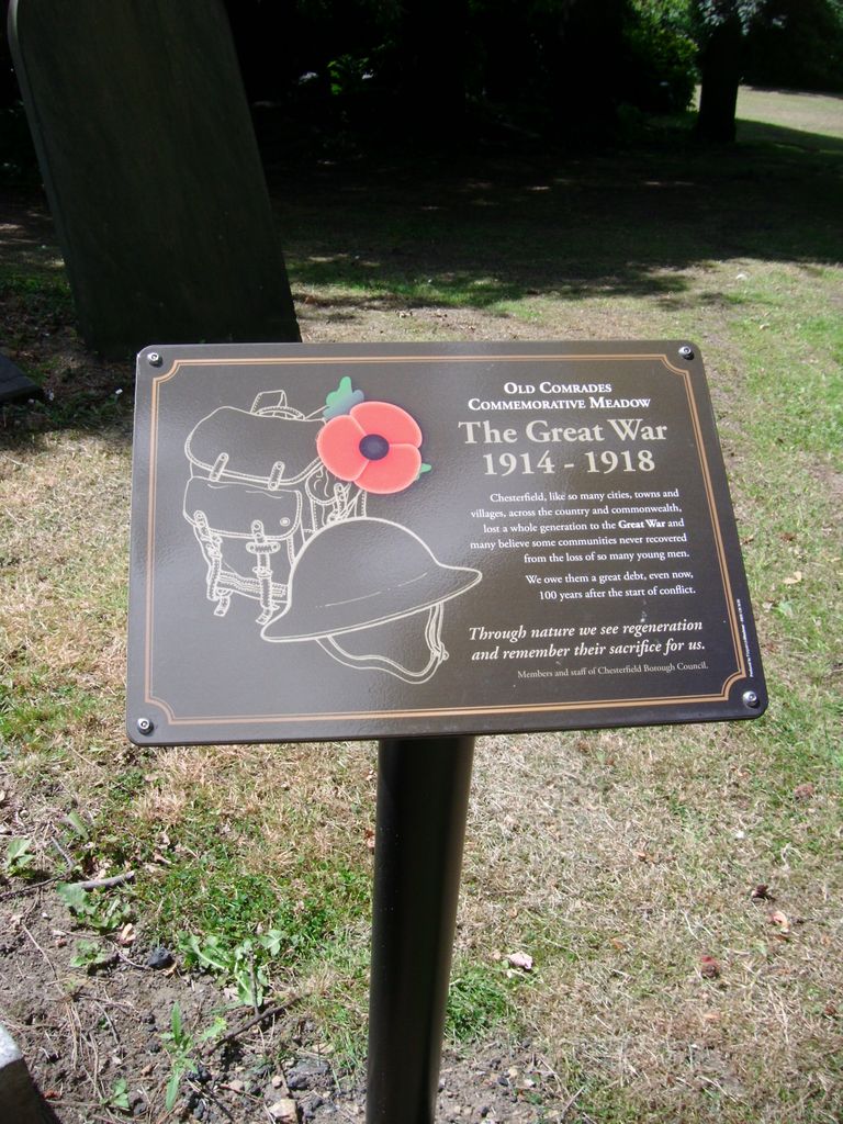
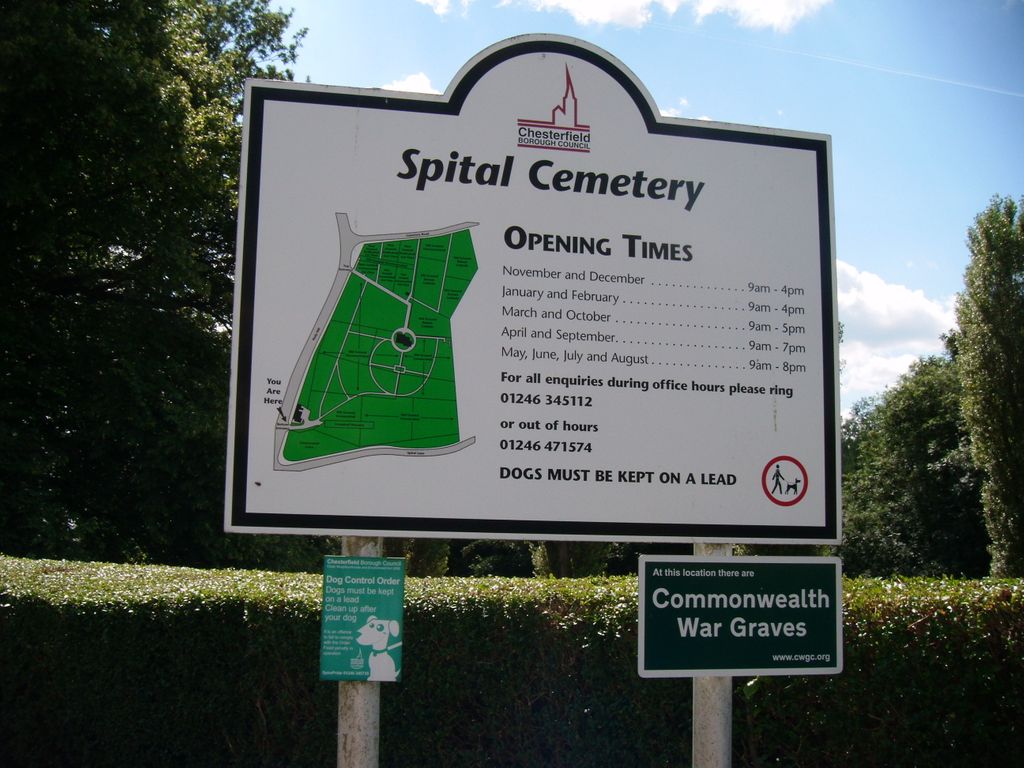
| Description | : | Situated three quarters of a mile from the town centre, Spital Cemetery was the first public cemetery to be opened in Chesterfield in 1857 to serve the local communities of Chesterfield and Tapton. It provides approximately 10.5 acres of burial space with the greatest number of burials of any of the Council's cemeteries to date. There are two entrances, off the A632 road at Hady Hill. |
frequently asked questions (FAQ):
-
Where is Spital Cemetery?
Spital Cemetery is located at Hady Hill Chesterfield, Chesterfield Borough ,Derbyshire , S41 0DZEngland.
-
Spital Cemetery cemetery's updated grave count on graveviews.com?
1 memorials
-
Where are the coordinates of the Spital Cemetery?
Latitude: 53.2322980
Longitude: -1.4160870
Nearby Cemetories:
1. St Mary and All Saints Churchyard
Chesterfield, Chesterfield Borough, England
Coordinate: 53.2363373, -1.4248396
2. Holy Trinity Churchyard
Chesterfield, Chesterfield Borough, England
Coordinate: 53.2401580, -1.4287290
3. Christ Church Churchyard
Chesterfield, Chesterfield Borough, England
Coordinate: 53.2463580, -1.4241670
4. St. Peter's Churchyard
Chesterfield, Chesterfield Borough, England
Coordinate: 53.2340842, -1.3902336
5. Hasland Cemetery
Hasland, North East Derbyshire District, England
Coordinate: 53.2122300, -1.4081600
6. Chesterfield and District Crematorium
Chesterfield, Chesterfield Borough, England
Coordinate: 53.2532570, -1.4066520
7. Brimington Cemetery
Brimington, Chesterfield Borough, England
Coordinate: 53.2538000, -1.4043520
8. St Thomas Churchyard
Brampton, North East Derbyshire District, England
Coordinate: 53.2314930, -1.4584950
9. St. John The Evangelist Churchyard
Newbold, Chesterfield Borough, England
Coordinate: 53.2573090, -1.4437910
10. All Saints Churchyard
Wingerworth, North East Derbyshire District, England
Coordinate: 53.2027700, -1.4281100
11. St. Bartholomew's Churchyard
Old Whittington, Chesterfield Borough, England
Coordinate: 53.2728810, -1.4249180
12. St Peter & St Paul's Church
Duckmanton, North East Derbyshire District, England
Coordinate: 53.2385800, -1.3377020
13. Saint Peter Churchyard
Holymoorside, North East Derbyshire District, England
Coordinate: 53.2184100, -1.4918500
14. Staveley Cemetery
Staveley, Chesterfield Borough, England
Coordinate: 53.2619760, -1.3529670
15. St. Peter and St. Paul Churchyard
Brampton, North East Derbyshire District, England
Coordinate: 53.2433700, -1.4978600
16. St John the Baptist Churchyard
Staveley, Chesterfield Borough, England
Coordinate: 53.2690540, -1.3514830
17. St Lawrence Churchyard
Barlow, North East Derbyshire District, England
Coordinate: 53.2680970, -1.4846110
18. North Wingfield Municipal Cemetery
North Wingfield, North East Derbyshire District, England
Coordinate: 53.1813170, -1.3773240
19. All Saints Churchyard
Heath, North East Derbyshire District, England
Coordinate: 53.1988682, -1.3305255
20. All Saints Church
Heath, North East Derbyshire District, England
Coordinate: 53.1986620, -1.3305840
21. Heath Old Churchyard
Chesterfield Borough, England
Coordinate: 53.1990661, -1.3240162
22. Clay Cross Central Methodist Church
Clay Cross, North East Derbyshire District, England
Coordinate: 53.1653476, -1.4151902
23. Dronfield Cemetery
Dronfield, North East Derbyshire District, England
Coordinate: 53.2968660, -1.4626160
24. Clay Cross Cemetery
Clay Cross, North East Derbyshire District, England
Coordinate: 53.1612080, -1.4072540