
| Memorials | : | 5 |
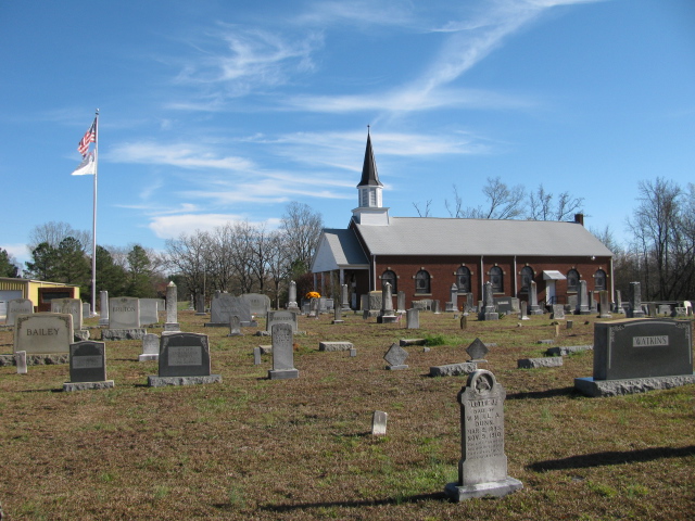
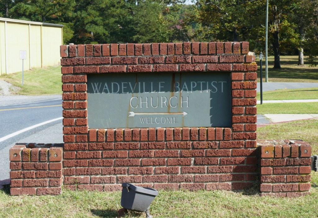
| Location | : | Wadeville, Montgomery County, USA |
| Coordinate | : | 35.2824250, -79.9683770 |
| Description | : | directions: Take Highway 109 north from Mount Gilead, N.C. Go to the city limits of Wadeville, N.C. Turn right on Shoe Factory Road. Church and cemetery will be on the right after you cross the railroad tracks. |
frequently asked questions (FAQ):
-
Where is Wadeville Baptist Church Cemetery?
Wadeville Baptist Church Cemetery is located at Wadeville, Montgomery County ,North Carolina ,USA.
-
Wadeville Baptist Church Cemetery cemetery's updated grave count on graveviews.com?
3 memorials
-
Where are the coordinates of the Wadeville Baptist Church Cemetery?
Latitude: 35.2824250
Longitude: -79.9683770
Nearby Cemetories:
1. Wadeville United Methodist Church Cemetery
Wadeville, Montgomery County, USA
Coordinate: 35.2796790, -79.9707540
2. Parsons Family Cemetery
Wadeville, Montgomery County, USA
Coordinate: 35.2819620, -79.9737970
3. McRae Cemetery
Pee Dee, Montgomery County, USA
Coordinate: 35.2736015, -79.9946976
4. Ropers Grove Cemetery
Mount Gilead, Montgomery County, USA
Coordinate: 35.2566986, -79.9966965
5. Stoney Fork Baptist Church Cemetery
Mount Gilead, Montgomery County, USA
Coordinate: 35.2755380, -80.0118270
6. Calvary Baptist Church Cemetery
Mount Gilead, Montgomery County, USA
Coordinate: 35.2544310, -79.9284410
7. Chisholm Cemetery
Wadeville, Montgomery County, USA
Coordinate: 35.2800560, -79.9127050
8. Chisholm Cemetery
Wadeville, Montgomery County, USA
Coordinate: 35.2851790, -79.9099590
9. Liberty Hill Baptist Church Cemetery
Liberty Hill, Montgomery County, USA
Coordinate: 35.3281590, -79.9964400
10. Zion Methodist Cemetery
Mount Gilead, Montgomery County, USA
Coordinate: 35.2725670, -80.0368520
11. Hunsucker Cemetery
Liberty Hill, Montgomery County, USA
Coordinate: 35.3357200, -80.0008500
12. New Covenant Church Cemetery
Troy, Montgomery County, USA
Coordinate: 35.3337200, -79.9241600
13. Pleasant Grove Baptist Church Cemetery
Mount Gilead, Montgomery County, USA
Coordinate: 35.2995000, -79.8937000
14. Haywood Cemetery
Mount Gilead, Montgomery County, USA
Coordinate: 35.2592010, -79.8961029
15. Sharon Cemetery
Mount Gilead, Montgomery County, USA
Coordinate: 35.2136002, -79.9796982
16. Sharon Presbyterian Church
Mount Gilead, Montgomery County, USA
Coordinate: 35.2156780, -80.0024410
17. Moore Family Cemetery
Montgomery County, USA
Coordinate: 35.2864200, -80.0581700
18. Bruton Cemetery
Troy, Montgomery County, USA
Coordinate: 35.2941990, -79.8788770
19. Thompson-Yarboro Cemetery
Montgomery County, USA
Coordinate: 35.2394000, -79.8838000
20. Bethel Baptist Church Cemetery
Mount Gilead, Montgomery County, USA
Coordinate: 35.2234300, -80.0391800
21. Mount Carmel Baptist Church Cemetery
Troy, Montgomery County, USA
Coordinate: 35.3648987, -79.9602890
22. Panagia Prousiotissa Greek Orthodox Monastery
Troy, Montgomery County, USA
Coordinate: 35.3533330, -79.9155560
23. White Crest Baptist Church Cemetery
Uwharrie, Montgomery County, USA
Coordinate: 35.3196360, -80.0598770
24. Holly Mount Baptist Church Cemetery
Mount Gilead, Montgomery County, USA
Coordinate: 35.2434940, -79.8757530