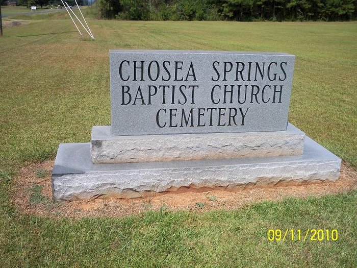
| Memorials | : | 0 |
| Location | : | Chosea Springs, Calhoun County, USA |
| Coordinate | : | 33.7016080, -85.6719980 |
| Description | : | Chosea Springs Baptist Church Cemetery is located on Ala. St. Hwy 9. between Iron City and White Plains communities. From the intersecton of U.S. Hwy 78 and Al. hwy 9, turn left -north- off of hwy 78.if coming from Oxford, Ala. Go 4.2 mi. and the church and cemetery is on the right side -East- side of the road. It is right off the hwy. |
frequently asked questions (FAQ):
-
Where is Chosea Springs Baptist Church Cemetery?
Chosea Springs Baptist Church Cemetery is located at Chosea Springs, Calhoun County ,Alabama ,USA.
-
Chosea Springs Baptist Church Cemetery cemetery's updated grave count on graveviews.com?
0 memorials
-
Where are the coordinates of the Chosea Springs Baptist Church Cemetery?
Latitude: 33.7016080
Longitude: -85.6719980
Nearby Cemetories:
1. Chosea Springs Community Cemetery
Chosea Springs, Calhoun County, USA
Coordinate: 33.6939000, -85.6689000
2. Hudson Cemetery
White Plains, Calhoun County, USA
Coordinate: 33.7216988, -85.6603012
3. Pleasant Ridge Cemetery
White Plains, Calhoun County, USA
Coordinate: 33.7119789, -85.6992035
4. Woodrow W. Smith Gravesite
Pleasant Ridge, Calhoun County, USA
Coordinate: 33.7173996, -85.6998978
5. Bains Gap Road
White Plains, Calhoun County, USA
Coordinate: 33.7173090, -85.6999890
6. Iron City Cemetery
Iron City, Calhoun County, USA
Coordinate: 33.6713982, -85.6669006
7. Bain Cemetery
White Plains, Calhoun County, USA
Coordinate: 33.7250160, -85.6972130
8. Bethany Baptist Cemetery
Iron City, Calhoun County, USA
Coordinate: 33.6674995, -85.6611023
9. White Plains Community Cemetery
White Plains, Calhoun County, USA
Coordinate: 33.7443810, -85.6845932
10. Harper Family Cemetery
White Plains, Calhoun County, USA
Coordinate: 33.7450600, -85.6858800
11. New Prospect Cemetery
Calhoun County, USA
Coordinate: 33.6567001, -85.7003021
12. Williamson-Little Cemetery
White Plains, Calhoun County, USA
Coordinate: 33.7518997, -85.6883011
13. Old Davistown Cemetery
Old Davisville, Calhoun County, USA
Coordinate: 33.6493988, -85.6635971
14. Harmony Baptist Church Cemetery
Choccolocco, Calhoun County, USA
Coordinate: 33.6496500, -85.7164050
15. Cole Cemetery
Cleburne County, USA
Coordinate: 33.7299995, -85.5980988
16. Watson-Cobb Family Cemetery
White Plains, Calhoun County, USA
Coordinate: 33.7831500, -85.6899400
17. Holley Springs Baptist Church Cemetery
Holly Springs, Calhoun County, USA
Coordinate: 33.6519012, -85.7521973
18. Calvary Baptist Church Cemetery
Heflin, Cleburne County, USA
Coordinate: 33.6432991, -85.6006012
19. New Oak Grove Cemetery
Piedmont, Calhoun County, USA
Coordinate: 33.7851982, -85.6522980
20. Antioch Cemetery
Anniston, Calhoun County, USA
Coordinate: 33.7122700, -85.7786300
21. Faith Tabernacle Baptist Church Cemetery
Rabbittown, Calhoun County, USA
Coordinate: 33.7905700, -85.6508800
22. Heflin Cemetery
Heflin, Cleburne County, USA
Coordinate: 33.6460991, -85.5836029
23. New Hope Cemetery
Anniston, Calhoun County, USA
Coordinate: 33.7305700, -85.7807800
24. Whites Gap Cemetery
Whites Gap, Calhoun County, USA
Coordinate: 33.7792015, -85.7388992

