
| Memorials | : | 0 |
| Location | : | Piedmont, Calhoun County, USA |
| Coordinate | : | 33.7851982, -85.6522980 |
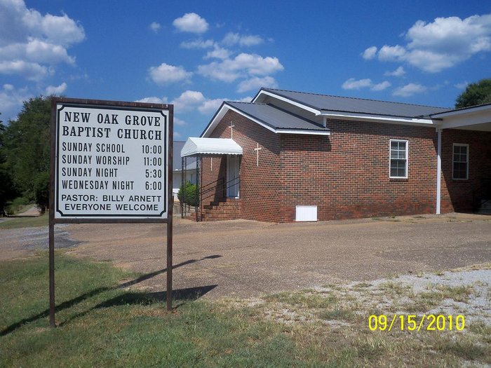
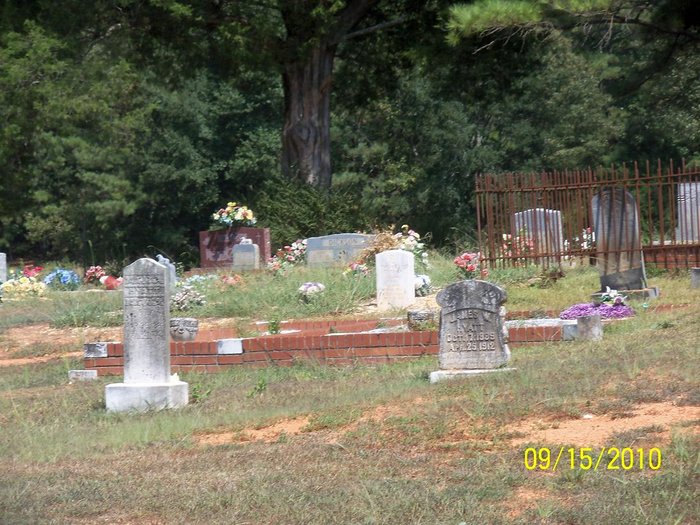
| Description | : | New Oak Grove Baptist Church Cemetery. The cemetery is located .5 miles Northeast of the old White Plains School on Chinch Creek Road, atop a hill behind the church. |
frequently asked questions (FAQ):
-
Where is New Oak Grove Cemetery?
New Oak Grove Cemetery is located at 3280 Chinch Creek Road Piedmont, Calhoun County ,Alabama , 36272USA.
-
New Oak Grove Cemetery cemetery's updated grave count on graveviews.com?
0 memorials
-
Where are the coordinates of the New Oak Grove Cemetery?
Latitude: 33.7851982
Longitude: -85.6522980
Nearby Cemetories:
1. Faith Tabernacle Baptist Church Cemetery
Rabbittown, Calhoun County, USA
Coordinate: 33.7905700, -85.6508800
2. Rabbittown Baptist Church Cemetery
Rabbittown, Calhoun County, USA
Coordinate: 33.8143692, -85.6483917
3. Watson-Cobb Family Cemetery
White Plains, Calhoun County, USA
Coordinate: 33.7831500, -85.6899400
4. Williamson-Little Cemetery
White Plains, Calhoun County, USA
Coordinate: 33.7518997, -85.6883011
5. White Plains Community Cemetery
White Plains, Calhoun County, USA
Coordinate: 33.7443810, -85.6845932
6. Harper Family Cemetery
White Plains, Calhoun County, USA
Coordinate: 33.7450600, -85.6858800
7. Newton Cemetery
Holley Crossroads, Calhoun County, USA
Coordinate: 33.8096733, -85.7193604
8. Hudson Cemetery
White Plains, Calhoun County, USA
Coordinate: 33.7216988, -85.6603012
9. Nances Creek United Methodist Church Cemetery
Jacksonville, Calhoun County, USA
Coordinate: 33.8506012, -85.6731033
10. Bain Cemetery
White Plains, Calhoun County, USA
Coordinate: 33.7250160, -85.6972130
11. Cole Cemetery
Cleburne County, USA
Coordinate: 33.7299995, -85.5980988
12. Whites Gap Cemetery
Whites Gap, Calhoun County, USA
Coordinate: 33.7792015, -85.7388992
13. Shoal Creek Cemetery
Cleburne County, USA
Coordinate: 33.7756004, -85.5642014
14. Dunn Cemetery
Cleburne County, USA
Coordinate: 33.8464012, -85.5958023
15. Woodrow W. Smith Gravesite
Pleasant Ridge, Calhoun County, USA
Coordinate: 33.7173996, -85.6998978
16. Bains Gap Road
White Plains, Calhoun County, USA
Coordinate: 33.7173090, -85.6999890
17. County Farm Cemetery
Jacksonville, Calhoun County, USA
Coordinate: 33.7787433, -85.7472271
18. Pleasant Ridge Cemetery
White Plains, Calhoun County, USA
Coordinate: 33.7119789, -85.6992035
19. Chosea Springs Baptist Church Cemetery
Chosea Springs, Calhoun County, USA
Coordinate: 33.7016080, -85.6719980
20. Jacksonville City Cemetery
Jacksonville, Calhoun County, USA
Coordinate: 33.8071900, -85.7578800
21. Chosea Springs Community Cemetery
Chosea Springs, Calhoun County, USA
Coordinate: 33.6939000, -85.6689000
22. McCain Cemetery
Jacksonville, Calhoun County, USA
Coordinate: 33.8546982, -85.7455978
23. Four Mile Cemetery
Four Mile, Calhoun County, USA
Coordinate: 33.7597008, -85.7746964
24. Hillcrest Cemetery
Jacksonville, Calhoun County, USA
Coordinate: 33.8217010, -85.7724991