
| Memorials | : | 27 |
| Location | : | Radlett, Hertsmere Borough, England |
| Coordinate | : | 51.6802460, -0.3163610 |
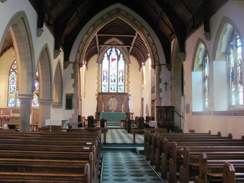
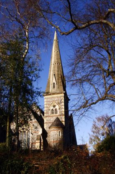
| Description | : | ============================================= Our history In Roman times the road from Londinium to Verulanium (St Albans), now known as Watling St, passed through the site of present day Radlett. Roman pottery kilns existed near Loom Lane just south-west of the church. In the same area clay was more recently extracted for brick making. The name Radlett appears to be derived from the Old English rad-gelaete meaning junction of roads. But although there were clusters of dwellings, Radlett did not become a real community until the 19th Century when the Midland Railway was built and the population began to grow. In 1864 the original Christ Church... Read More |
frequently asked questions (FAQ):
-
Where is Christ Church?
Christ Church is located at Watling Street: Phone Number 01923 859963 Radlett, Hertsmere Borough ,Hertfordshire , WD7 7JJEngland.
-
Christ Church cemetery's updated grave count on graveviews.com?
0 memorials
-
Where are the coordinates of the Christ Church?
Latitude: 51.6802460
Longitude: -0.3163610
Nearby Cemetories:
1. St. John the Baptist Churchyard
Aldenham, Hertsmere Borough, England
Coordinate: 51.6734130, -0.3531610
2. Hill End Hospital Cemetery
St Albans, St Albans District, England
Coordinate: 51.6982051, -0.2901128
3. St Martin's Churchyard
Shenley, Hertsmere Borough, England
Coordinate: 51.6897547, -0.2794666
4. Saint Bololph's Churchyard
Shenley, Hertsmere Borough, England
Coordinate: 51.7030296, -0.2890460
5. Sir David Yule Mausoleum
St Albans, St Albans District, England
Coordinate: 51.7024660, -0.3505190
6. Bushey Jewish Cemetery
Bushey, Watford Borough, England
Coordinate: 51.6580150, -0.3572810
7. Allum Lane Cemetery
Elstree, Hertsmere Borough, England
Coordinate: 51.6478270, -0.2939220
8. All Saints Churchyard
Borehamwood, Hertsmere Borough, England
Coordinate: 51.6553200, -0.2744900
9. St. Nicholas' Churchyard
Elstree, Hertsmere Borough, England
Coordinate: 51.6450300, -0.2979000
10. Holy Trinity Churchyard
St Albans, St Albans District, England
Coordinate: 51.7170354, -0.3334244
11. Frogmore Holy Trinity Burial Ground
St Albans District, England
Coordinate: 51.7197598, -0.3365342
12. St Margaret Churchyard
Ridge, Hertsmere Borough, England
Coordinate: 51.6897880, -0.2455900
13. Bushey United Reformed Congregational Churchyard
Bushey, Watford Borough, England
Coordinate: 51.6440000, -0.3611200
14. West Herts Crematorium
Watford, Watford Borough, England
Coordinate: 51.7004195, -0.3847509
15. All Saints Churchyard
Watford Borough, England
Coordinate: 51.6954810, -0.3885560
16. St. James' Churchyard
Bushey, Watford Borough, England
Coordinate: 51.6443700, -0.3679250
17. London Road Cemetery
St Albans, St Albans District, England
Coordinate: 51.7333610, -0.3066110
18. North Watford Cemetery
Watford, Watford Borough, England
Coordinate: 51.6832680, -0.4033640
19. St. Giles Churchyard
South Mimms, Hertsmere Borough, England
Coordinate: 51.6961860, -0.2329300
20. Edgwarebury Cemetery
Edgware, London Borough of Barnet, England
Coordinate: 51.6304800, -0.2797200
21. St. Mary's Churchyard
Watford, Watford Borough, England
Coordinate: 51.6546240, -0.3958510
22. Vicarage Road Cemetery
Watford, Watford Borough, England
Coordinate: 51.6517850, -0.4008620
23. East Lane Cemetery
Leavesden, Three Rivers District, England
Coordinate: 51.7084796, -0.4036263
24. St Peter Churchyard
Arkley, London Borough of Barnet, England
Coordinate: 51.6474200, -0.2320430