
| Memorials | : | 24 |
| Location | : | Watford Borough, England |
| Coordinate | : | 51.6954810, -0.3885560 |
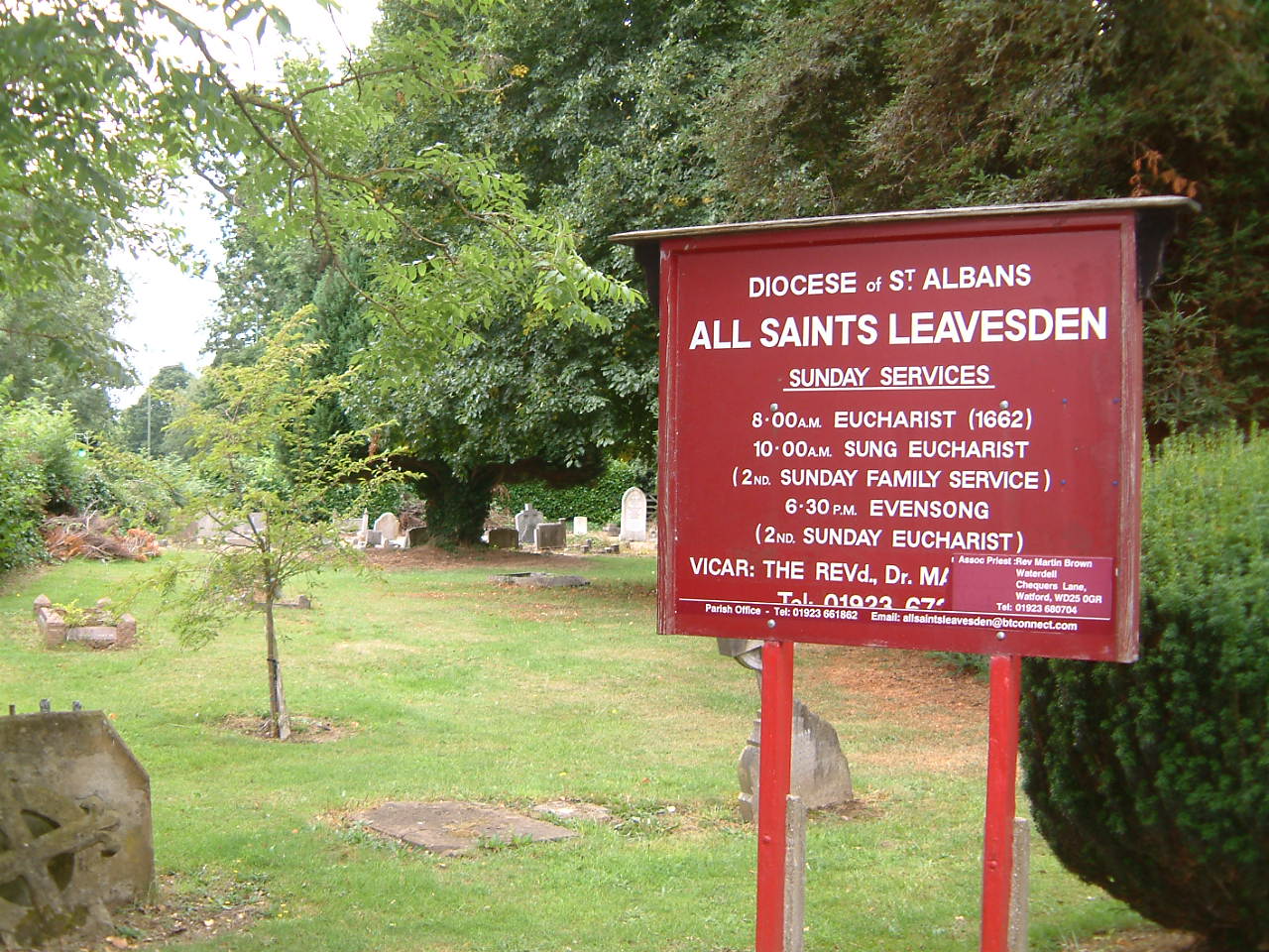
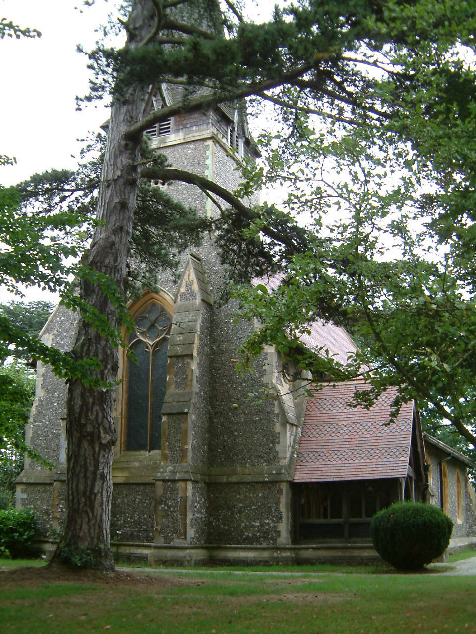
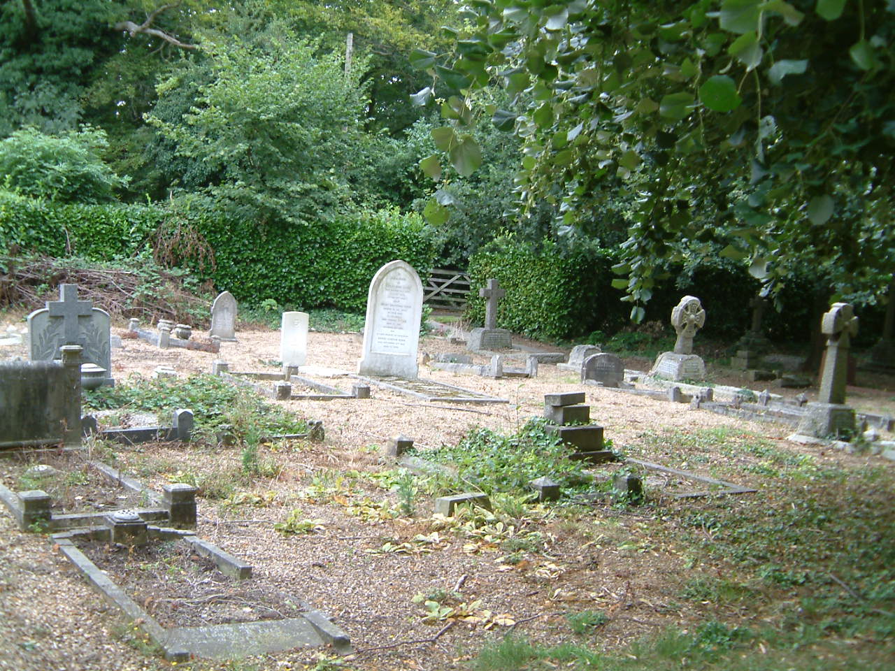
| Description | : | All Saints Churchyard surrounds the parish church of All Saints Leavesden a grade II listed building designed and built in 1853 by Sir George Gilbert Scott. It contains five Commonwealth War Graves; two from World War I and three from World War II. The churchyard is now closed for new burials and is maintained by Watford Borough Council. It is open to the public at all times. |
frequently asked questions (FAQ):
-
Where is All Saints Churchyard?
All Saints Churchyard is located at Horseshoe Lane Watford Borough ,Hertfordshire , WD25 0LUEngland.
-
All Saints Churchyard cemetery's updated grave count on graveviews.com?
24 memorials
-
Where are the coordinates of the All Saints Churchyard?
Latitude: 51.6954810
Longitude: -0.3885560
Nearby Cemetories:
1. West Herts Crematorium
Watford, Watford Borough, England
Coordinate: 51.7004195, -0.3847509
2. North Watford Cemetery
Watford, Watford Borough, England
Coordinate: 51.6832680, -0.4033640
3. East Lane Cemetery
Leavesden, Three Rivers District, England
Coordinate: 51.7084796, -0.4036263
4. St Lawrence the Martyr Churchyard
Abbots Langley, Three Rivers District, England
Coordinate: 51.7077650, -0.4170030
5. Sir David Yule Mausoleum
St Albans, St Albans District, England
Coordinate: 51.7024660, -0.3505190
6. St. Paul Churchyard
Kings Langley, Dacorum Borough, England
Coordinate: 51.6931700, -0.4383900
7. St. John the Baptist Churchyard
Aldenham, Hertsmere Borough, England
Coordinate: 51.6734130, -0.3531610
8. All Saints Churchyard
Kings Langley, Dacorum Borough, England
Coordinate: 51.7109030, -0.4479280
9. Frogmore Holy Trinity Burial Ground
St Albans District, England
Coordinate: 51.7197598, -0.3365342
10. Holy Trinity Churchyard
St Albans, St Albans District, England
Coordinate: 51.7170354, -0.3334244
11. St. Mary's Churchyard
Watford, Watford Borough, England
Coordinate: 51.6546240, -0.3958510
12. Bushey Jewish Cemetery
Bushey, Watford Borough, England
Coordinate: 51.6580150, -0.3572810
13. Vicarage Road Cemetery
Watford, Watford Borough, England
Coordinate: 51.6517850, -0.4008620
14. Christ Church
Radlett, Hertsmere Borough, England
Coordinate: 51.6802460, -0.3163610
15. Kings Langley Priory
Kings Langley, Dacorum Borough, England
Coordinate: 51.7130000, -0.4603000
16. St. Stephen's Churchyard
St Albans, St Albans District, England
Coordinate: 51.7417450, -0.3483370
17. St. James' Churchyard
Bushey, Watford Borough, England
Coordinate: 51.6443700, -0.3679250
18. Bushey United Reformed Congregational Churchyard
Bushey, Watford Borough, England
Coordinate: 51.6440000, -0.3611200
19. Holy Trinity Churchyard
Leverstock Green, Dacorum Borough, England
Coordinate: 51.7466800, -0.4295770
20. St Michael’s Churchyard
St Albans, St Albans District, England
Coordinate: 51.7529540, -0.3560640
21. Hill End Hospital Cemetery
St Albans, St Albans District, England
Coordinate: 51.6982051, -0.2901128
22. Saint Alban's Cathedral
St Albans, St Albans District, England
Coordinate: 51.7504425, -0.3423680
23. St Mary's Church Apsley End
Apsley, Dacorum Borough, England
Coordinate: 51.7347710, -0.4659480
24. Saint Bololph's Churchyard
Shenley, Hertsmere Borough, England
Coordinate: 51.7030296, -0.2890460