
| Memorials | : | 64 |
| Location | : | Euxton, Chorley Borough, England |
| Website | : | www.euxtonparishchurch.org |
| Coordinate | : | 53.6650950, -2.6743630 |
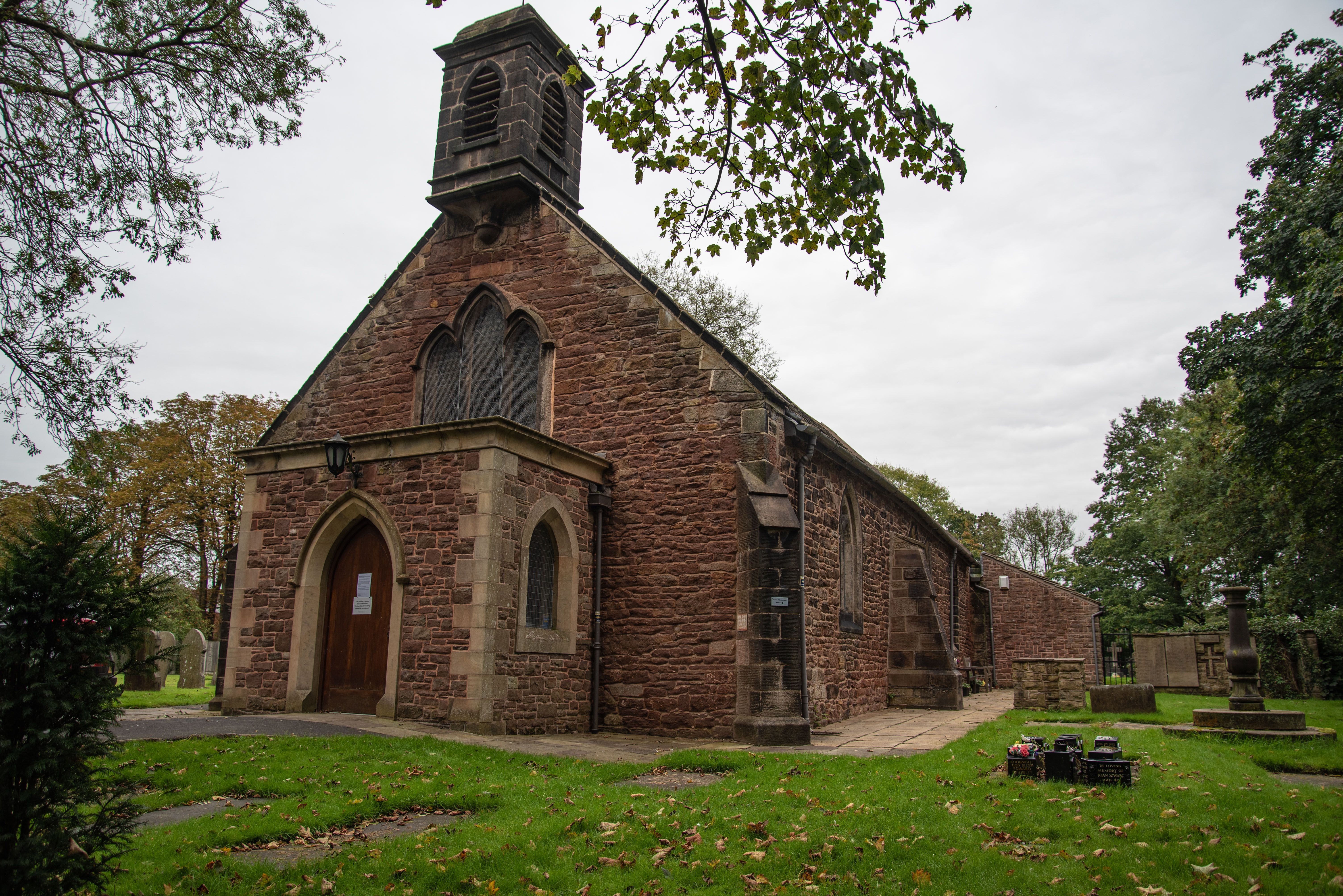
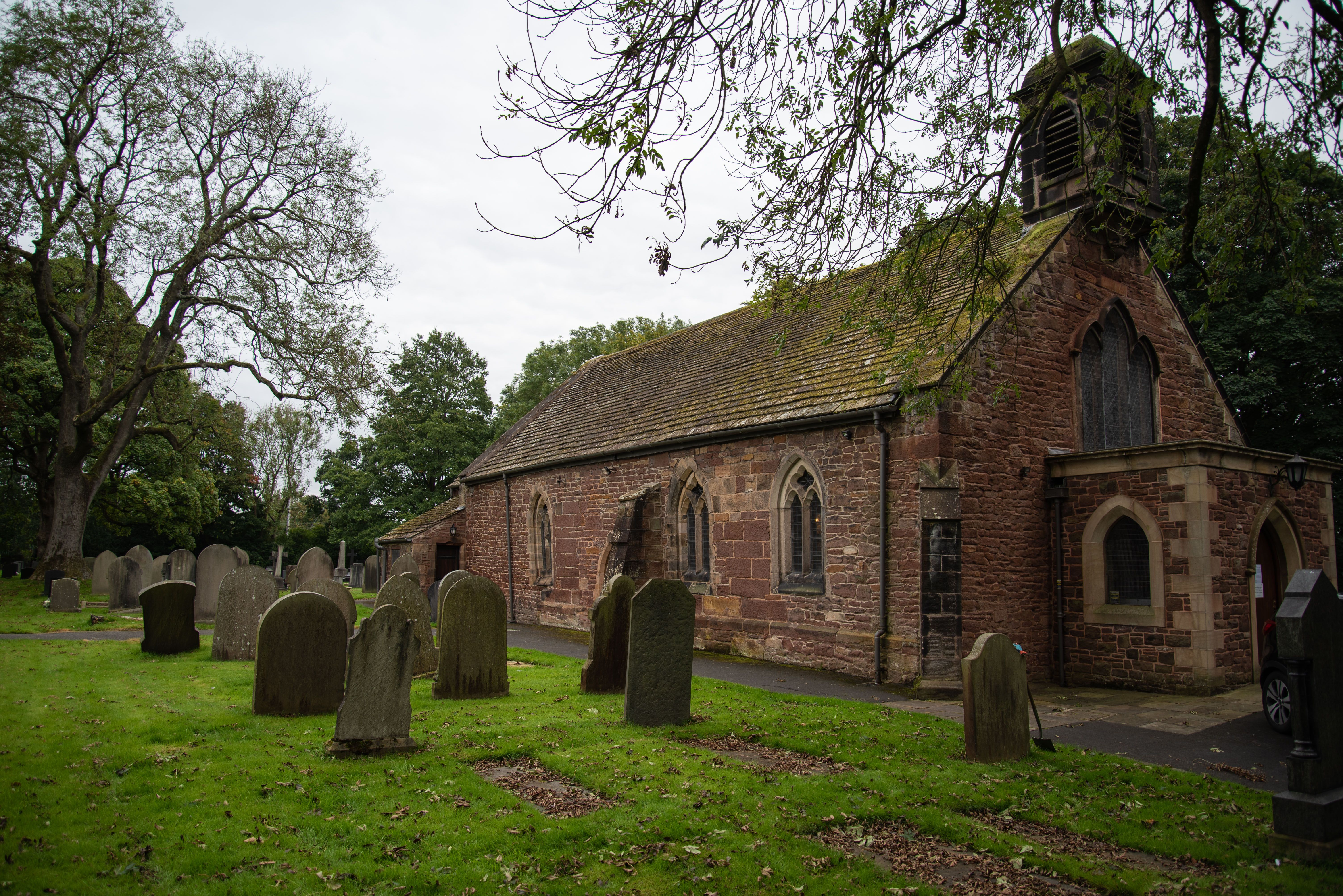
| Description | : | This Church of England parish meets in a small 17th century church building, set in the middle of Euxton. Although the history of the church dates back to the 14th century. |
frequently asked questions (FAQ):
-
Where is Euxton Parish Churchyard?
Euxton Parish Churchyard is located at Wigan Road Euxton, Chorley Borough ,Lancashire , PR7 6JHEngland.
-
Euxton Parish Churchyard cemetery's updated grave count on graveviews.com?
62 memorials
-
Where are the coordinates of the Euxton Parish Churchyard?
Latitude: 53.6650950
Longitude: -2.6743630
Nearby Cemetories:
1. St. Mary's Churchyard
Euxton, Chorley Borough, England
Coordinate: 53.6669580, -2.6768350
2. Charnock Richard Crematorium
Chorley, Chorley Borough, England
Coordinate: 53.6518550, -2.6763080
3. Chorley Cemetery
Chorley, Chorley Borough, England
Coordinate: 53.6549770, -2.6447530
4. Saint Andrews Churchyard
Leyland, South Ribble Borough, England
Coordinate: 53.6881270, -2.6957880
5. St Laurence's Church
Chorley, Chorley Borough, England
Coordinate: 53.6546880, -2.6327020
6. St Mary's Roman Catholic Churchyard
Leyland, South Ribble Borough, England
Coordinate: 53.6880510, -2.6983240
7. Christ Church
Charnock Richard, Chorley Borough, England
Coordinate: 53.6367200, -2.6773400
8. St George's Churchyard
Chorley, Chorley Borough, England
Coordinate: 53.6521460, -2.6295520
9. St Peters Churchyard
Chorley, Chorley Borough, England
Coordinate: 53.6607430, -2.6232100
10. St John the Evangelist Churchyard
Whittle-le-Woods, Chorley Borough, England
Coordinate: 53.6883280, -2.6400320
11. St Gregory Weld Bank Church Cemetery
Chorley, Chorley Borough, England
Coordinate: 53.6390300, -2.6307480
12. St Mary the Virgin Churchyard
Eccleston, Chorley Borough, England
Coordinate: 53.6528800, -2.7331920
13. St. Chad's South Hill Churchyard
Wheelton, Chorley Borough, England
Coordinate: 53.6826040, -2.6125010
14. Saint James Churchyard
Leyland, South Ribble Borough, England
Coordinate: 53.6896630, -2.7327430
15. St Oswald’s Churchyard
Coppull, Chorley Borough, England
Coordinate: 53.6217176, -2.6714738
16. St Barnabas Churchyard
Heapey, Chorley Borough, England
Coordinate: 53.6792520, -2.6043310
17. St. Bedes Churchyard
Clayton-le-Woods, Chorley Borough, England
Coordinate: 53.7079260, -2.6390320
18. Coppull Parish Churchyard Extension
Coppull, Chorley Borough, England
Coordinate: 53.6170200, -2.6555420
19. Coppull Parish Churchyard
Coppull, Chorley Borough, England
Coordinate: 53.6168000, -2.6549710
20. St. James the Great Churchyard
Wrightington, West Lancashire District, England
Coordinate: 53.6168220, -2.7175670
21. St. Saviour's Churchyard
Bamber Bridge, South Ribble Borough, England
Coordinate: 53.7197301, -2.6598985
22. St. Peter and St. Paul Churchyard
Mawdesley, Chorley Borough, England
Coordinate: 53.6266580, -2.7451420
23. St Paul Churchyard
Farington, South Ribble Borough, England
Coordinate: 53.7199900, -2.7017200
24. Croston Cemetery
Croston, Chorley Borough, England
Coordinate: 53.6586700, -2.7733100