
| Memorials | : | 0 |
| Location | : | Eaton Hastings, Vale of White Horse District, England |
| Coordinate | : | 51.6852000, -1.6212000 |
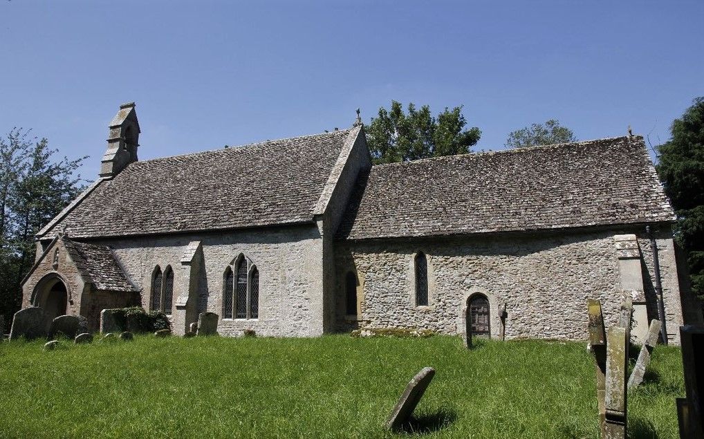
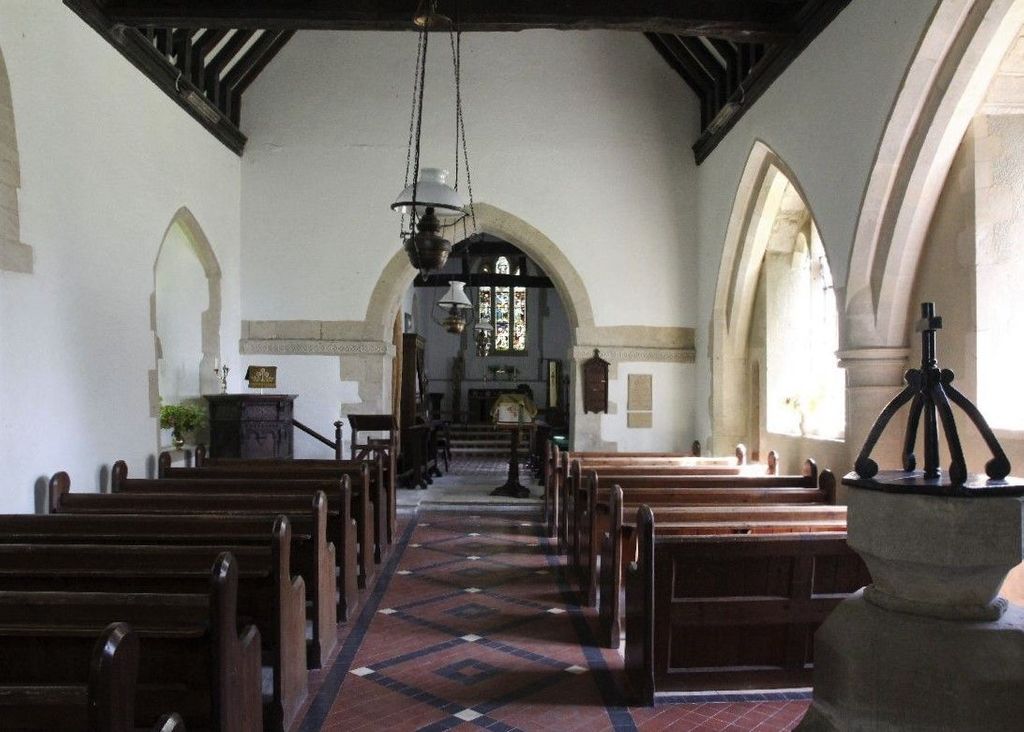
| Description | : | The Church of England parish church of Saint Michael and All Angels is the most prominent surviving building of the original settlement. The earliest parts of the church were built in the 11th century. It is built of rubblestone and consists of a simple nave, chancel and bellcote. The chancel is largely 13th century. In 1870–1873 the church underwent Victorian restoration. St Michael's is a Grade II listed building. The west window has a stained glass depicting archangels Michael, Raphael and Gabriel. The window was installed in 1935 by Morris & Co. The designs date from 1860 and were created by... Read More |
frequently asked questions (FAQ):
-
Where is Church of Saint Michael and All Angels?
Church of Saint Michael and All Angels is located at Eaton Hastings, Vale of White Horse District ,Oxfordshire , SN7England.
-
Church of Saint Michael and All Angels cemetery's updated grave count on graveviews.com?
0 memorials
-
Where are the coordinates of the Church of Saint Michael and All Angels?
Latitude: 51.6852000
Longitude: -1.6212000
Nearby Cemetories:
1. St. George's Churchyard
Kelmscott, West Oxfordshire District, England
Coordinate: 51.6925550, -1.6408780
2. Buscot Park
Faringdon, Vale of White Horse District, England
Coordinate: 51.6684973, -1.6518000
3. St. Mary's Churchyard
Buscot, Vale of White Horse District, England
Coordinate: 51.6815710, -1.6736770
4. Faringdon Nonconformist Cemetery
Faringdon, Vale of White Horse District, England
Coordinate: 51.6576700, -1.5907200
5. All Saints Churchyard
Faringdon, Vale of White Horse District, England
Coordinate: 51.6595730, -1.5839770
6. St. Stephen's Churchyard
Clanfield, West Oxfordshire District, England
Coordinate: 51.7174060, -1.5911740
7. Saint Matthew's Churchyard
Langford, West Oxfordshire District, England
Coordinate: 51.7209390, -1.6405280
8. St. Margaret's Churchyard
Little Faringdon, West Oxfordshire District, England
Coordinate: 51.7109400, -1.6739760
9. Littleworth Cemetery
Littleworth, Vale of White Horse District, England
Coordinate: 51.6722500, -1.5492500
10. St. Giles Churchyard
Great Coxwell, Vale of White Horse District, England
Coordinate: 51.6389520, -1.6114148
11. St. Mary's Churchyard
Little Coxwell, Vale of White Horse District, England
Coordinate: 51.6398280, -1.5941840
12. All Saints Churchyard
Coleshill, Vale of White Horse District, England
Coordinate: 51.6422960, -1.6611320
13. St. Peter's Churchyard
Alvescot, West Oxfordshire District, England
Coordinate: 51.7392910, -1.6046704
14. Saint Mary's Churchyard
Black Bourton, West Oxfordshire District, England
Coordinate: 51.7360520, -1.5864600
15. St Peter's Churchyard
Filkins, West Oxfordshire District, England
Coordinate: 51.7358700, -1.6578250
16. St Georges Churchyard
Kencot, West Oxfordshire District, England
Coordinate: 51.7407160, -1.6330900
17. St. Mary the Virgin Churchyard
Bampton, West Oxfordshire District, England
Coordinate: 51.7278250, -1.5487270
18. Bampton Cemetery
Bampton, West Oxfordshire District, England
Coordinate: 51.7296400, -1.5490200
19. St John the Evangelist Churchyard
Fernham, Vale of White Horse District, England
Coordinate: 51.6251600, -1.5777100
20. St. Faith Churchyard
Shellingford, Vale of White Horse District, England
Coordinate: 51.6394270, -1.5407780
21. St George Roman Catholic Churchyard
Buckland, Vale of White Horse District, England
Coordinate: 51.6804300, -1.5068720
22. St Mary the Virgin Parish Churchyard
Longcot, Vale of White Horse District, England
Coordinate: 51.6146420, -1.6056320
23. St Mary Churchyard
Buckland, Vale of White Horse District, England
Coordinate: 51.6819730, -1.5060150
24. Watchfield Military Cemetery
Watchfield, Vale of White Horse District, England
Coordinate: 51.6110800, -1.6469400