| Memorials | : | 22 |
| Location | : | Black Bourton, West Oxfordshire District, England |
| Website | : | svbb.org.uk/black-bourton/ |
| Coordinate | : | 51.7360520, -1.5864600 |
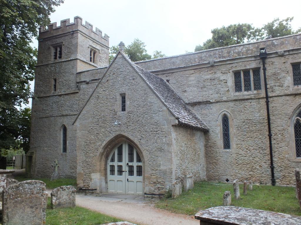
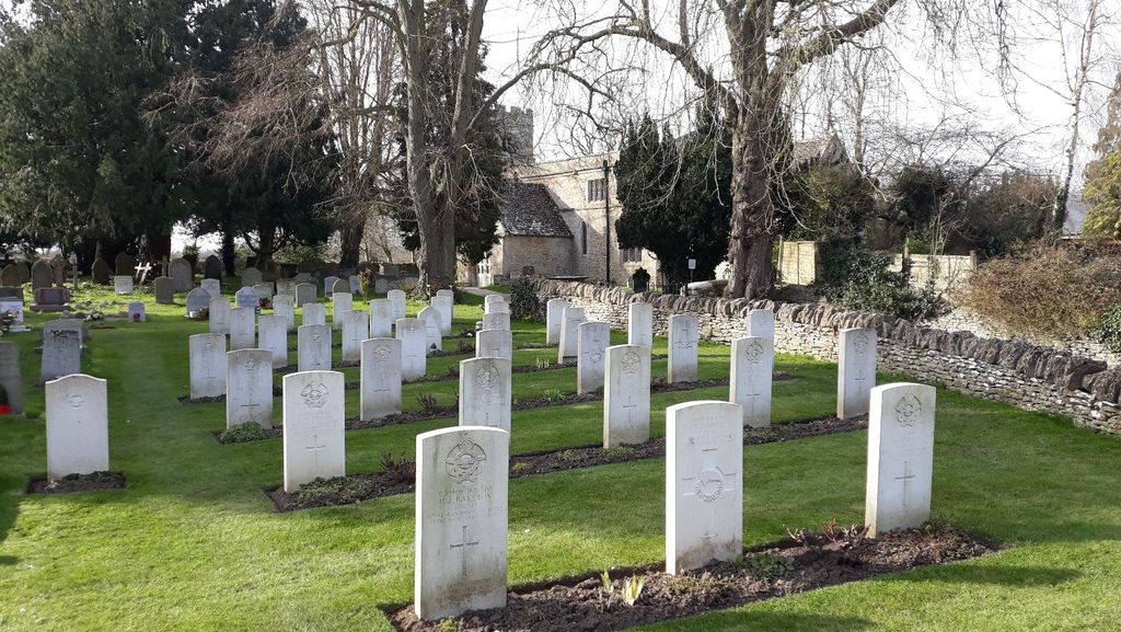
| Description | : | The earliest part of the church dates back to early 12th Century with Hungerford Chapel Addition in 13th Century and the Tower added around 1500. Early Notables were buried in the Church with others buried in the Churchyard which has expanded far behind the church. St Mary's churchyard includes 32 Commonwealth War Graves Commission burials. There are 30 Second World War burials, one from the First World War and one other. Most of the Second World War graves are of members of the RAF and Allied Air Forces from RAF Brize Norton. |
frequently asked questions (FAQ):
-
Where is Saint Mary's Churchyard?
Saint Mary's Churchyard is located at Black Bourton, West Oxfordshire District ,Oxfordshire ,England.
-
Saint Mary's Churchyard cemetery's updated grave count on graveviews.com?
22 memorials
-
Where are the coordinates of the Saint Mary's Churchyard?
Latitude: 51.7360520
Longitude: -1.5864600
Nearby Cemetories:
1. St. Peter's Churchyard
Alvescot, West Oxfordshire District, England
Coordinate: 51.7392910, -1.6046704
2. St. Stephen's Churchyard
Clanfield, West Oxfordshire District, England
Coordinate: 51.7174060, -1.5911740
3. Bampton Cemetery
Bampton, West Oxfordshire District, England
Coordinate: 51.7296400, -1.5490200
4. St. Mary the Virgin Churchyard
Bampton, West Oxfordshire District, England
Coordinate: 51.7278250, -1.5487270
5. St Georges Churchyard
Kencot, West Oxfordshire District, England
Coordinate: 51.7407160, -1.6330900
6. St. Britius Churchyard Extension
Brize Norton, West Oxfordshire District, England
Coordinate: 51.7660800, -1.5662600
7. St. Britius Churchyard
Brize Norton, West Oxfordshire District, England
Coordinate: 51.7662000, -1.5667000
8. Saint Matthew's Churchyard
Langford, West Oxfordshire District, England
Coordinate: 51.7209390, -1.6405280
9. Holy Trinity Church
Witney, West Oxfordshire District, England
Coordinate: 51.7726500, -1.6142050
10. Holy Rood Churchyard
Shilton, West Oxfordshire District, England
Coordinate: 51.7726519, -1.6142058
11. St Peter's Churchyard
Filkins, West Oxfordshire District, England
Coordinate: 51.7358700, -1.6578250
12. St. James the Great Churchyard
Aston, West Oxfordshire District, England
Coordinate: 51.7252620, -1.5059510
13. St. George's Churchyard
Kelmscott, West Oxfordshire District, England
Coordinate: 51.6925550, -1.6408780
14. Church of Saint Michael and All Angels
Eaton Hastings, Vale of White Horse District, England
Coordinate: 51.6852000, -1.6212000
15. St John The Baptist
Curbridge, West Oxfordshire District, England
Coordinate: 51.7764570, -1.5203140
16. Cote Baptist Chapel
Cote, West Oxfordshire District, England
Coordinate: 51.7254430, -1.4929510
17. St. Margaret's Churchyard
Little Faringdon, West Oxfordshire District, England
Coordinate: 51.7109400, -1.6739760
18. St Nicholas Parish Church
Asthall, West Oxfordshire District, England
Coordinate: 51.8003600, -1.5850500
19. Littleworth Cemetery
Littleworth, Vale of White Horse District, England
Coordinate: 51.6722500, -1.5492500
20. St Mary Churchyard
Swinbrook, West Oxfordshire District, England
Coordinate: 51.8072090, -1.5954540
21. St Oswald's Churchyard
Widford, West Oxfordshire District, England
Coordinate: 51.8067780, -1.6047160
22. St. Bartholomew Churchyard
Ducklington, West Oxfordshire District, England
Coordinate: 51.7658689, -1.4810340
23. Saint Kenelm's Churchyard
Minster Lovell, West Oxfordshire District, England
Coordinate: 51.8000620, -1.5314550
24. Tower Hill Cemetery
Witney, West Oxfordshire District, England
Coordinate: 51.7852950, -1.4999610


