
| Memorials | : | 0 |
| Location | : | Faringdon, Vale of White Horse District, England |
| Phone | : | 01367240932 |
| Website | : | buscot-park.com |
| Coordinate | : | 51.6684973, -1.6518000 |
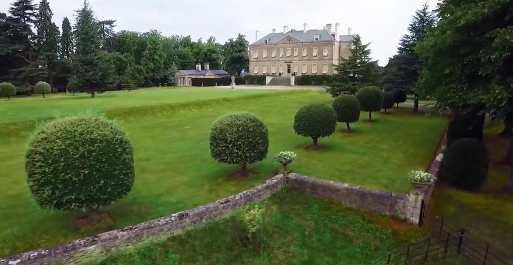
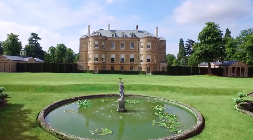
| Description | : | Buscot Park is a country house at Buscot near the town of Faringdon in Oxfordshire within the historic boundaries of Berkshire. It was built in an austere neoclassical style between 1780 and 1783 for Edward Loveden Loveden. It remained in the family until sold in 1859 to Robert Tertius Campbell, an Australian. Campbell's daughter Florence would later be famous as Mrs Charles Bravo, the central character in a Victorian murder case that remains unsolved to this day. On Campbell's death, in 1887, the house and its estate were sold to Alexander Henderson a financier, later to be ennobled as Baron... Read More |
frequently asked questions (FAQ):
-
Where is Buscot Park?
Buscot Park is located at Faringdon, Vale of White Horse District ,Oxfordshire , SN7 8BUEngland.
-
Buscot Park cemetery's updated grave count on graveviews.com?
0 memorials
-
Where are the coordinates of the Buscot Park?
Latitude: 51.6684973
Longitude: -1.6518000
Nearby Cemetories:
1. St. Mary's Churchyard
Buscot, Vale of White Horse District, England
Coordinate: 51.6815710, -1.6736770
2. St. George's Churchyard
Kelmscott, West Oxfordshire District, England
Coordinate: 51.6925550, -1.6408780
3. Church of Saint Michael and All Angels
Eaton Hastings, Vale of White Horse District, England
Coordinate: 51.6852000, -1.6212000
4. All Saints Churchyard
Coleshill, Vale of White Horse District, England
Coordinate: 51.6422960, -1.6611320
5. St. Giles Churchyard
Great Coxwell, Vale of White Horse District, England
Coordinate: 51.6389520, -1.6114148
6. Faringdon Nonconformist Cemetery
Faringdon, Vale of White Horse District, England
Coordinate: 51.6576700, -1.5907200
7. All Saints Churchyard
Faringdon, Vale of White Horse District, England
Coordinate: 51.6595730, -1.5839770
8. St. Margaret's Churchyard
Little Faringdon, West Oxfordshire District, England
Coordinate: 51.7109400, -1.6739760
9. St. Mary's Churchyard
Little Coxwell, Vale of White Horse District, England
Coordinate: 51.6398280, -1.5941840
10. Saint Matthew's Churchyard
Langford, West Oxfordshire District, England
Coordinate: 51.7209390, -1.6405280
11. Watchfield Military Cemetery
Watchfield, Vale of White Horse District, England
Coordinate: 51.6110800, -1.6469400
12. Watchfield Cemetery
Watchfield, Vale of White Horse District, England
Coordinate: 51.6109220, -1.6467980
13. St. Thomas Churchyard
Watchfield, Vale of White Horse District, England
Coordinate: 51.6107409, -1.6468265
14. Highworth Cemetery
Highworth, Swindon Unitary Authority, England
Coordinate: 51.6285450, -1.7212890
15. St Mary the Virgin Parish Churchyard
Longcot, Vale of White Horse District, England
Coordinate: 51.6146420, -1.6056320
16. St. Stephen's Churchyard
Clanfield, West Oxfordshire District, England
Coordinate: 51.7174060, -1.5911740
17. St John the Evangelist Churchyard
Fernham, Vale of White Horse District, England
Coordinate: 51.6251600, -1.5777100
18. St. James' Churchyard
Sevenhampton, Swindon Unitary Authority, England
Coordinate: 51.6119590, -1.6984440
19. Littleworth Cemetery
Littleworth, Vale of White Horse District, England
Coordinate: 51.6722500, -1.5492500
20. St Peter's Churchyard
Filkins, West Oxfordshire District, England
Coordinate: 51.7358700, -1.6578250
21. St. Andrew's Churchyard
Shrivenham, Vale of White Horse District, England
Coordinate: 51.6000270, -1.6537370
22. St. Mary's Churchyard
Kempsford, Cotswold District, England
Coordinate: 51.6670420, -1.7681363
23. St Georges Churchyard
Kencot, West Oxfordshire District, England
Coordinate: 51.7407160, -1.6330900
24. Shrivenham Parish Cemetery
Shrivenham, Vale of White Horse District, England
Coordinate: 51.5942061, -1.6517227