
| Memorials | : | 15 |
| Location | : | Phoenix, Maricopa County, USA |
| Coordinate | : | 33.4450100, -112.0909040 |
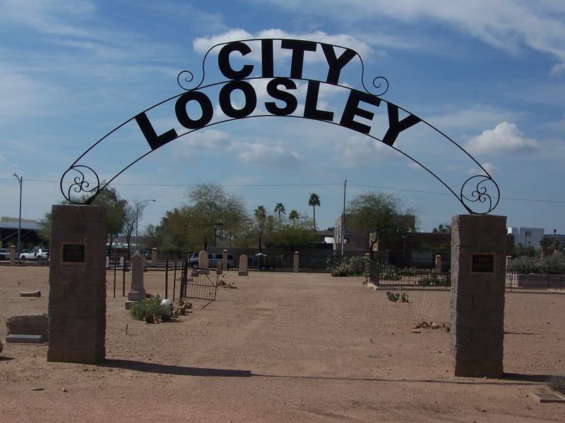
| Description | : | When the early citizens of Phoenix decided that City Cemetery was a disgrace to their beautiful city, the bodies were reinterred and most of them to the City Loosley Cemetery. This cemetery is one of seven historic cemeteries located inside the Pioneer & Military memorial Park which now lies virtually in the middle of downtown Phoenix. These historical cemeteries are normally available for walking tours each Thursday from 9:00 am to 3:00pm. Tours during the middle of summer are not advised. The last burial in the cemeteries occured in 1914 and many Phoenix pioneers and early American War veterans are... Read More |
frequently asked questions (FAQ):
-
Where is City Loosley Cemetery?
City Loosley Cemetery is located at Phoenix, Maricopa County ,Arizona ,USA.
-
City Loosley Cemetery cemetery's updated grave count on graveviews.com?
13 memorials
-
Where are the coordinates of the City Loosley Cemetery?
Latitude: 33.4450100
Longitude: -112.0909040
Nearby Cemetories:
1. Independent Order of Odd Fellows Cemetery
Phoenix, Maricopa County, USA
Coordinate: 33.4451220, -112.0898740
2. Knights of Pythias Cemetery
Phoenix, Maricopa County, USA
Coordinate: 33.4447460, -112.0898310
3. Masons Cemetery
Phoenix, Maricopa County, USA
Coordinate: 33.4455060, -112.0898580
4. Ancient Order of United Workmen Cemetery
Phoenix, Maricopa County, USA
Coordinate: 33.4443830, -112.0898100
5. Rosedale Cemetery
Phoenix, Maricopa County, USA
Coordinate: 33.4465140, -112.0908180
6. Pioneer and Military Memorial Park
Phoenix, Maricopa County, USA
Coordinate: 33.4464690, -112.0903850
7. Porter Cemetery
Phoenix, Maricopa County, USA
Coordinate: 33.4462630, -112.0898040
8. Cementerio Lindo
Phoenix, Maricopa County, USA
Coordinate: 33.4304390, -112.0925598
9. Greenwood Memory Lawn Cemetery
Phoenix, Maricopa County, USA
Coordinate: 33.4557991, -112.1097031
10. Trinity Episcopal Cathedral Columbarium
Phoenix, Maricopa County, USA
Coordinate: 33.4590270, -112.0749940
11. Beth El Cemetery
Phoenix, Maricopa County, USA
Coordinate: 33.4592018, -112.1117020
12. Encanto Community Church Memorial Garden
Phoenix, Maricopa County, USA
Coordinate: 33.4793340, -112.0835480
13. Beth Israel Cemetery
Phoenix, Maricopa County, USA
Coordinate: 33.4444008, -112.1327972
14. Arizona State Hospital Cemetery
Phoenix, Maricopa County, USA
Coordinate: 33.4525960, -112.0295240
15. Sotelo–Heard Ranch Cemetery
Phoenix, Maricopa County, USA
Coordinate: 33.4035260, -112.0536480
16. Faith Lutheran Church Columbarium
Phoenix, Maricopa County, USA
Coordinate: 33.5088420, -112.0640250
17. First United Methodist Church Columbarium
Phoenix, Maricopa County, USA
Coordinate: 33.5167465, -112.0740433
18. All Saints Episcopal Church Cemetery
Phoenix, Maricopa County, USA
Coordinate: 33.5297000, -112.0746000
19. Shepherd of the Valley Lutheran Church
Phoenix, Maricopa County, USA
Coordinate: 33.5315580, -112.0914890
20. Cross Cut Cemetery
Phoenix, Maricopa County, USA
Coordinate: 33.4514370, -111.9794850
21. Church of the Beatitudes Columbarium
Phoenix, Maricopa County, USA
Coordinate: 33.5380000, -112.0815000
22. Saint Marys Episcopal Church Cemetery
Phoenix, Maricopa County, USA
Coordinate: 33.5321080, -112.1431430
23. Trinity United Methodist Church Memorial Garden
Phoenix, Maricopa County, USA
Coordinate: 33.5387480, -112.1261220
24. Resthaven Park East Cemetery
Phoenix, Maricopa County, USA
Coordinate: 33.3944016, -111.9878006