
| Memorials | : | 0 |
| Location | : | Phoenix, Maricopa County, USA |
| Coordinate | : | 33.4464690, -112.0903850 |
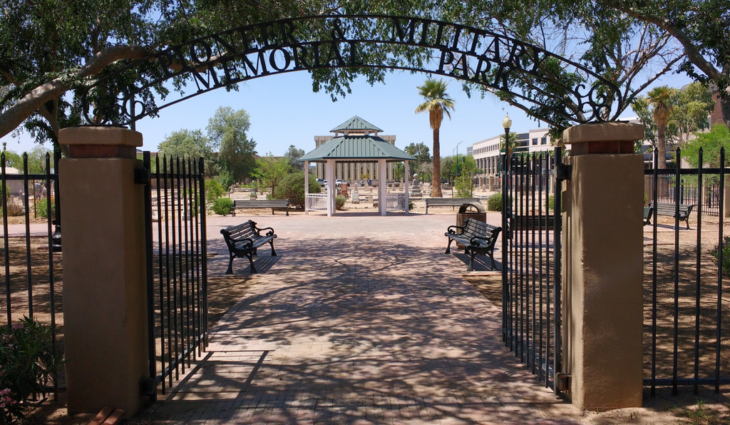
| Description | : | The Pioneer & Military Memorial Park is comprised of seven historic cemeteries which were in use between 1884 and 1914. The cemeteries are: Ancient Order of United Workmen (AOUW) Cemetery, Independent Order of Odd Fellows (IOOF) Cemetery, Knights of Pythias (K of P) Cemetery, Loosley Cemetery (also known as City Cemetery), Masons Cemetery, Porter Cemetery, and Rosedale Cemetery. After the city of Phoenix was incorporated, the fraternal orders of the city purchased Block 32. They used the east half of the block for their own cemeteries and sold the west half to others for cemetery... Read More |
frequently asked questions (FAQ):
-
Where is Pioneer and Military Memorial Park?
Pioneer and Military Memorial Park is located at 13th Avenue and W Jefferson Avenue Phoenix, Maricopa County ,Arizona , 85007USA.
-
Pioneer and Military Memorial Park cemetery's updated grave count on graveviews.com?
0 memorials
-
Where are the coordinates of the Pioneer and Military Memorial Park?
Latitude: 33.4464690
Longitude: -112.0903850
Nearby Cemetories:
1. Rosedale Cemetery
Phoenix, Maricopa County, USA
Coordinate: 33.4465140, -112.0908180
2. Porter Cemetery
Phoenix, Maricopa County, USA
Coordinate: 33.4462630, -112.0898040
3. Masons Cemetery
Phoenix, Maricopa County, USA
Coordinate: 33.4455060, -112.0898580
4. Independent Order of Odd Fellows Cemetery
Phoenix, Maricopa County, USA
Coordinate: 33.4451220, -112.0898740
5. City Loosley Cemetery
Phoenix, Maricopa County, USA
Coordinate: 33.4450100, -112.0909040
6. Knights of Pythias Cemetery
Phoenix, Maricopa County, USA
Coordinate: 33.4447460, -112.0898310
7. Ancient Order of United Workmen Cemetery
Phoenix, Maricopa County, USA
Coordinate: 33.4443830, -112.0898100
8. Cementerio Lindo
Phoenix, Maricopa County, USA
Coordinate: 33.4304390, -112.0925598
9. Trinity Episcopal Cathedral Columbarium
Phoenix, Maricopa County, USA
Coordinate: 33.4590270, -112.0749940
10. Greenwood Memory Lawn Cemetery
Phoenix, Maricopa County, USA
Coordinate: 33.4557991, -112.1097031
11. Beth El Cemetery
Phoenix, Maricopa County, USA
Coordinate: 33.4592018, -112.1117020
12. Encanto Community Church Memorial Garden
Phoenix, Maricopa County, USA
Coordinate: 33.4793340, -112.0835480
13. Beth Israel Cemetery
Phoenix, Maricopa County, USA
Coordinate: 33.4444008, -112.1327972
14. Arizona State Hospital Cemetery
Phoenix, Maricopa County, USA
Coordinate: 33.4525960, -112.0295240
15. Sotelo–Heard Ranch Cemetery
Phoenix, Maricopa County, USA
Coordinate: 33.4035260, -112.0536480
16. Faith Lutheran Church Columbarium
Phoenix, Maricopa County, USA
Coordinate: 33.5088420, -112.0640250
17. First United Methodist Church Columbarium
Phoenix, Maricopa County, USA
Coordinate: 33.5167465, -112.0740433
18. All Saints Episcopal Church Cemetery
Phoenix, Maricopa County, USA
Coordinate: 33.5297000, -112.0746000
19. Shepherd of the Valley Lutheran Church
Phoenix, Maricopa County, USA
Coordinate: 33.5315580, -112.0914890
20. Church of the Beatitudes Columbarium
Phoenix, Maricopa County, USA
Coordinate: 33.5380000, -112.0815000
21. Cross Cut Cemetery
Phoenix, Maricopa County, USA
Coordinate: 33.4514370, -111.9794850
22. Saint Marys Episcopal Church Cemetery
Phoenix, Maricopa County, USA
Coordinate: 33.5321080, -112.1431430
23. Trinity United Methodist Church Memorial Garden
Phoenix, Maricopa County, USA
Coordinate: 33.5387480, -112.1261220
24. Resthaven Park East Cemetery
Phoenix, Maricopa County, USA
Coordinate: 33.3944016, -111.9878006