| Memorials | : | 7 |
| Location | : | Phoenix, Maricopa County, USA |
| Coordinate | : | 33.4525960, -112.0295240 |
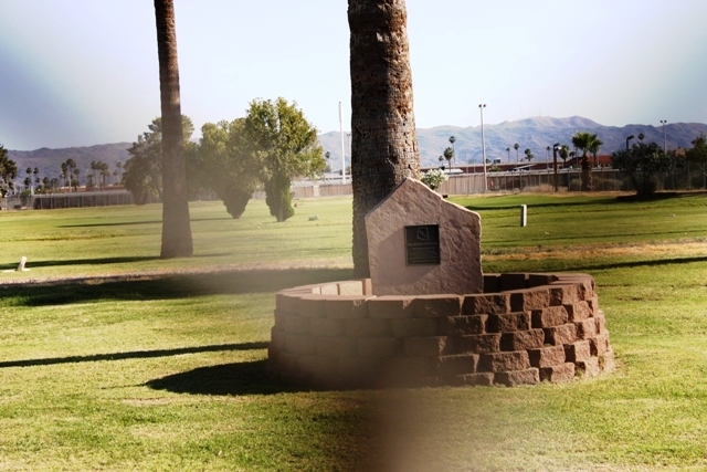
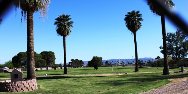
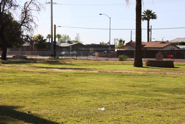
| Description | : | This cemetery is not accessible. It is on the grounds of the state hospital and is completely surrounded by a fence topped with barbed wire. There is only one padlocked gate. From outside the fence, there are only about a dozen tombstones visible and none of them are readable. Estimates are that there are about 2,400 graves in this cemetery but all but the already mentioned dozen are unmarked and the original grave location register was lost in a fire. |
frequently asked questions (FAQ):
-
Where is Arizona State Hospital Cemetery?
Arizona State Hospital Cemetery is located at 2500 E. Van Buren Phoenix, Maricopa County ,Arizona , 85008USA.
-
Arizona State Hospital Cemetery cemetery's updated grave count on graveviews.com?
6 memorials
-
Where are the coordinates of the Arizona State Hospital Cemetery?
Latitude: 33.4525960
Longitude: -112.0295240
Nearby Cemetories:
1. Trinity Episcopal Cathedral Columbarium
Phoenix, Maricopa County, USA
Coordinate: 33.4590270, -112.0749940
2. Cross Cut Cemetery
Phoenix, Maricopa County, USA
Coordinate: 33.4514370, -111.9794850
3. Porter Cemetery
Phoenix, Maricopa County, USA
Coordinate: 33.4462630, -112.0898040
4. Saint Francis Catholic Cemetery
Phoenix, Maricopa County, USA
Coordinate: 33.4733009, -111.9738998
5. Masons Cemetery
Phoenix, Maricopa County, USA
Coordinate: 33.4455060, -112.0898580
6. Independent Order of Odd Fellows Cemetery
Phoenix, Maricopa County, USA
Coordinate: 33.4451220, -112.0898740
7. Knights of Pythias Cemetery
Phoenix, Maricopa County, USA
Coordinate: 33.4447460, -112.0898310
8. Ancient Order of United Workmen Cemetery
Phoenix, Maricopa County, USA
Coordinate: 33.4443830, -112.0898100
9. Pioneer and Military Memorial Park
Phoenix, Maricopa County, USA
Coordinate: 33.4464690, -112.0903850
10. Rosedale Cemetery
Phoenix, Maricopa County, USA
Coordinate: 33.4465140, -112.0908180
11. City Loosley Cemetery
Phoenix, Maricopa County, USA
Coordinate: 33.4450100, -112.0909040
12. Encanto Community Church Memorial Garden
Phoenix, Maricopa County, USA
Coordinate: 33.4793340, -112.0835480
13. Sotelo–Heard Ranch Cemetery
Phoenix, Maricopa County, USA
Coordinate: 33.4035260, -112.0536480
14. Cementerio Lindo
Phoenix, Maricopa County, USA
Coordinate: 33.4304390, -112.0925598
15. Faith Lutheran Church Columbarium
Phoenix, Maricopa County, USA
Coordinate: 33.5088420, -112.0640250
16. Tempe Double Butte Cemetery
Tempe, Maricopa County, USA
Coordinate: 33.4072189, -111.9756393
17. Phoenix Zoo
Phoenix, Maricopa County, USA
Coordinate: 33.4501220, -111.9496530
18. Greenwood Memory Lawn Cemetery
Phoenix, Maricopa County, USA
Coordinate: 33.4557991, -112.1097031
19. Resthaven Park East Cemetery
Phoenix, Maricopa County, USA
Coordinate: 33.3944016, -111.9878006
20. Beth El Cemetery
Phoenix, Maricopa County, USA
Coordinate: 33.4592018, -112.1117020
21. Prince of Peace Lutheran Church Columbarium
Phoenix, Maricopa County, USA
Coordinate: 33.4909000, -111.9596330
22. Shepherd of the Hills UCC Memorial Garden
Phoenix, Maricopa County, USA
Coordinate: 33.4950920, -111.9626900
23. Twin Buttes Cemetery
Tempe, Maricopa County, USA
Coordinate: 33.4047700, -111.9667300
24. Papago Park
Phoenix, Maricopa County, USA
Coordinate: 33.4519000, -111.9443000


