
| Memorials | : | 3 |
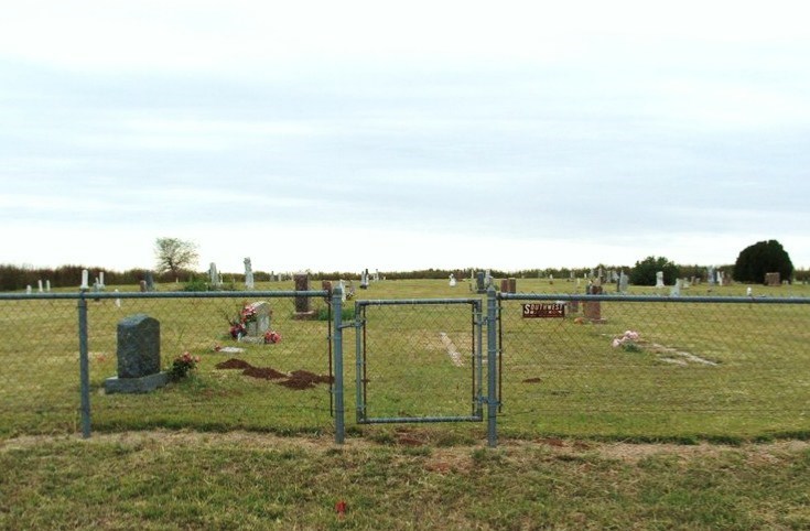
| Location | : | Cloud Chief, Washita County, USA |
| Coordinate | : | 35.2397003, -98.8606033 |
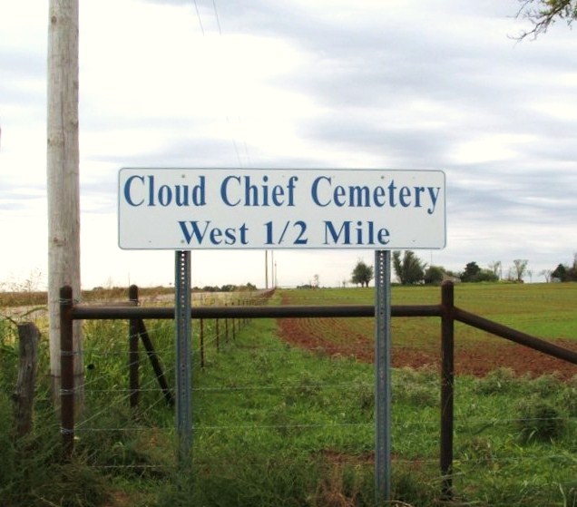
| Description | : | From Cordell, Ok, 7 miles Easton Hwy 152, then south on Hwy 54 for 3 1/2 miles, and ½ mile west. Located in Segar Township; Legal description: SE ¼ Section 23, Township 9 N, Range 16 W. The land was homesteaded by David Palmenter and in September 1902, he sold the land to Rua L. Good with the understanding that 5 acres would be used for a cemetery and he could have certain plots in the cemetery. Sexton: Jackie Cook |
frequently asked questions (FAQ):
-
Where is Cloud Chief Cemetery?
Cloud Chief Cemetery is located at Cloud Chief, Washita County ,Oklahoma ,USA.
-
Cloud Chief Cemetery cemetery's updated grave count on graveviews.com?
2 memorials
-
Where are the coordinates of the Cloud Chief Cemetery?
Latitude: 35.2397003
Longitude: -98.8606033
Nearby Cemetories:
1. Brethren Cemetery
Cordell, Washita County, USA
Coordinate: 35.2551994, -98.9063034
2. Sharon Cemetery
Lake Valley, Washita County, USA
Coordinate: 35.1925087, -98.8659897
3. Frazier Family Cemetery
Cloud Chief, Washita County, USA
Coordinate: 35.1893806, -98.8406448
4. Sichar Cemetery
Cordell, Washita County, USA
Coordinate: 35.3191986, -98.9233017
5. Odessa Cemetery
Lake Valley, Washita County, USA
Coordinate: 35.1459500, -98.8979000
6. Elm Flat Cemetery
Rocky, Washita County, USA
Coordinate: 35.1746826, -98.9540710
7. Feeser Family Cemetery
Cloud Chief, Washita County, USA
Coordinate: 35.1453018, -98.8022003
8. Lawnview Cemetery
Cordell, Washita County, USA
Coordinate: 35.3036995, -98.9645996
9. Strickland Cemetery
Cordell, Washita County, USA
Coordinate: 35.2193985, -98.9933014
10. Shelley Cemetery
Corn, Washita County, USA
Coordinate: 35.3497009, -98.8703003
11. Sappington Chapel Cemetery
Cowden, Washita County, USA
Coordinate: 35.2322884, -98.7229691
12. Rainey Cemetery
Rocky, Washita County, USA
Coordinate: 35.1464005, -98.9552994
13. Pleasant View Cemetery
Corn, Washita County, USA
Coordinate: 35.3347015, -98.7561035
14. Herold Mennonite Church Cemetery
Bessie, Washita County, USA
Coordinate: 35.3596497, -98.9226608
15. Russell Cemetery
Cordell, Washita County, USA
Coordinate: 35.2616997, -99.0192032
16. Van Dyke Cemetery
Cowden, Washita County, USA
Coordinate: 35.2895203, -98.7114182
17. Salem Cemetery
Rocky, Washita County, USA
Coordinate: 35.1307182, -98.9547195
18. Bible Mennonite Brethren Cemetery
Bessie, Washita County, USA
Coordinate: 35.3624496, -98.9346313
19. Oakdale Cemetery
Cowden, Washita County, USA
Coordinate: 35.1394005, -98.7414017
20. Red Top Cemetery
Colony, Washita County, USA
Coordinate: 35.3011017, -98.7033005
21. Mennonite Brethren Cemetery
Corn, Washita County, USA
Coordinate: 35.3717003, -98.7825012
22. Sod Cemetery
Cordell, Washita County, USA
Coordinate: 35.3205986, -99.0113983
23. Mountain View Cemetery
Mountain View, Kiowa County, USA
Coordinate: 35.1100006, -98.7593994
24. Ebenezer Mennonite Cemetery
Gotebo, Kiowa County, USA
Coordinate: 35.0881004, -98.8150711