
| Memorials | : | 0 |
| Location | : | Gene Autry, Carter County, USA |
| Coordinate | : | 34.2729000, -97.0752500 |
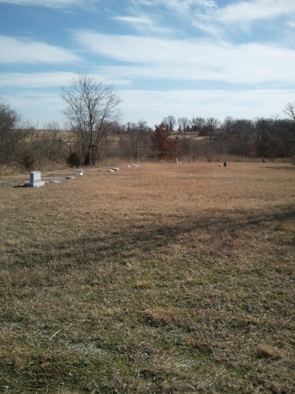
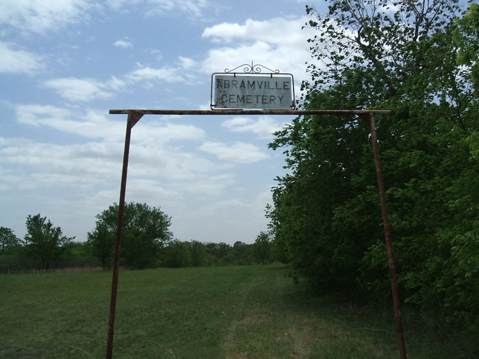
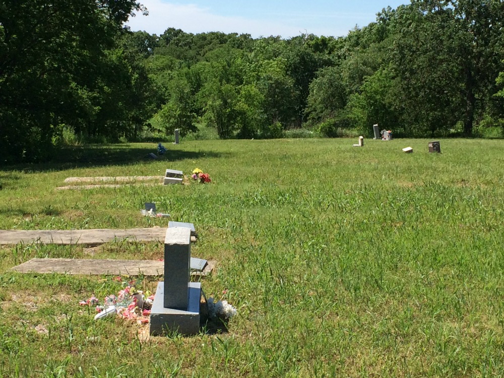
| Description | : | Abramville Cemetery is a small African American cemetery, located about three miles southwest of Gene Autry, Oklahoma. The cemetery was established in the early 1900s and is still an active cemetery. Directions To Abramville Cemetery: From Gene Autry Museum, take Tumbleweed Road approximately two miles west. Turn south (left) on Happy Trail Road and go about one mile to Grassland Road. Turn west (right) on Grassland Road and travel about 150 yards. The entrance to Abramville Cemetery will be on the left. |
frequently asked questions (FAQ):
-
Where is Abramville Cemetery?
Abramville Cemetery is located at Grassland Road Gene Autry, Carter County ,Oklahoma , 73436USA.
-
Abramville Cemetery cemetery's updated grave count on graveviews.com?
0 memorials
-
Where are the coordinates of the Abramville Cemetery?
Latitude: 34.2729000
Longitude: -97.0752500
Nearby Cemetories:
1. Berwyn Cemetery
Gene Autry, Carter County, USA
Coordinate: 34.2848015, -97.0421982
2. Old Berwyn Cemetery
Gene Autry, Carter County, USA
Coordinate: 34.2909775, -97.0420685
3. Big Branch Cemetery
Carter County, USA
Coordinate: 34.2910995, -97.0307999
4. Cole Cemetery
Ardmore, Carter County, USA
Coordinate: 34.2281560, -97.1025460
5. Mount Pleasant Cemetery
Gene Autry, Carter County, USA
Coordinate: 34.2517014, -97.0180969
6. Calvary Cemetery
Gene Autry, Carter County, USA
Coordinate: 34.3213150, -97.0451350
7. Springer Cemetery
Springer, Carter County, USA
Coordinate: 34.3129700, -97.1367000
8. Henderson Cemetery
Gene Autry, Carter County, USA
Coordinate: 34.3168983, -97.0117035
9. Maxwell-Woods Cemetery
Ardmore, Carter County, USA
Coordinate: 34.2219500, -97.1360900
10. Pruitt Cemetery
Ardmore, Carter County, USA
Coordinate: 34.1974983, -97.0736008
11. Hutchins Cemetery
Baum, Carter County, USA
Coordinate: 34.2712631, -96.9771805
12. Young Cemetery
Gene Autry, Carter County, USA
Coordinate: 34.2969017, -96.9760971
13. Oil Springs Cemetery
Carter County, USA
Coordinate: 34.3072100, -96.9764000
14. Clearview Cemetery
Ardmore, Carter County, USA
Coordinate: 34.1878260, -97.1075960
15. Thomas Cemetery
Baum, Carter County, USA
Coordinate: 34.2449989, -96.9672012
16. Goddard Cemetery
Gene Autry, Carter County, USA
Coordinate: 34.3073570, -96.9633280
17. Big Canyon Cemetery
Murray County, USA
Coordinate: 34.3630981, -97.0255966
18. Cobb Cemetery
Springer, Carter County, USA
Coordinate: 34.3445560, -97.1648810
19. Glenn Cemetery
Glenn, Carter County, USA
Coordinate: 34.3067500, -97.1961000
20. Rice Cemetery
Carter County, USA
Coordinate: 34.3067500, -97.1961600
21. Saint Philip's Episcopal Church Columbarium
Ardmore, Carter County, USA
Coordinate: 34.1727540, -97.1351420
22. Gaines Cemetery
Carter County, USA
Coordinate: 34.2788800, -97.2130500
23. Lone Cedar Cemetery
Johnston County, USA
Coordinate: 34.2502460, -96.9287830
24. Provence Cemetery
Ardmore, Carter County, USA
Coordinate: 34.1549988, -97.0211029