
| Memorials | : | 0 |
| Location | : | Kenosha, Kenosha County, USA |
| Coordinate | : | 42.6015010, -87.8222180 |
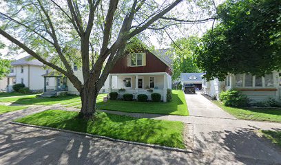
| Description | : | - Burial site of the wife and infant child of WI. pioneer, Garret Post (both, mother and child, died "last of" April 1836). The mother is believed to have been the FIRST known DEATH of a white settler (in Kenosha Co., WI.). The infant, the FIRST known BIRTH, and thus the FIRST known DEATH of a pioneer child within Kenosha Co., WI. --- The burials took place in late April of 1836 on land, later owned by, Colonel James Henry Howe [FAG #103830780], Civil War veteran (his estate, the house and land - was sold to the St. John's Lutheran Church, of Kenosha,... Read More |
frequently asked questions (FAQ):
-
Where is Colonel Howe Estate Cemetery?
Colonel Howe Estate Cemetery is located at Eighth Ave. Kenosha, Kenosha County ,Wisconsin , 53140USA.
-
Colonel Howe Estate Cemetery cemetery's updated grave count on graveviews.com?
0 memorials
-
Where are the coordinates of the Colonel Howe Estate Cemetery?
Latitude: 42.6015010
Longitude: -87.8222180
Nearby Cemetories:
1. Saint George Cemetery
Kenosha, Kenosha County, USA
Coordinate: 42.6147003, -87.8238983
2. Saint Matthews Episcopal Church Columbarium
Kenosha, Kenosha County, USA
Coordinate: 42.5819290, -87.8215848
3. B'nai Zedek Cemetery
Kenosha, Kenosha County, USA
Coordinate: 42.6255188, -87.8248978
4. Green Ridge Cemetery
Kenosha, Kenosha County, USA
Coordinate: 42.5722008, -87.8197021
5. Saint Casimir Cemetery
Kenosha, Kenosha County, USA
Coordinate: 42.6060982, -87.8641968
6. Saint James Cemetery
Kenosha, Kenosha County, USA
Coordinate: 42.5696000, -87.8195100
7. Old Saint Marks Cemetery
Kenosha, Kenosha County, USA
Coordinate: 42.5630600, -87.8208300
8. Sunset Ridge Memorial Park
Kenosha, Kenosha County, USA
Coordinate: 42.6007996, -87.8833008
9. Oakwood Cemetery
Somers, Kenosha County, USA
Coordinate: 42.6394005, -87.8743973
10. Saint John Chrysostomos Greek Orthodox Monastery C
Pleasant Prairie, Kenosha County, USA
Coordinate: 42.5394300, -87.8653200
11. All Saints Cemetery
Pleasant Prairie, Kenosha County, USA
Coordinate: 42.5336800, -87.8504300
12. Vale Cemetery
Kenosha, Kenosha County, USA
Coordinate: 42.5675011, -87.9241638
13. Good Shepherd Mausoleum
Pleasant Prairie, Kenosha County, USA
Coordinate: 42.5209200, -87.8602200
14. Kenosha County Cemetery
Pleasant Prairie, Kenosha County, USA
Coordinate: 42.5483284, -87.9130630
15. East Meadows Cemetery
Racine, Racine County, USA
Coordinate: 42.6975020, -87.8407900
16. Parker Family Cemetery
Sturtevant, Racine County, USA
Coordinate: 42.6973000, -87.8848400
17. Collegiate Church of Saint John Chapel Grounds
Racine, Racine County, USA
Coordinate: 42.7054860, -87.7861730
18. Spring Brook Cemetery
Pleasant Prairie, Kenosha County, USA
Coordinate: 42.5028000, -87.8918991
19. Mound Cemetery
Racine, Racine County, USA
Coordinate: 42.7206001, -87.8131027
20. Holy Cross Catholic Cemetery
Racine, Racine County, USA
Coordinate: 42.7242012, -87.8163986
21. Racine Jewish Memorial Cemetery
Racine, Racine County, USA
Coordinate: 42.7254900, -87.8276000
22. Graceland Cemetery
Racine, Racine County, USA
Coordinate: 42.7263700, -87.8220000
23. Calvary Catholic Cemetery & Mausoleum
Racine, Racine County, USA
Coordinate: 42.7263985, -87.8143997
24. Sylvania Cemetery
Sylvania, Racine County, USA
Coordinate: 42.6819600, -87.9538400