
| Memorials | : | 0 |
| Location | : | Racine, Racine County, USA |
| Coordinate | : | 42.7054860, -87.7861730 |
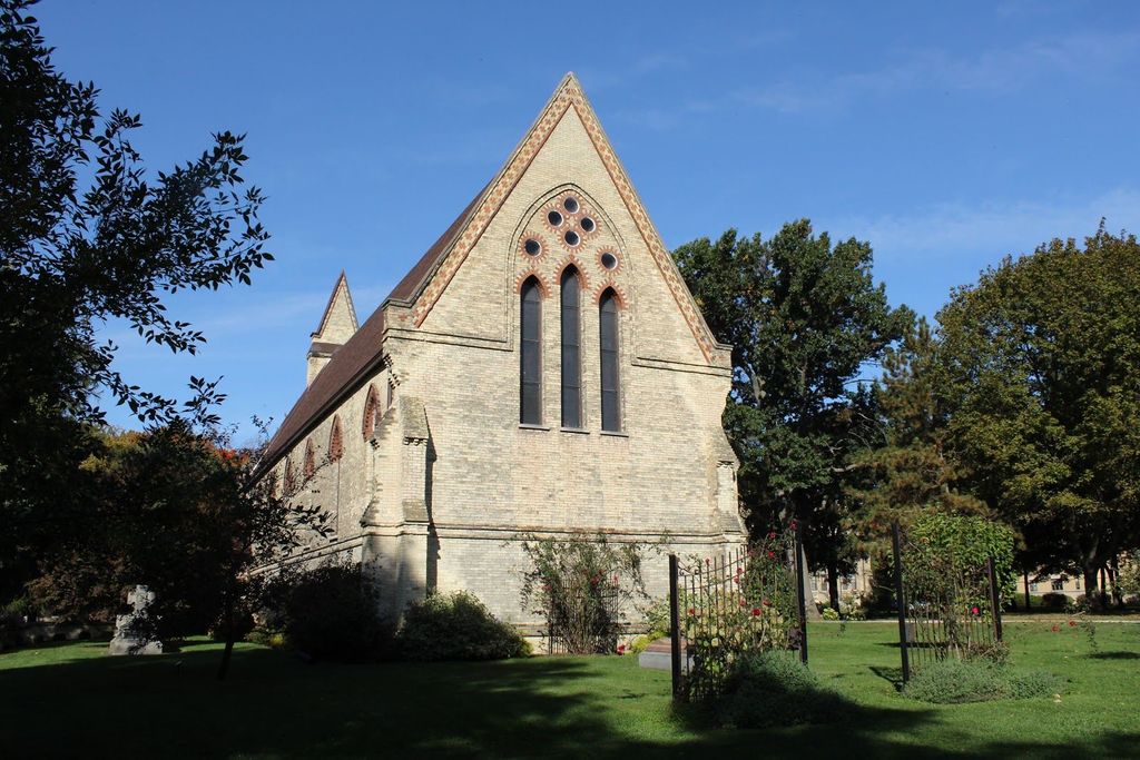
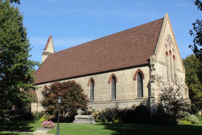
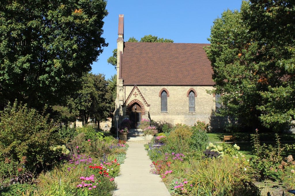
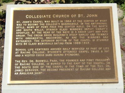
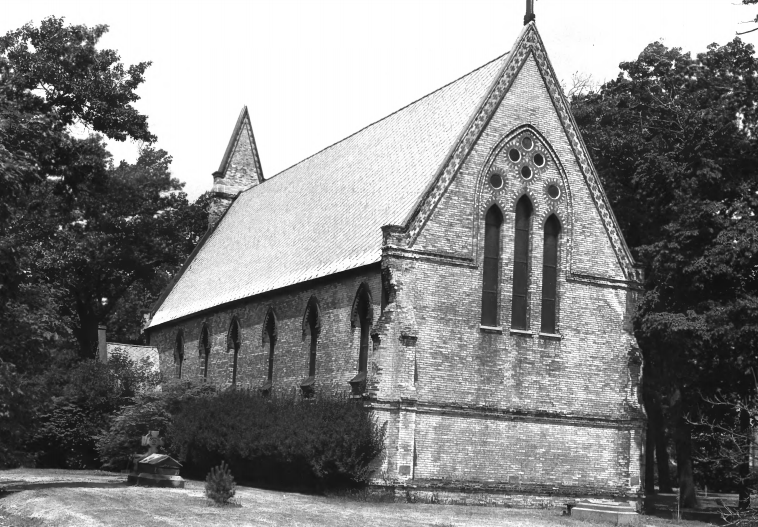
| Description | : | The Collegiate Church of St. John is located at the center of the DeKoven Center, on the campus of the former Racine College. The Rev. Dr. Roswell Park, founder and first president of Racine College, is buried to the east of the chapel grounds. The Rev. Dr. James DeKoven, warden of Racine College and an Anglican Saint, is entombed on the south side. |
frequently asked questions (FAQ):
-
Where is Collegiate Church of Saint John Chapel Grounds?
Collegiate Church of Saint John Chapel Grounds is located at 600 21st Street Racine, Racine County ,Wisconsin , 53403USA.
-
Collegiate Church of Saint John Chapel Grounds cemetery's updated grave count on graveviews.com?
0 memorials
-
Where are the coordinates of the Collegiate Church of Saint John Chapel Grounds?
Latitude: 42.7054860
Longitude: -87.7861730
Nearby Cemetories:
1. Saint Lukes Episcopal Church Columbarium
Racine, Racine County, USA
Coordinate: 42.7262800, -87.7829500
2. Mound Cemetery
Racine, Racine County, USA
Coordinate: 42.7206001, -87.8131027
3. Holy Cross Catholic Cemetery
Racine, Racine County, USA
Coordinate: 42.7242012, -87.8163986
4. Calvary Catholic Cemetery & Mausoleum
Racine, Racine County, USA
Coordinate: 42.7263985, -87.8143997
5. Graceland Cemetery
Racine, Racine County, USA
Coordinate: 42.7263700, -87.8220000
6. Racine Jewish Memorial Cemetery
Racine, Racine County, USA
Coordinate: 42.7254900, -87.8276000
7. East Meadows Cemetery
Racine, Racine County, USA
Coordinate: 42.6975020, -87.8407900
8. Parker Family Cemetery
Sturtevant, Racine County, USA
Coordinate: 42.6973000, -87.8848400
9. West Lawn Memorial Park
Mount Pleasant, Racine County, USA
Coordinate: 42.7235985, -87.8972015
10. B'nai Zedek Cemetery
Kenosha, Kenosha County, USA
Coordinate: 42.6255188, -87.8248978
11. Holy Cross Catholic Cemetery
Caledonia, Racine County, USA
Coordinate: 42.7919006, -87.8186035
12. Oakwood Cemetery
Somers, Kenosha County, USA
Coordinate: 42.6394005, -87.8743973
13. Saint George Cemetery
Kenosha, Kenosha County, USA
Coordinate: 42.6147003, -87.8238983
14. Pet Valhalla Cemetery
Franksville, Racine County, USA
Coordinate: 42.7545440, -87.9083540
15. Holy Family Catholic Cemetery
Caledonia, Racine County, USA
Coordinate: 42.8011017, -87.8364029
16. Bohemian National Cemetery
Caledonia, Racine County, USA
Coordinate: 42.7987700, -87.8474700
17. Country Haven Cemetery
Caledonia, Racine County, USA
Coordinate: 42.7987010, -87.8487160
18. Colonel Howe Estate Cemetery
Kenosha, Kenosha County, USA
Coordinate: 42.6015010, -87.8222180
19. Saint Casimir Cemetery
Kenosha, Kenosha County, USA
Coordinate: 42.6060982, -87.8641968
20. Sylvania Cemetery
Sylvania, Racine County, USA
Coordinate: 42.6819600, -87.9538400
21. Saint Matthews Episcopal Church Columbarium
Kenosha, Kenosha County, USA
Coordinate: 42.5819290, -87.8215848
22. Sunset Ridge Memorial Park
Kenosha, Kenosha County, USA
Coordinate: 42.6007996, -87.8833008
23. Caledonia Memorial Park
Caledonia, Racine County, USA
Coordinate: 42.8072014, -87.8955994
24. Green Ridge Cemetery
Kenosha, Kenosha County, USA
Coordinate: 42.5722008, -87.8197021