
| Memorials | : | 0 |
| Location | : | Sturtevant, Racine County, USA |
| Coordinate | : | 42.6973000, -87.8848400 |
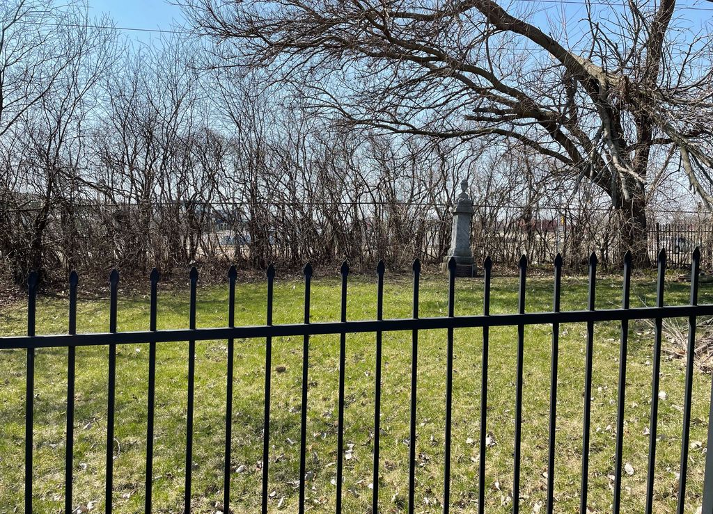
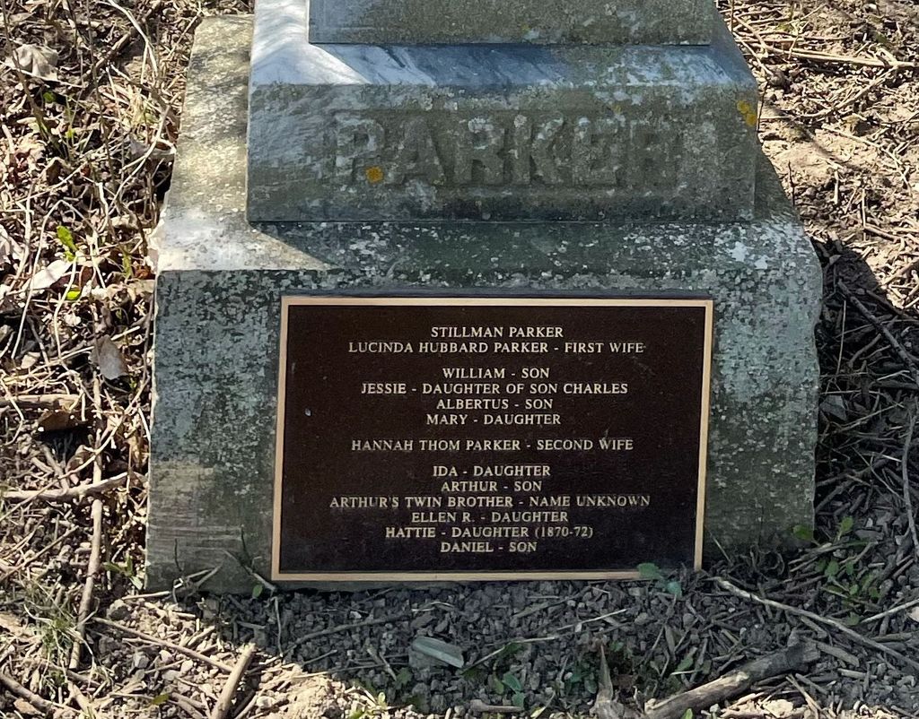
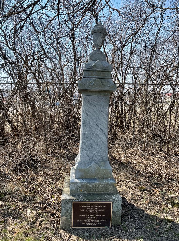
| Description | : | The Parker Family Cemetery is located on the south side of Durand Avenue/Wisconsin Highway 11 at the intersection with 84th Street. It is surrounded by a small fence near to the road. This cemetery was established on the farm of Stillman Parker. Before his wife Lucinda died, she asked to be buried next to the family orchard. At least ten Parker family members were buried here. |
frequently asked questions (FAQ):
-
Where is Parker Family Cemetery?
Parker Family Cemetery is located at Durand Avenue/Wisconsin State Highway 11 Sturtevant, Racine County ,Wisconsin , 53177USA.
-
Parker Family Cemetery cemetery's updated grave count on graveviews.com?
0 memorials
-
Where are the coordinates of the Parker Family Cemetery?
Latitude: 42.6973000
Longitude: -87.8848400
Nearby Cemetories:
1. West Lawn Memorial Park
Mount Pleasant, Racine County, USA
Coordinate: 42.7235985, -87.8972015
2. East Meadows Cemetery
Racine, Racine County, USA
Coordinate: 42.6975020, -87.8407900
3. Racine Jewish Memorial Cemetery
Racine, Racine County, USA
Coordinate: 42.7254900, -87.8276000
4. Sylvania Cemetery
Sylvania, Racine County, USA
Coordinate: 42.6819600, -87.9538400
5. Graceland Cemetery
Racine, Racine County, USA
Coordinate: 42.7263700, -87.8220000
6. Holy Cross Catholic Cemetery
Racine, Racine County, USA
Coordinate: 42.7242012, -87.8163986
7. Mound Cemetery
Racine, Racine County, USA
Coordinate: 42.7206001, -87.8131027
8. Oakwood Cemetery
Somers, Kenosha County, USA
Coordinate: 42.6394005, -87.8743973
9. Calvary Catholic Cemetery & Mausoleum
Racine, Racine County, USA
Coordinate: 42.7263985, -87.8143997
10. Pet Valhalla Cemetery
Franksville, Racine County, USA
Coordinate: 42.7545440, -87.9083540
11. Collegiate Church of Saint John Chapel Grounds
Racine, Racine County, USA
Coordinate: 42.7054860, -87.7861730
12. Saint Lukes Episcopal Church Columbarium
Racine, Racine County, USA
Coordinate: 42.7262800, -87.7829500
13. Paris Lutheran Cemetery
Paris, Kenosha County, USA
Coordinate: 42.6549350, -87.9805540
14. B'nai Zedek Cemetery
Kenosha, Kenosha County, USA
Coordinate: 42.6255188, -87.8248978
15. Saint Casimir Cemetery
Kenosha, Kenosha County, USA
Coordinate: 42.6060982, -87.8641968
16. Saint George Cemetery
Kenosha, Kenosha County, USA
Coordinate: 42.6147003, -87.8238983
17. Sunset Ridge Memorial Park
Kenosha, Kenosha County, USA
Coordinate: 42.6007996, -87.8833008
18. Trinity Cemetery
Raymond, Racine County, USA
Coordinate: 42.7631370, -87.9848410
19. Pilgrims Home Cemetery
Raymond, Racine County, USA
Coordinate: 42.7633700, -87.9854200
20. Country Haven Cemetery
Caledonia, Racine County, USA
Coordinate: 42.7987010, -87.8487160
21. Bohemian National Cemetery
Caledonia, Racine County, USA
Coordinate: 42.7987700, -87.8474700
22. Colonel Howe Estate Cemetery
Kenosha, Kenosha County, USA
Coordinate: 42.6015010, -87.8222180
23. Holy Cross Catholic Cemetery
Caledonia, Racine County, USA
Coordinate: 42.7919006, -87.8186035
24. Holy Family Catholic Cemetery
Caledonia, Racine County, USA
Coordinate: 42.8011017, -87.8364029