
| Memorials | : | 0 |
| Location | : | Atoka, Atoka County, USA |
| Coordinate | : | 34.3983002, -96.1164017 |
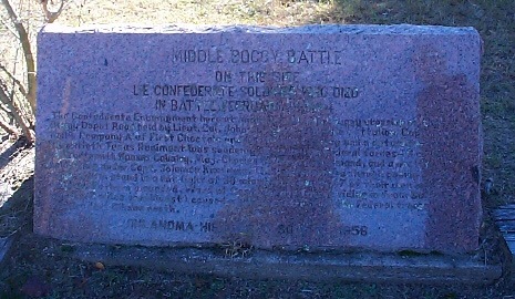
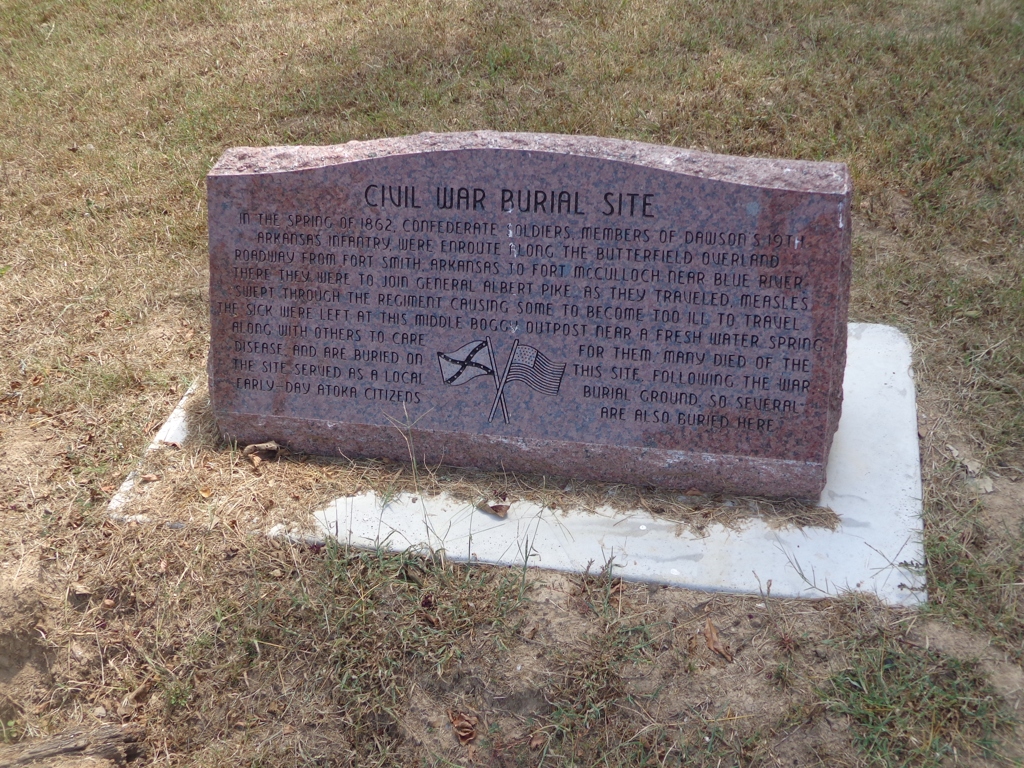
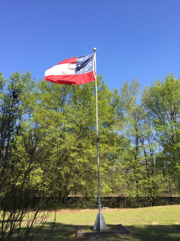
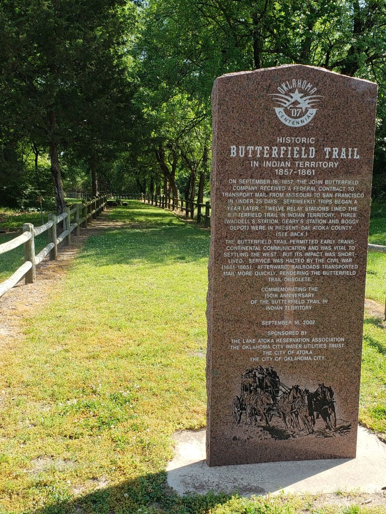
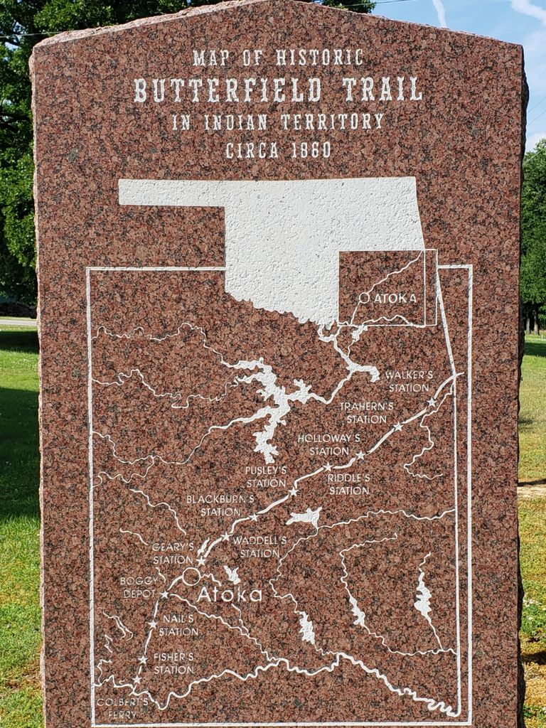
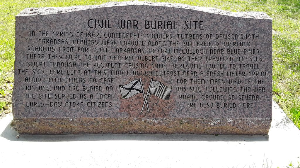
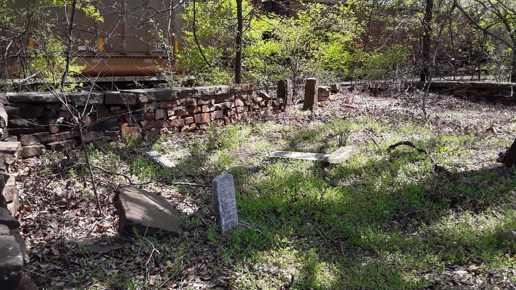
| Description | : | Before this place was a cemetery, it was a crude "burying ground" first used by emigrants traveling on the Butterfield stagecoach road, which was in use from 1858 to 1861. The stagecoach stop was at a spring, which was called "Harkins Spring," just north of Middle Boggy River, today known as Muddy Boggy River. During the Civil War, Confederate forces kept an outpost camp at the spring to guard the route to Boggy Depot, which lay some 15 miles to the southwest. In the winter of 1862, Colonel C.L. Dawson's 19th Arkansas Infantry was assigned to help in the building... Read More |
frequently asked questions (FAQ):
-
Where is Confederate Cemetery?
Confederate Cemetery is located at Atoka, Atoka County ,Oklahoma ,USA.
-
Confederate Cemetery cemetery's updated grave count on graveviews.com?
0 memorials
-
Where are the coordinates of the Confederate Cemetery?
Latitude: 34.3983002
Longitude: -96.1164017
Nearby Cemetories:
1. B Street Catholic Churchyard
Atoka, Atoka County, USA
Coordinate: 34.3863090, -96.1211550
2. B Street Cemetery
Atoka, Atoka County, USA
Coordinate: 34.3853615, -96.1194889
3. Green Hill Cemetery
Atoka, Atoka County, USA
Coordinate: 34.3817800, -96.1191150
4. Westview Cemetery
Atoka, Atoka County, USA
Coordinate: 34.3838420, -96.1331060
5. Green Meadows Cemetery
Atoka, Atoka County, USA
Coordinate: 34.3983700, -96.1455630
6. Macedonia Cemetery
Atoka, Atoka County, USA
Coordinate: 34.4350000, -96.1447300
7. Coal Creek Cemetery
Atoka, Atoka County, USA
Coordinate: 34.4563889, -96.1286111
8. Stringtown Cemetery
Stringtown, Atoka County, USA
Coordinate: 34.4639015, -96.0625000
9. New Zion Cemetery
Tushka, Atoka County, USA
Coordinate: 34.3166330, -96.1140910
10. Wells Street Cemetery
Atoka County, USA
Coordinate: 34.4668007, -96.0606003
11. Plainview Cemetery
Atoka County, USA
Coordinate: 34.3717003, -96.2118988
12. Buffalo Community Cemetery
Atoka, Atoka County, USA
Coordinate: 34.3313800, -96.0561110
13. Stringtown Unnamed Cemetery
Stringtown, Atoka County, USA
Coordinate: 34.4651690, -96.0509350
14. Midway Cemetery
Lehigh, Coal County, USA
Coordinate: 34.4402800, -96.2081200
15. Tushka Cemetery
Tushka, Atoka County, USA
Coordinate: 34.3238983, -96.1707993
16. Bera Cemetery
Atoka, Atoka County, USA
Coordinate: 34.3142320, -96.0754340
17. Old Lehigh Cemetery
Lehigh, Coal County, USA
Coordinate: 34.4435997, -96.2164001
18. Boggy Bend Cemetery
Stringtown, Atoka County, USA
Coordinate: 34.4955556, -96.0775000
19. Mount Olive Church Cemetery
Atoka County, USA
Coordinate: 34.4591130, -96.0084110
20. Bethany Cemetery
Atoka, Atoka County, USA
Coordinate: 34.2872009, -96.1160965
21. Wards Chapel Cemetery
Atoka, Atoka County, USA
Coordinate: 34.3675003, -96.2497025
22. Valley View Cemetery
Atoka County, USA
Coordinate: 34.4068985, -96.2632980
23. Lehigh Cemetery
Lehigh, Coal County, USA
Coordinate: 34.4775900, -96.2319400
24. High Hill Cemetery
Atoka County, USA
Coordinate: 34.2738991, -96.1785965